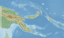
Wanigela Airport
Wanigela Airport | |
|---|---|
| Summary | |
| Location | Wanigela, Papua New Guinea |
| Coordinates | 09°20′15″S 149°09′20″E / 9.33750°S 149.15556°E |
| Map | |
Source: [1] | |
Wanigela Airport (IATA: AGL[2], ICAO: AYWG) is an airport in Wanigela,[1] a village in the Oro Province (also known as Northern Province) in Papua New Guinea.
History
The airfield was built by Australia New Guinea Administrative Unit authorities in July 1942 during World War II. Consisting of a single grassed runway, it was used primarily for transport flights.[citation needed]
Airlines and destinations
The following airlines offer scheduled passenger service from this airport:
| Airlines | Destinations |
|---|---|
| Airlines PNG | Port Moresby, Tufi |
References
- ^ a b Airport information for Wanigela, Papua-New Guinea (AGL) at Great Circle Mapper.
- ^ "Airline and Airport Code Search (AGL: Wanigela)". International Air Transport Association (IATA). Retrieved 1 October 2012.

