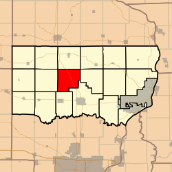
Welton Township, Clinton County, Iowa
Appearance
Welton Township | |
|---|---|
 Location in Clinton County | |
| Coordinates: 41°54′26″N 090°36′45″W / 41.90722°N 90.61250°W | |
| Country | |
| State | |
| County | Clinton |
| Area | |
| • Total | 32.15 sq mi (83.28 km2) |
| • Land | 32.15 sq mi (83.28 km2) |
| • Water | 0 sq mi (0 km2) 0% |
| Elevation | 787 ft (240 m) |
| Population (2000) | |
| • Total | 528 |
| • Density | 16.4/sq mi (6.3/km2) |
| GNIS feature ID | 0468968 |
Welton Township is a township in Clinton County, Iowa, USA. As of the 2000 census, its population was 528.
History
Welton Township was organized in 1858.[1]
Geography
Welton Township covers an area of 32.15 square miles (83.3 km2) and contains one incorporated settlement, Welton. According to the USGS, it contains three cemeteries: Oak View, Walrod and Welton.
The stream of Negro Creek runs through this township.
Notes
- ^ Wolfe, Patrick B. (1911). Wolfe's History of Clinton County, Iowa, Volume 1. B. F. Bowen. p. 281.
References
External links

