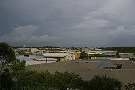
Winnellie, Northern Territory
Appearance
| Winnellie Darwin, Northern Territory | |||||||||||||||
|---|---|---|---|---|---|---|---|---|---|---|---|---|---|---|---|
 | |||||||||||||||
| Population | 337 (2006)[1] | ||||||||||||||
| • Density | 59.1/km2 (153.1/sq mi) | ||||||||||||||
| Established | 1941 | ||||||||||||||
| Postcode(s) | 0820, 0821 | ||||||||||||||
| Area | 5.7 km2 (2.2 sq mi) | ||||||||||||||
| Location | 8.3 km (5 mi) from Darwin | ||||||||||||||
| LGA(s) | City of Darwin | ||||||||||||||
| Territory electorate(s) | Fong Lim | ||||||||||||||
| Federal division(s) | Solomon | ||||||||||||||
| |||||||||||||||
Winnellie is a northern suburb of Darwin, Northern Territory, in the Northern Territory of Australia.
History
Winnellie is an industrial suburb to the south of Darwin International Airport. The name came the 'Winnellie Camp' formed there by the Army in 1941. Recently there has been some newer residential areas in the suburb.
References
- ^ Australian Bureau of Statistics (25 October 2007). "Leanyer (State Suburb)". 2006 Census QuickStats. Retrieved 30 December 2007.
