
Wisconsin Highway 47
State Trunk Highway 47 | ||||
|---|---|---|---|---|
| Route information | ||||
| Maintained by WisDOT | ||||
| Length | 188.01 mi[1] (302.57 km) | |||
| Major junctions | ||||
| South end | ||||
| North end | ||||
| Location | ||||
| Country | United States | |||
| State | Wisconsin | |||
| Counties | Winnebago, Outagamie, Shawano, Menominee, Langlade, Oneida, Vilas, Iron | |||
| Highway system | ||||
| ||||

State Trunk Highway 47 (often called Highway 47, STH 47 or WIS 47) is a state highway in the U.S. state of Wisconsin. It runs in a diagonal northwest-southeast in northeastern and northern Wisconsin from Manitowish to Menasha.
Of the 188-mile (303 km) route, about 76 miles (122 km) are cosigned with other highways. From south to north, WIS 47 is aligned with WIS 29 from south of Bonduel to South of Shawano, WIS 55 from South of Bonduel to Keshena. After a solo segment, WIS 47 follows U.S. Route 45 from south of Antigo to Monico and U.S. Route 8 from Monico to Rhinelander.[1]
Termini
The northern terminus of Highway 47 is a combined terminus with STH 182 at US-51 in Manitowish. Its southern terminus is at STH 114 at the corner of Third and DePere Streets in Menasha.
Municipalities served by Highway 47
- Manitowish
- Lac du Flambeau
- Woodruff
- Lake Tomahawk
- Rhinelander
- Antigo
- Keshena
- Shawano
- Bonduel
- Black Creek
- Appleton
- Menasha
Images
-
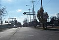 Looking south at the southern terminus.
 -
 The northern terminus (along with Wisconsin Highway 182) at Manitowish, Wisconsin.


References
- ^ a b Bessert, Chris. "Wisconsin Highways: Highways 40-49 (Highway 47)". Wisconsin Highways. Retrieved 2007-03-20.