Yigo, Guam
Yigo Yigu | |
|---|---|
 | |
 Location of Yigo within the Terrority of Guam. | |
| Country | United States |
| Territory | Guam |
| Government | |
| • Mayor | Rudy M. Matanane (R) |
| • Vice Mayor | Anthony "Tony" P. Sanchez (R) |
| Area | |
| • Total | 35 sq mi (90 km2) |
| Population (2010)[1] | |
| • Total | 20,539 |
| Time zone | UTC+10 (ChST) |

Yigo (Chamorro: Yigu; pronounced /ˈdʒiːɡoʊ/) is the northernmost village of the United States territory of Guam, and is the location of Andersen Air Force Base. The municipality of Yigo is larger than any other village on the island in terms of area.
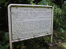
Yigo is historically one of Guam's richest farming areas. [citation needed] During World War II, the village was the site of a concentration camp during Japanese occupation of the island. It was also the site of the island's final battle during the war. The South Pacific Memorial Peace Park was built by the Japanese Government and is dedicated to the many Japanese and American soldiers who died in the battle of Guam.
Education
Yigo has several kindergarten through 5th grade elementary schools:
- Daniel L. Perez Elementary School (formerly Yigo Elementary School)
- Machananao Elementary School
- Upi Elementary School
- F.B. Leon Guerrero Middle School, formerly an elementary school until 1981, when it was converted into a middle school, and Simon Sanchez High School are in Yigo. Sanchez opened as a junior high school in 1974; the school became a high school in 1982 to serve north-eastern Guam.[2]
Simon Sanchez became a high school in 1992. The first graduating class graduated in May 1993.
Mayor of Yigo
Mayor
- Antonio A. Calvo (1973–1981)
- David G. Blas (1981–1989)
- John F. Blas (1989–1993)
- Edward C. Artero (1993–1997)
- Robert "Bob" S. Lizama (1997–2013)
- Rudy M. Matanane (2013–present)
Vice Mayor
- Ronald J. Flores (2009–2013)
- Anthony "Tony" P. Sanchez (2013–present)
Demographics
| Census | Pop. | Note | %± |
|---|---|---|---|
| 1960 | 7,682 | — | |
| 1970 | 11,542 | 50.2% | |
| 1980 | 10,359 | −10.2% | |
| 1990 | 14,213 | 37.2% | |
| 2000 | 19,474 | 37.0% | |
| 2010 | 20,539 | 5.5% | |
| Source:[1] | |||
See also
References
- ^ a b "2010 Guam Statistical Yearbook" (PDF). Archived July 23, 2014, at the Wayback Machine (4.3 MB), (rev. 2011)
- ^ "Guam's Public High Schools." Guam Public School System. Accessed September 8, 2008.
Further reading
- Rogers, Robert F. (1995). Destiny's Landfall: A History of Guam. University of Hawai'i Press. ISBN 0-8248-1678-1.
External links
- Yigo Guam at Guam Portal
- Yigo Map from PDN
- PDN Village Maps
- "Municipalities of Guam". Statoids.
13°32′04″N 144°53′08″E / 13.53444°N 144.88556°E
