
Borșa
You can help expand this article with text translated from the corresponding article in Romanian. (June 2012) Click [show] for important translation instructions.
|
Borșa | |
|---|---|
 Houses in Borșa | |
 Coat of arms | |
 Location in Maramureș County | |
 Borșa Location in Romania | |
| Coordinates: 47°39′19″N 24°39′47″E / 47.65528°N 24.66306°E | |
| Country | Romania |
| County | Maramureș |
| Government | |
| • Mayor (2020–2024) | Ion-Sorin Timiș[1] (CMM) |
| Area | 424.12 km2 (163.75 sq mi) |
| Population (2021-12-01)[2] | 27,711 |
| • Density | 65/km2 (170/sq mi) |
| Time zone | EET/EEST (UTC+2/+3) |
| Vehicle reg. | MM |
| Website | www |
Borșa (Romanian pronunciation: [ˈborʃa]; Hungarian: Borsa, German: Borscha, Yiddish: בורשא Borsha) is a town in eastern Maramureș County, Maramureș, Romania, in the valley of the river Vișeu and near the Prislop Pass. Linking Transylvania to Bukovina, Prislop Pass is surrounded by the Rodna and Maramureș Mountains, both ranges of the Carpathians. The highest peak in the region is Pietrosul Rodnei — 2,303 meters.
The Rodna National Park (which has an area of 463 km²) can be accessed from Borșa. The town is home to a wooden church, built in 1718. It administers one village, Băile Borșa.
In 1891 there were 1,432 Jews living in Borșa. The area has lost much of its population following the collapse of the Communist regime.
Natives
- Israel Polack (1909–1993), textile industrialist
- Frank Timiș (born 1964), rich businessman based in London
Population
| Year | Pop. | ±% |
|---|---|---|
| 1977 | 24,406 | — |
| 1992 | 27,450 | +12.5% |
| 2002 | 27,247 | −0.7% |
| 2011 | 27,611 | +1.3% |
| Source: Census data | ||
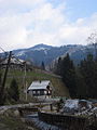
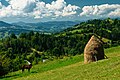
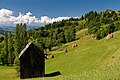
Gallery
-
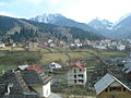 Houses in Borșa
 -
 Houses in Borșa
 -
 Church of the Moisei monastery
 -
 Pietrosu Mare near Borșa
 -
-
 Horses' waterfall
 -
-

-

-


.JPG)

References
- ^ "Results of the 2020 local elections". Central Electoral Bureau. Retrieved 14 June 2021.
- ^ "Populaţia rezidentă după grupa de vârstă, pe județe și municipii, orașe, comune, la 1 decembrie 2021" (XLS). National Institute of Statistics.
Wikimedia Commons has media related to Borșa.
