Forest of Dean District
Forest of Dean District | |
|---|---|
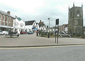
 Coleford Market Place, the town where Forest of Dean District Council is based | |
 Forest of Dean shown within Gloucestershire | |
| Sovereign state | United Kingdom |
| Constituent country | England |
| Region | South West England |
| Non-metropolitan county | Gloucestershire |
| Status | Non-metropolitan district |
| Admin HQ | Coleford |
| Incorporated | 1 April 1974 |
| Government | |
| • Type | Non-metropolitan district council |
| • Body | Forest of Dean District Council |
| • Leadership | Leader & Cabinet (Conservative (council NOC)) |
| • MPs | Mark Harper |
| Area | |
| • Total | 203.2 sq mi (526.4 km2) |
| • Rank | 75th (of 296) |
| Population (2022) | |
| • Total | 87,937 |
| • Rank | 270th (of 296) |
| • Density | 430/sq mi (170/km2) |
| • Ethnicity | 99.1% White |
| Time zone | UTC0 (GMT) |
| • Summer (DST) | UTC+1 (BST) |
| ONS code | 23UD (ONS) E07000080 (GSS) |
| OS grid reference | SO6206309601 |
| Website | www |
Forest of Dean District Council | |
|---|---|
 | |
| Type | |
| Type | |
| Leadership | |
Leader | Tim Gwilliam, Independent since 13 July 2017 |
Opposition Leader | Harry Ives, Conservative |
| Structure | |
| Seats | 38 councillors[1] |
 | |
7 / 38 | |
7 / 38 | |
6 / 38 | |
5 / 38 | |
5 / 38 | |
3 / 38 | |
3 / 38 | |
2 / 38 | |
| Elections | |
| First past the post | |
Last election | 2 May 2019 |
Next election | May 2023 |
| Website | |
| www | |
Forest of Dean is a local government district in Gloucestershire, England, named after the Forest of Dean. Its council is based in Coleford. Other towns and villages in the district include Blakeney, Cinderford, Drybrook, English Bicknor, Huntley, Littledean, Longhope, Lydbrook, Lydney, Mitcheldean, Newnham and Newent.[2][3]
The district was formed on 1 April 1974 under the Local Government Act 1972, as a merger of the East Dean Rural District, Lydney Rural District, Newent Rural District and West Dean Rural District, and from Gloucester Rural District the parishes of Newnham and Westbury-on-Severn.[4]
Parishes and settlements
- Alvington, Awre, Aylburton
- Blaisdon, Bream, Brockweir, Bromsberrow, Blakeney
- Churcham, Cinderford, Coleford
- Drybrook, Dymock
- Ellwood, English Bicknor
- Gorsley and Kilcot
- Hartpury, Hewelsfield, Highleadon, Huntley
- Kempley
- Littledean, Little London, Longhope, Lydbrook, Lydney
- Mitcheldean
- Newent, Newland, Newnham
- Oxenhall
- Pauntley, Parkend
- Redmarley D'Abitot, Ruardean, Rudford, Ruspidge
- Soudley, St. Briavels, Staunton (near Coleford), Symonds Yat
- Taynton, Tibberton, Tidenham
- Upleadon
- Westbury-on-Severn, West Dean, Woolaston
Responsibilities
Forest of Dean District Council carries out a variety of district council functions including:
- Benefits - Housing and Council Tax
- Car Parking
- Concessionary Travel
- Council Tax - Administration and Collection
- Elections and Electoral Registration
- Environmental Health (includes Domestic and Commercial Premises)
- Food Safety and Hygiene Complaints
- Noise Pollution and Pest Control
- Housing Administration
- Licensing
- Caravan Sites
- Planning, including Planning Applications, Advice and Appeals
- Public Conveniences (in some locales)
- Health and Leisure Centres
- Refuse Collection
- Recycling
- Tourism and Visitor Information.
See also
- Forest of Dean District Council elections for historic elections, political control and leadership.
References
- ^ "Find a district councillor - Forest of Dean District Council".
- ^ "Forest of Dean Parish Map" (PDF). Gloucestershire County Council. Archived (PDF) from the original on 25 August 2020. Retrieved 25 August 2020.
- ^ "Administrative unit Forest of Dean District District/Unitary Authority". A Vision of Britain. Archived from the original on 9 July 2020. Retrieved 25 August 2020.
- ^ "Forest of Dean: Local government and public services Pages 377-381 A History of the County of Gloucester: Volume 5, Bledisloe Hundred, St. Briavels Hundred, the Forest of Dean". British History Online. Victoria County History. Archived from the original on 7 March 2016. Retrieved 25 August 2020.
