
Ibanda
Ibanda | |
|---|---|
 Ibanda Map of Uganda showing the location of Ibanda. | |
| Coordinates: 00°08′05″S 30°29′42″E / 0.13472°S 30.49500°E | |
| District | Ibanda District |
| Elevation | 1,400 m (4,600 ft) |
| Population (2014 Census) | |
| • Total | 31,316[1] |
| Time zone | UTC+3 (EAT) |
| Climate | Aw |
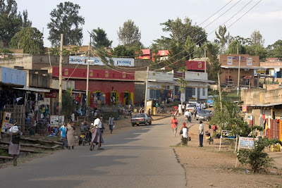
Ibanda is a town in the Western Region of Uganda. It is the main political, administrative, and commercial centre of Ibanda District and the site of the district headquarters. It started wayback in 1990s and was elevated from a trading centre to a town board, town council and in 2016 it was granted a Municipality status. The Municipal Council has three Divisions of Kagongo, Bisheshe and Bufunda with 21 wards of Kyaruhanga, Bufunda, Nyamirima, Nsasi, Kayenje, Kashangura, Rwenshuri, Kigarama, Rugazi, Rwobuzizi, Kakatsi, Bugarama, Karangara, Kabaare, Kanyansheko, Nyakatookye, Kyeikucu, Kikoni, Kagongo, Ruyonza and Katongore ward. Ibanda Municipal Council has over 230 villages. Ibanda Municipal council commenced its operations on 1 July 2016 after being elevated from a Town Council and other sub counties that were annexed to. (Bisheshe Sub County, Nsasi, Part of Nyabuhikye Sub County and Kashangura).
Location[edit]
Ibanda is located approximately 70 kilometres (43 mi), by road, northwest of Mbarara, the largest city in the Ankole sub-region.[2] This is about 290 kilometres (180 mi), by road, southwest of Kampala, the capital of and largest city in Uganda.[3] The coordinates of the town are 0°08'05.0"S, 30°29'42.0"E (Latitude:-0.134712; Longitude:30.495000).[4]
Ibanda Municipal Council is located in Ibanda South Constituency of Ibanda District, south western part of Uganda. It borders with Igorora Town Council, Kikyenkye, Kijongo and Ishongororo sub-counties of Ibanda District, Kinoni s/c in Kiruhura District and Kicheche Sub-County of Kamwenge district and it hosts the Ibanda District headquarters. The total geographical area of the council is about 372.21 square kilometres (143.71 sq mi), both dry land (built environment and open land) wetlands and open water area. The former town council started back in 1994 with two wards of Bufunda and Kagongo and during the physical development plan process in 2010, three more wards were created i.e. Rugazi, Kigarama and Kyaruhanga, covering a total area of 51.49 km2 (19.88 sq mi).
History[edit]
Ibanda is known for the killing of Harry George Galt, a British sub-commissioner for the western province of the Uganda Protectorate, on 19 May 1905.[citation needed] Its name came from a native word Ibandwa where the local people used to climb the hill to settle their misfortunes with their gods hence translated as ibandwa hill.
Population[edit]
The 2002 national census estimated the population of Ibanda at 22,730. In 2010, the Uganda Bureau of Statistics (UBOS) estimated the population at 27,800. In 2011, UBOS estimated the mid-year population at 28,500.[5] In 2014, the national population census put the population at 31,316.[1]
Points of interest[edit]
The following additional points of interest lie in Ibanda town or close to its borders:
- offices of Ibanda Town Council
- the headquarters of Ibanda District Administration
- Ibanda University, a private co-educational institution of higher learning, established in 2014.
- Uganda Martyrs' Hospital Ibanda, a community hospital administered by the Roman Catholic Archdiocese of Mbarara[6]
Photos[edit]
See also[edit]
References[edit]
- ^ a b UBOS (29 November 2014). "The Population of The Regions of the Republic of Uganda And All Cities And Towns of More Than 15,000 Inhabitants". Citypopulation.de Quoting Uganda Bureau of Statistics (UBOS). Retrieved 27 February 2015.
- ^ "Distance Between Mbarara And Ibanda With Map". Globefeed.com. Retrieved 5 June 2014.
- ^ "Map Showing Kampala And Ibanda With Distance Marker". Globefeed.com. Retrieved 5 June 2014.
- ^ Google (4 July 2015). "Location of Ibanda At Google Maps" (Map). Google Maps. Google. Retrieved 4 July 2015.
- ^ UBOS. "Estimated Population of Ibanda In 2002, 2010 & 2011" (PDF). Uganda Bureau of Statistics (UBOS). Archived from the original (PDF) on 7 July 2014. Retrieved 5 June 2014.
- ^ My Country Uganda (25 July 2015). "About Ibanda Hospital". My Country Uganda. Retrieved 25 July 2015.
External links[edit]
Capital: Ibanda | ||
| Counties and sub-counties |
|  |
| Towns and villages | ||
| Economy | ||
| Health | ||
| Transport | ||
| Notable landmarks | ||
| Education | ||
| Notable people | ||