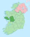
Inishark
 | |
| Geography | |
|---|---|
| Location | Atlantic Ocean |
| Highest elevation | 96.6 m (316.9 ft) |
| Administration | |
| Demographics | |
| Population | 0 |
Inishark or Inishshark (Irish: Inis Airc), sometimes called Shark Island, is a small island neighbouring the larger Inishbofin in County Galway, Ireland.
Overview

Now uninhabited, the last 23 inhabitants of this former isolated fishing and farming community were evacuated in October 1960.[2] The islanders had been unable to leave for months in winter and the government opted to resettle them on the mainland rather than build an expensive pier on the island.
The island was occupied for thousands of years and has many Bronze Age sites such as burial grounds and monuments.
Like Inishbofin, Inishark is composed almost entirely of Silurian slates and shales. It rises almost to 100 metres above sea level.[1]
The documentary film Inis Airc, Bás Oileáin (Inishark, Death of an Island) produced in 2007 by C-Board Films for TG4, told the story of the last years and abandonment of Inishark. Produced and directed by Kieran Concannon, it featured interviews with surviving islanders and archive newsreel footage of the final evacuation.
In 2009, Boston College's Irish Studies program (in cooperation with Irish Film Institute) screened Inis Airc, Bás Oileáin (Inishark, Death of an Island) as part of the Irish Studies Film Series telling the evacuation story from the surviving islanders viewpoint.
The island's patron saint was Leo of Inis Airc, who lived there sometime between the sixth and eighth centuries. The remains of a 19th-century church named after him lie on the island today.[3]
Demographics
The table below reports data on Inishhark's population taken from Discover the Islands of Ireland (Alex Ritsema, Collins Press, 1999) and the Census of Ireland. Census data in Ireland before 1841 are not considered complete and/or reliable.
|
| ||||||||||||||||||||||||||||||
| Source: John Chambers. "Islands - Change in Population 1841 - 2011". irishislands.info. Retrieved February 19, 2015. | |||||||||||||||||||||||||||||||
See also
- Clare Island
- Caher Island, County Mayo
- Inishturk
External links
- Inishark, Death of an Island. Contemporary Daily Mirror story about the day the island was evacuated. 1960-10-27.
- The surviving residents of Inishark: Narrated documentary slideshow about Inishark and its surviving residents produced for the fiftieth anniversary of the evacuation of the island. Cyril Byrne. The Irish Times, 2010-10-20.
References
- ^ a b "Inishark Island". MountainViews. Ordnance Survey Ireland. Retrieved February 21, 2015.
- ^ Murphy, Judy. "The Island that Died for Want of a Telephone". The Free Library. Farlex, Inc. Retrieved 1 Sep 2010.
- ^ Hoffstot, Daryln (1999-08-01). "Where Legends Outnumber People". nytimes.com. Retrieved 1 Sep 2010.
53°36′42″N 10°16′58″W / 53.6117°N 10.2828°W

