Mark (Dintel)
Appearance
| Mark river | |
|---|---|
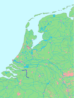
 Location of the Mark river | |
 | |
| Location | |
| Country | Netherlands |
| Physical characteristics | |
| Mouth | |
• location | Dintel |
| Length | 80.6 km |

The Mark (Dutch pronunciation: [ˈmɑr(ə)k]) is a river in Belgium and the Netherlands.
Characteristics
The Mark rises north of Turnhout, Belgium, in the municipality of Merksplas. It passes through Hoogstraten before crossing the border with the Netherlands. In the city centre of Breda it receives its main tributary Aa of Weerijs. Below Oudenbosch the Mark is known under the name Dintel. The Dintel flows into the Volkerak (part of the Rhine–Meuse–Scheldt delta) at Dintelsas. The Dintel and Mark are navigable for cargo ships up to 86 metres (282 ft) long from Dintelsas to Breda.
Tributaries
- Kleine Mark (English: Little Mark)
- Merkske
- Heerlese Loop
- Strijbeekse beek
- Chaamse Beek
- Molenlei
- Aa of Weerijs
- Watermolenbeek
51°39′31″N 4°22′08″E / 51.6587°N 4.3689°E
