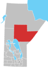
Norway House Cree Nation
| People | Cree |
|---|---|
| Treaty | Treaty 5[1] |
| Headquarters | Norway House |
| Province | Manitoba |
| Land[3] | |
| Main reserve | Norway House 17[2] |
| Population (October 2019)[3] | |
| On reserve | 8389 |
| On other land | 68 |
| Off reserve | 1918 |
| Total population | 10375 |
| Government[3] | |
| Chief | Larson Anderson |
| Council |
|
| Website | |
| http://nhcn.ca/ (under construction as of November 2019[update]) | |
The Norway House Cree Nation is based at Norway House, Manitoba, which is located on the Playgreen Lake section of the Nelson River system. The people are Swampy Cree from the Rocky Cree (Asinīskāwiyiniwak) band government. They are in possession of a number of reserves, but population is centered at IR Norway House 17 (06392).[2] There are over 8300 members living on-reserve with another 1900 plus members at various locations off-reserve.[4] The 2016 Census reported an official population of 7,927 inhabitants at Norway House 17 up from 4 7,758 in 2011.[5]
The Norway House Cree Nation school is the subject of a documentary by Alanis Obomsawin.[6]
History
Prior to the signing of Treaty 5, the Cree people of Norway House were requesting to enter a treaty with the government of Canada as many other Indigenous peoples had been doing down south.[7] They were struggling to survive, running low on food, housing supplies, and medicine. On September 24, 1875, Treaty 5 was signed at the Hudson's Bay outpost of Norway House, thereby creating the reserve of Norway House Cree Nation. A few families from Norway House Cree Nation then migrated down south to where is now Fisher River Cree Nation to establish an agricultural community. After signing Treaty 5, the government was then responsible for the education, public health, and food supplies for the community.
In 1900, the Norway House Residential School was built to accommodate the educational needs of First Nations students primarily from northern Manitoba.[8] Children experienced poor sanitation standards and learned skills pertaining to labour, such as housekeeping, sewing, and mending. In the winter of 1906/07, student Charles Clyne ran away from the school after receiving corporal punishment. Charles’ feet were badly frostbitten after spending a night in a cabin in the woods, and he was then permanently disabled. The school was poorly maintained, and burnt down in 1913. Another building was built in 1915, and was then destroyed by a fire in 1946. And again, another was erected in 1954 until it closed permanently in 1967.
References
- ^ Government of Great Britain (1885). Edward Hertslet (ed.). . A Complete Collection of the Treaties and Conventions between Great Britain and Foreign Powers. Vol. XV. Butterworths, Law. pp. 702–799 – via Wikisource.
- ^ a b "Reserves/Settlements/Villages". Indigenous and Northern Affairs Canada. 26 September 2019.
- ^ "First Nation Detail". Indigenous and Northern Affairs Canada. 26 September 2019.
- ^ "Registered Population". Indigenous and Northern Affairs Canada. 26 September 2019.
- ^ "Norway House Cree Nation (Code 4622058) Census Profile". 2016 census. Government of Canada - Statistics Canada.
- ^ Brownstein, Bill (10 November 2016). "There's no stopping legendary documentarian Alanis Obomsawin". Montreal Gazette. Postmedia. Retrieved 15 November 2016.
- ^ Coates, Kenneth; Morrison, William. "Treaty Research Report - Treaty 5 (1875)". Government of Canada. Indian and Northern Affairs Canada. Retrieved 20 March 2020.
- ^ "Norway House Indian Residential School". The Children Remembered. The United Church of Canada Archives. Retrieved 20 March 2020.
- Lyon, D.M. (20 June 2016). Norway House (online ed.). Historica Canada.
{{cite encyclopedia}}:|work=ignored (help)

