
Portal:Worcestershire
The Worcestershire portal
 |
 |

| |
Worcestershire (/ˈwʊstərʃər/ ⓘ WUUST-ər-shər, /-ʃɪər/ -sheer; written abbreviation: Worcs) is a ceremonial county in the West Midlands of England. It is bordered by Shropshire, Staffordshire, and the West Midlands county to the north, Warwickshire to the east, Gloucestershire to the south, and Herefordshire to the west. The city of Worcester is the largest settlement and the county town.
The county is largely rural, and has an area of 1,741 km2 (672 sq mi) and a population of 592,057. After Worcester (103,872) the largest settlements are Redditch (87,036), Kidderminster (57,400), and Malvern (30,462). It contains six local government districts, which are part of a two-tier non-metropolitan county also called Worcestershire. The county historically had complex boundaries, and included Dudley and the southwestern suburbs of Birmingham.
The River Severn flows through the centre of the county from north to south, forming a wide plain. The southwest of the county contains part of the Malvern Hills, a National Landscape which contains Worcestershire Beacon, at 425 m (1,394 ft) the county's highest point. The southwest contains a small part of the Cotswolds, and in the northwest is part of the Wyre Forest, a national nature reserve.
There is some evidence of Roman occupation in Worcestershire; the area later became part of the Anglo-Saxon kingdom of Hwicce, and then Mercia. Worcestershire was constituted as a county around 927, as the Kingdom of England formed. During the High Middle Ages the county was the site of the Battle of Evesham, in which Simon de Montfort was defeated, and in 1651 the Battle of Worcester was the last major engagement of the Wars of the Three Kingdoms. During the Industrial Revolution the north of the county was part of the Black Country, a major manufacturing centre, Kidderminster became famous for carpet production, and Worcester for porcelain. (Full article...)
 Featured article -
The battle of Powick Bridge was a skirmish fought on 23 September 1642 south of Worcester, England, during the First English Civil War. It was the first engagement between elements of the principal field armies of the Royalists and Parliamentarians. Sir John Byron was escorting a Royalist convoy of valuables from Oxford to King Charles's army in Shrewsbury and, worried about the proximity of the Parliamentarians, took refuge in Worcester on 16 September to await reinforcements. The Royalists despatched a force commanded by Prince Rupert. Meanwhile, the Parliamentarians sent a detachment, under Colonel John Brown, to try to capture the convoy. Each force consisted of around 1,000 mounted troops, a mix of cavalry and dragoons. (Full article...)

List of Featured articles
|
|---|
General images
-
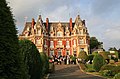 Chateau Impney, near Droitwich (from Droitwich Spa)
 -
 Welcome to Malvern, on an approach road to the town centre. (from Malvern, Worcestershire)
 -
-
 The Lickey Incline about 1845 (from History of Worcestershire)
 -
-
 Classical composer Sir Edward Elgar was born in this house in Broadheath, Worcestershire, currently used as the Elgar Birthplace Museum. (from Worcestershire)
 -
 The Almonry, originally part of Evesham Abbey (from Evesham)
 -
 Grafton Manor, home of the Catholic Talbot family, holding leading military posts in Worcestershire's Royalist forces in the Civil War (from Bromsgrove)
 -
 Seven shillings a week: this nailmaker in 1896 worked from 7am to 10pm, and turned out 11lbs of nails a week. (from Bromsgrove)
 -
 The Enigma Fountain and statue of Edward Elgar, a group of sculptures by artist Rose Garrard, on Belle Vue Terrace (from Malvern, Worcestershire)
 -
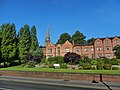
 St Stephen's Church (Church of England) (from Redditch)
 -
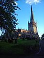
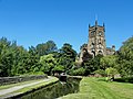 St Mary's and All Saints Parish Church, seen from the Staffordshire and Worcestershire Canal (from Kidderminster)
 -
 All Saints Church Evesham (from Evesham)
 -
 St John the Baptist's Church (Church of England), built in 1843 (from Kidderminster)
 -
 Droitwich transmitting station, Wychbold (from Droitwich Spa)
 -
 Council House (built 1874), viewed from Priory Park, is the headquarters of the District Council. (from Malvern, Worcestershire)
 -
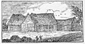 Tithe barn of St Johns, Bromsgrove, shortly before it was sold and demolished in 1844. It was used as a theatre in the 1700s. (from Bromsgrove)
 -
 Halesowen was an exclave of neighbouring Shropshire until 1844 when it was reincorporated into Worcestershire. It is now within the metropolitan county of the West Midlands. (from Worcestershire)
 -
 Thai Gy-Nguang brand Formula 2 Worcestershire sauce (2010) (from Worcestershire sauce)
 -
 Sanders Park (from Bromsgrove)
 -
 Grave of Sir Thomas Chavasse (1854–1913) and his family in Bromsgrove (from Bromsgrove)
 -
 Summit of the Worcestershire Beacon in the Malvern Hills, the county's highest point (from Worcestershire)
 -
 The Old Town Hall (from Droitwich Spa)
 -
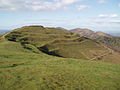 Iron Age earthworks, British Camp
 -
 St Peter's Church, Droitwich (from Droitwich Spa)
 -
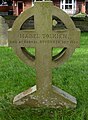
 Graves of railway engineers Tom Scaife and Joseph Rutherford, killed in an engine explosion in Bromsgrove in 1840 (from Bromsgrove)
 -
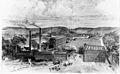
The Lickey Incline in 1840 (from Bromsgrove)
-
 St John's Court: 19th century vicarage, served as council offices from 1920s to 1980s, now a care home. (from Bromsgrove)
 -
 The former Redditch Bus Station, c. 1996 (from Redditch)
 -
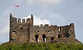
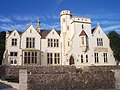
 Caldwall Castle (from Kidderminster)
 -
 The hand axe discovered in the 1970s in Hallow. Potentially the first Early Middle Palaeolithic artefact from the West Midlands. (from History of Worcestershire)
 -
 Interior of a Bromsgrove Nailmaker's shed in 1896; occupied by the tenant and two stallers, the latter worked each on his own account, and paid 6d. a week apiece and one-third of the firing. The oliver, or heavy hammer used for heading the nails, is attached to the bench in front of the little anvil. (from Bromsgrove)
 -
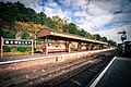 Bewdley Station, now restored as part of the Severn Valley Railway (from Bewdley)
 -
 A.E. Housman, poet, lived at Perry Hall, Bromsgrove (from Bromsgrove)
 -
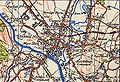 Map of Stourport, 1942 (from Stourport-on-Severn)
 -
 Worcester Bosch; Bosch Thermotechnology are in Warndon (from Worcestershire)
 -
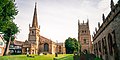
 Evesham Town Hall (from Evesham)
 -
 The North West View of the City of Worcester (from History of Worcestershire)
 -
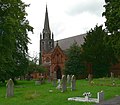
 The 1906 sandstone and red brick Evesham Methodist Church on the banks of the River Avon (from Evesham)
 -
 Malvern Theatres (from Malvern, Worcestershire)
 -
The hand axe discovered in 1970s in Hallow. Potentially the first Early Middle Palaeolithic artefact from the West Midlands. (from Worcestershire)
-
 Bromsgrove War Memorial (from Bromsgrove)
 -

-
 John's tomb, Worcester Cathedral (from History of Worcestershire)
 -
 Richard Baxter, the leading Puritan in Kidderminster, noted the rising opposition to King Charles' policies of taxation and rule without Parliament (from History of Worcestershire)
 -
 The spa town of Great Malvern was laid out and developed largely during the 19th century
 -
 Bewdley from the racks, 2019 (from Bewdley)
 -
 William Lloyd (from History of Worcestershire)
 -
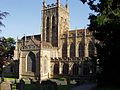
 Parish church of St John the Baptist (from Bromsgrove)
 -
 Oswald and Eadnoth (from History of Worcestershire)
 -
 Bewdley Guildhall (from Bewdley)
 -
 Aggborough is the home ground of the professional club Kidderminster Harriers, formerly of the Football League. (from Kidderminster)
 -
 Lea & Perrins advertisement (1900) (from History of Worcestershire)
 -
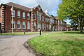
 Malvern St James girls school main building (from Malvern, Worcestershire)
 -
 Bewdley Bridge and Severn Side South, 2003 (from Bewdley)
 -
 Detail of buildings and shops in Church Street, Great Malvern (from Malvern, Worcestershire)
 -
 Portrait of Sir William Waller, 1643, whose raids thoroughly depleted the Vale of Evesham (from History of Worcestershire)
 -
 The former Bromsgrove railway station (from Bromsgrove)
 -
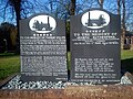
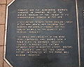 Commemorative pavement plaque in Alcester Street (from Redditch)
 -
 Roosevelt plaque, Aldwyn Tower, Malvern (from Malvern, Worcestershire)
 -
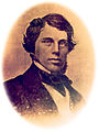 James McConnell (from Bromsgrove)
 -
-
 Grave of Mabel Tolkien (née Suffield, 1870–1904), mother of J. R. R. Tolkien, in Bromsgrove (from Bromsgrove)
 -
 The flag of the historic county of Worcestershire (from Worcestershire)
 -
 Nailmakers in Bromsgrove c.1896 (from History of Worcestershire)
 -
 Evesham Abbey bell tower (from Evesham)
 -
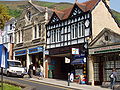
 Droitwich Spa High Street on St. Richard's Day 2009 (from Droitwich Spa)
 -
 Worcester Square (from Redditch)
 -
Iron Age earthworks, British Camp
-
 Landsdown Methodist Church, Great Malvern (from Malvern, Worcestershire)
 -
 View across Arrow Valley Lake (from Redditch)
 -
 Saltworkers by British sculptor John McKenna in the town centre (from Droitwich Spa)
 -
 The Market Place in Evesham, circa 1904 by Edmund Hort New. (from Evesham)
 -
 The Malvhina Fountain in the town centre, a sculpture by artist Rose Garrard. (from Malvern, Worcestershire)
 -
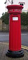 Victorian pillar box on the corner of Priory Road and Orchard Road
 -
 Hand-drawn map of Worcestershire by Christopher Saxton from 1577. (from Worcestershire)
 -
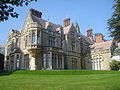
 Prior's Croft, Grange Road (Victorian Gothic architecture)
 -
 15th-century Merchant's House formerly located on Bromsgrove's High Street, now at Avoncroft Museum of Historic Buildings (from Bromsgrove)
 -
 St Ann's Well spout (from Malvern, Worcestershire)
 -
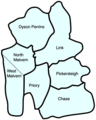 Council wards of Malvern town (from Malvern, Worcestershire)
 -
 Stourport Road Bridge (from Stourport-on-Severn)
 -
 The coat of arms of Worcestershire County Council (from Worcestershire)
 -
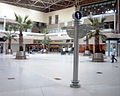
 The Riverside Shopping Centre (from Evesham)
 -
 View of the QinetiQ facility from the Malvern Hills. Malvern College campus in the foreground, and the village of Poolbrook to the rear
 -
 New Road is the home of Worcestershire County Cricket Club, across the River Severn from Worcester Cathedral. (from Worcestershire)
 -
 The Abbey Gateway in the town centre is now the home of the Malvern Museum
 -
 Parkside, headquarters of Bromsgrove District Council (from Bromsgrove)
 -
 The former Slingfield Mill (from Kidderminster)
 -
 The art deco Regal Cinema (from Evesham)
 -
 Stafford tomb, St John the Baptist Church, Bromsgrove: one of the most powerful families in Worcestershire, living just south of the town (from Bromsgrove)
 -
 Priory Park with Malvern Theatres complex and Priory Church tower in the background (from Malvern, Worcestershire)
 -
 Bromsgrove Guild maker's mark on a main gate of Buckingham Palace (from Bromsgrove)
 -
Nailmakers in Bromsgrove c.1896 (from Bromsgrove)
-
 Bewdley and surrounding area (Ordnance Survey) (from Bewdley)
 -

-
 Honeybourne railway station on the Cotswold Line and the potential Honeybourne Line (from Worcestershire)
 -
 Malvern post office, town centre
 -
 Due to its cathedral (pictured), the county town of Worcester is the only settlement in the county with city status. (from Worcestershire)
 -
Qinetiq at the Malvern Hills Science Park, or Malvern Technology Centre; the integrated circuit was invented here in 1952 (from Worcestershire)
-
 Coat of Arms of the former Bromsgrove Rural District Council (from Bromsgrove)
 -
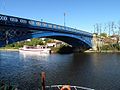
 Bewdley Bridge (from Bewdley)
 -
 Battle of Worcester (from History of Worcestershire)
 -
 Bromsgrove Museum (from Bromsgrove)
 -
 The Battle of Powick Bridge on the River Teme on 23 September 1642 began the English Civil War. (from Worcestershire)
 -

-
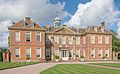 Hanbury Hall, completed around 1706 (from History of Worcestershire)
 -
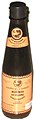
 A bottle of Shanghainese "spicy soy sauce", Taikang Yellow brand (from Worcestershire sauce)


.jpg)


.jpg)


.jpg)

_Tower,_Castle_Road,_Kidderminster_(geograph_2328286).jpg)


.jpg)


_-_geograph.org.uk_-_693296.jpg)


.jpg)

.jpg)


.jpg)


 Good article -

The administrative boundaries of Worcestershire, England have been fluid for over 150 years since the first major changes in 1844. There were many detached parts of Worcestershire in the surrounding counties, and conversely there were islands of other counties within Worcestershire. The 1844 Counties (Detached Parts) Act began the process of eliminating these, but the process was not completed until 1966, when Dudley was absorbed into Staffordshire.
The expansion of Birmingham and the Black Country during and after the Industrial Revolution also altered the county map considerably. Local government commissions were set up to recommend changes to the local government structures, and as early as 1945 recommendations were made to merge Worcestershire with Herefordshire. Eventually in 1974, a form of this recommendation was carried out, most of Worcestershire was combined with Herefordshire to form a new county named Hereford and Worcester, while the northern Black Country towns and villages of Worcestershire, along with adjoining areas of Staffordshire and Warwickshire, formed the new administrative county of West Midlands. (Full article...)Selected quotes
| “ | The top three hardest things to say are:
|
” |
- — Unknown
Did you know?

- ...that Simon de Montfort was killed and had his testicles cut off at the Battle of Evesham (pictured)?
- ...that Whittington Tump in Worcestershire was the site of a motte castle?
- ...that the investigation into the murder of Céline Figard saw the UK's first national DNA screening programme in the hunt for a suspect?
- ...that the medieval nobleman Walter de Beauchamp was granted the right to keep pheasants on his lands and fine any who poached them by King Henry I of England?
Things you can do for WikiProject Worcestershire
WORCS/ToDo is a list of urgent tasks. If they have been addressed, please do not remove them from the list, but check them off with the {{done}} (![]() Done) template, and sign your name with four tildes: ~~~~ (Full article...)
Done) template, and sign your name with four tildes: ~~~~ (Full article...)
Categories
Related WikiProjects
| WikiProject Cities WikiProject UK geography WikiProject England |
West Midlands
Warwickshire Gloucestershire (inactive) Herefordshire (low activity) Shropshire (low activity) Staffordshire (no project yet) |
WikiProject UK Railways WikiProject UK Roads WikiProject UK Waterways WikiProject UK Trams |
Berkshire
Cambridge Cheshire Cornwall Derbyshire Devon Dorset Greater Manchester Hampshire Hertfordshire Kent Lancashire and Cumbria Lincolnshire London Merseyside North East England Northamptonshire Nottinghamshire Somerset Surrey Sussex Warwickshire West Midlands Wight Worcestershire Yorkshire |
|---|
Related Portals
Religions here
British Isles
Associated Wikimedia
The following Wikimedia Foundation sister projects provide more on this subject:
-
 Commons
Free media repository -
 Wikibooks
Free textbooks and manuals -
 Wikidata
Free knowledge base -
 Wikinews
Free-content news -
 Wikiquote
Collection of quotations -
 Wikisource
Free-content library -
 Wikiversity
Free learning tools -
 Wikivoyage
Free travel guide -
 Wiktionary
Dictionary and thesaurus


