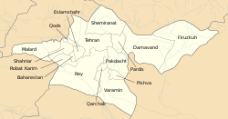
Shahriar County
Appearance
Shahriar County
شهرستان شهریار | |
|---|---|
 Location of Shahriar County in Tehran province | |
 Location of Tehran province in Iran | |
| Coordinates: 35°39′32″N 51°03′36″E / 35.659°N 51.060°E | |
| Country | |
| Province | Tehran |
| Capital | Shahriar |
| Districts | 3 (2006) |
| Area | |
| • Total | 335.9 km2 (129.7 sq mi) |
| Population (2016) | |
| • Total | 744,210 |
| • Density | 2,200/km2 (5,700/sq mi) |
| Time zone | UTC+3:30 (IRST) |
| • Summer (DST) | UTC+4:30 (IRDT) |
| Year | Pop. | ±% |
|---|---|---|
| 2006 | 518,661 | — |
| 2011 | 624,440 | +20.4% |
| 2016 | 744,210 | +19.2% |
| amar.org.ir Excluding areas under the jurisdiction of the county in previous censuses. | ||
Shahriar County (Persian: شهرستان شهریار) is located in Tehran province, Iran. The capital of the county is Shahriar. At the 2006 census, the county's population (including those portions of the county later split off to form Malard County and Qods County) was 1,044,707, in 273,826 families.[1] At the 2016 census, the population was 744,210, in 226,011 families.[2]
Administrative divisions
| Administrative Divisions | Pop. |
|---|---|
| Central District | 516,022 |
| Ferdows Rural District | 15,225 |
| Juqin Rural District | 22,587 |
| Maviz Rural District | 6,199 |
| Qaemabad Rural District | 30,682 |
| Razakan Rural District | 25,395 |
| Saidabad Rural District | 16,176 |
| Andisheh City | 75,596 |
| Baghestan City | 52,330 |
| Ferdowsieh City | 20,854 |
| Sabashahr City | 18,132 |
| Shahedshahr City | 18,855 |
| Shahriar City | 189,120 |
| Vahidieh City | 24,871 |
| Malard District1 | 291,608 |
| Akhtarabad Rural District | 3,598 |
| Bibi Sakineh Rural District | 16,003 |
| Malard Rural District | 27,479 |
| Malard City | 228,673 |
| Safadasht City | 15,855 |
| Qods District2 | 237,077 |
| Danesh Rural District | 4,799 |
| Haft Juy Rural District | 2,924 |
| Qods City | 229,354 |
| Total Shahriar County | 1,044,707 |
1Became a part of Malard County
2Became a part of Qods County
References
- ^ a b "Census of the Islamic Republic of Iran, 1385 (2006)" (Excel). Statistical Center of Iran. Archived from the original on 2011-09-20.
- ^ "Census 2016 | Iran Data Portal". Retrieved 2020-11-17.
Wikimedia Commons has media related to Shahriar County.

