Shirabad Waterfall
| Shirabad Waterfall | |
|---|---|
| آبشار شیرآباد | |
 | |
 | |
| Location | Shirabad, Fenderesk District, Ramian County, Golestan Province, Iran |
| Longest drop | 30 metres (98 ft) |
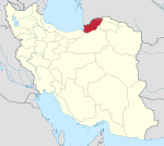
The Shirabad Waterfall is a waterfall in the northern Iranian village of Shirabad. It is 7 kilometers south of Khanbebin, in the Fenderesk District of Golestan Province and in the slopes of the Alborz mountains in a forested area. This waterfall is in the form of a stairway and includes 12 large and small waterfalls. Its largest waterfall is 30 metres (98 ft) high and its plunge pool is 40 to 80 metres (130 to 260 ft) deep. There are several caves nearby, which are home to the critically endangered Gorgan salamander.
36°58′21″N 55°01′31″E / 36.97250°N 55.02528°E

