Alsónyék: Difference between revisions
Appearance
Content deleted Content added
m Bot: Migrating 9 interwiki links, now provided by Wikidata on d:q516516 (Report Errors) |
m rm area_magnitude |
||
| (6 intermediate revisions by 5 users not shown) | |||
| Line 1: | Line 1: | ||
{{Infobox |
{{Infobox settlement |
||
<!-- General information --> |
|||
| |
|name =Alsónyék |
||
| image_skyline = |
|||
| |
|image_shield =HUN Alsónyék COA.jpg |
||
| |
|image_flag = |
||
<!-- Pushpin map --> |
|||
| ⚫ | |||
|pushpin_map =Hungary |
|||
| ⚫ | |||
|pushpin_map_caption =Location of Alsónyék in Hungary |
|||
| ⚫ | |||
<!-- Political information --> |
|||
| ⚫ | |||
| |
|subdivision_type =Country |
||
|subdivision_name =[[Hungary]] |
|||
| ⚫ | |||
|subdivision_type1 =[[List of regions of Hungary|Region]] |
|||
| latd = 46.20279 |
|||
|subdivision_name1 =[[{{Hungarian county region|Tolna}}]] |
|||
| longd = 18.73555 |
|||
|subdivision_type2 =[[Counties of Hungary|County]] |
|||
|ksh_code = 11563 |
|||
|subdivision_name2 ={{Hungarian county link|Tolna}} |
|||
| ⚫ | |||
|subdivision_type3 =[[Subregions of Hungary|Subregion]] |
|||
| ⚫ | |||
| ⚫ | |||
| ⚫ | |||
|subdivision_type6 =Rank |
|||
|website = www.alsonyek.hu |
|||
| ⚫ | |||
|leader_title =Mayor |
|||
| ⚫ | |||
<!-- Geographical information --> |
|||
| ⚫ | |||
|area_footnotes =<ref name="ksh_cite_area">[http://www.ksh.hu/apps/!cp.hnt2.telep?nn=11563 Alsónyék] at the [[Hungarian Central Statistical Office]] (Hungarian).</ref> |
|||
|coordinates ={{coord|46.20279|N|18.73555|E|region:HU|display=inline}} |
|||
<!-- Demographical information --> |
|||
| ⚫ | |||
|postal_code_type =[[Postal code]] |
|||
|area_code =+36 74 |
|||
|area_code_type =[[Telephone numbers in Hungary|Area code]] |
|||
|timezone =[[Central European Time|CET]] |
|||
|utc_offset =+1 |
|||
|timezone_DST =[[Central European Summer Time|CEST]] |
|||
|utc_offset_DST =+2 |
|||
|total_type =Total |
|||
| ⚫ | |||
|population_density_km2 =auto |
|||
|population_density_urban_km2 =auto |
|||
|population_density_metro_km2 =auto |
|||
| ⚫ | |||
| ⚫ | |||
|blank_name =[[Hungarian Central Statistical Office|KSH code]] |
|||
|blank_info =11563<ref name="ksh_cite_area">[http://www.ksh.hu/apps/!cp.hnt2.telep?nn=11563 Alsónyék] at the [[Hungarian Central Statistical Office]] (Hungarian).</ref> |
|||
|website =[http://www.alsonyek.hu www.alsonyek.hu] |
|||
}} |
}} |
||
| Line 26: | Line 53: | ||
{{Tolna}} |
{{Tolna}} |
||
{{authority control}} |
|||
{{DEFAULTSORT:Alsonyek}} |
{{DEFAULTSORT:Alsonyek}} |
||
[[Category:Populated places in Tolna |
[[Category:Populated places in Tolna County]] |
||
{{Tolna-geo-stub}} |
{{Tolna-geo-stub}} |
||
Latest revision as of 11:43, 25 November 2022
Alsónyék | |
|---|---|
| Coordinates: 46°12′10″N 18°44′08″E / 46.20279°N 18.73555°E | |
| Country | Hungary |
| Region | Southern Transdanubia |
| County | Tolna |
| Subregion | Szekszárdi |
| Rank | Village |
| Government | |
| • Mayor | Dózsa Pál Tibor |
| Area | |
| • Total | 32.05 km2 (12.37 sq mi) |
| Population (1 January 2008)[2] | |
| • Total | 786 |
| • Density | 25/km2 (64/sq mi) |
| Time zone | UTC+1 (CET) |
| • Summer (DST) | UTC+2 (CEST) |
| Postal code | 7148 |
| Area code | +36 74 |
| KSH code | 11563[1] |
| Website | www.alsonyek.hu |
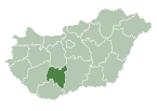
Alsónyék is a village in Tolna County, Hungary.
References
[edit]- ^ a b Alsónyék at the Hungarian Central Statistical Office (Hungarian).
- ^ Alsónyék at the Hungarian Central Statistical Office (Hungarian). 1 January 2008
46°12′N 18°44′E / 46.200°N 18.733°E


