
Vanderkloof: Difference between revisions
Content deleted Content added
Wesley olis (talk | contribs) Include Photos of the town to put it on the map Tag: Reverted |
No edit summary Tags: Reverted Visual edit |
||
| Line 63: | Line 63: | ||
==Gallery== |
==Gallery== |
||
<gallery mode="packed" heights="130"> |
<gallery mode="packed" heights="130"> |
||
File:Dam Wall Holiday Resorts.png |
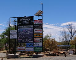
File:Dam Wall Holiday Resorts.png| Main Road entrance of Vanderkloof |
||
File:VanderKloofTown2 Boat club.jpg |
File:VanderKloofTown2 Boat club.jpg| Vanderkloof Boating Club |
||
File:VanderKloofTownPanoOfTheDam Park2.jpg |
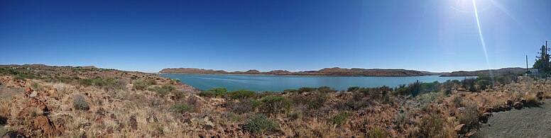
File:VanderKloofTownPanoOfTheDam Park2.jpg| Rolfontein Nature Reserve |
||
File:VanderKloofTown1.jpg |
File:VanderKloofTown1.jpg |
||
File:VanderKloofTownCampSuperTube.jpg |
File:VanderKloofTownCampSuperTube.jpg |
||
| Line 84: | Line 84: | ||
File:VanderKloofTownOfTheDam4.jpg |
File:VanderKloofTownOfTheDam4.jpg |
||
File:VanderKloofDamLookingDown.jpg |
File:VanderKloofDamLookingDown.jpg |
||
</gallery> |
</gallery> |
||
Revision as of 20:18, 5 March 2021
Vanderkloof | |
|---|---|
 Vanderkloof  Vanderkloof | |
| Coordinates: 30°0′S 24°44′E / 30.000°S 24.733°E | |
| Country | South Africa |
| Province | Northern Cape |
| District | Pixley ka Seme |
| Municipality | Renosterberg |
| Area | |
| • Total | 4.91 km2 (1.90 sq mi) |
| Population (2011)[1] | |
| • Total | 1,228 |
| • Density | 250/km2 (650/sq mi) |
| Racial makeup (2011) | |
| • Black African | 17.8% |
| • Coloured | 45.3% |
| • Indian/Asian | 0.4% |
| • White | 35.2% |
| • Other | 1.3% |
| First languages (2011) | |
| • Afrikaans | 90.1% |
| • English | 3.1% |
| • Xhosa | 3.1% |
| • Tswana | 1.7% |
| • Other | 2.0% |
| Time zone | UTC+2 (SAST) |
| Postal code (street) | 8771 |
| PO box | 8771 |
| Area code | 053 |
Vanderkloof is a town in the Northern Cape province of South Africa. It is located on the Orange River and near the Rolfontein Nature Reserve.
Village on the site of the Vanderkloof Dam, (formerly the P.K. le Roux Dam), 9 km north-east of Petrusville. It was established to house the labour force constructing the dam. The name is derived from the surname of Petrus J van der Walt, and a ravine (Afrikaans kloof) in the vicinity.[2]
Gallery
-
 Main Road entrance of Vanderkloof
 -
 Vanderkloof Boating Club
 -
 Rolfontein Nature Reserve
 -

-

-
-

-

-

-

-

-

-

-

-

-

-

-

-

-

-


References
- ^ a b c d "Main Place Vanderkloof". Census 2011.
- ^ "Dictionary of Southern African Place Names (Public Domain)". Human Science Research Council. p. 453.
This Northern Cape location article is a stub. You can help Wikipedia by expanding it. |
Municipalities and communities of Pixley ka Seme District Municipality, Northern Cape | ||
|---|---|---|
District seat: De Aar | ||
| Emthanjeni | .svg) | |
| Kareeberg | ||
| Renosterberg | ||
| Siyancuma | ||
| Siyathemba | ||
| Thembelihle | ||
| Ubuntu | ||
| Umsobomvu | ||