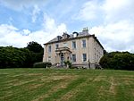
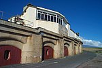
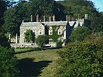
Grade II* listed buildings in South Hams: Difference between revisions
Appearance
Content deleted Content added
Agathoclea (talk | contribs) Semi-automated addition of image(s) and/or commonscat link(s) to monument list |
Add images and links |
||
| Line 1,243: | Line 1,243: | ||
{{EH listed building row |
{{EH listed building row |
||
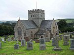
| name= Church of St Matthew |
| name= Church of St Matthew |
||
| location= Landscove, Staverton, |
| location= Landscove, [[Staverton, Devon|Staverton]] |
||
| type= Parish Church |
| type= Parish Church |
||
| completed= 1849-1850 |
| completed= 1849-1850 |
||
| Line 1,253: | Line 1,253: | ||
| uid= 1108532 |
| uid= 1108532 |
||
| show_img = yes |
| show_img = yes |
||
| image=St Matthew's church, Landscove - geograph.org.uk - 1075194.jpg |
|||
| commonscat= St Matthew's church, Landscove |
| commonscat= St Matthew's church, Landscove |
||
| upload_desc= Church of St Matthew |
| upload_desc= Church of St Matthew |
||
|image=St Matthew's church, Landscove - geograph.org.uk - 1075194.jpg |
|||
}} |
}} |
||
{{EH listed building row |
{{EH listed building row |
||
| name= Dovecote |
| name= Dovecote approximately 100 Metres North West of Pridhamsleigh Manor |
||
| location= Staverton, |
| location= [[Staverton, Devon|Staverton]] |
||
| type= Dovecote |
| type= Dovecote |
||
| completed= circa 16th century |
| completed= circa 16th century |
||
| Line 1,274: | Line 1,274: | ||
{{EH listed building row |
{{EH listed building row |
||
| name= Kingston House |
| name= Kingston House |
||
| location= Staverton, |
| location= [[Staverton, Devon|Staverton]] |
||
| type= Country House |
| type= Country House |
||
| completed= 1743 |
| completed= 1743 |
||
| Line 1,284: | Line 1,284: | ||
| uid= 1108525 |
| uid= 1108525 |
||
| show_img = yes |
| show_img = yes |
||
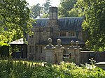
| image=Kingston House - geograph.org.uk - 1067159.jpg |
|||
| image= |
|||
| upload_desc= Kingston House |
| upload_desc= Kingston House |
||
}} |
}} |
||
{{EH listed building row |
{{EH listed building row |
||
| name= Pridhamsleigh Manor Farm House |
| name= Pridhamsleigh Manor Farm House |
||
| location= Staverton, |
| location= [[Staverton, Devon|Staverton]] |
||
| type= Farmhouse |
| type= Farmhouse |
||
| completed= 16th century |
| completed= 16th century |
||
| Line 1,304: | Line 1,304: | ||
{{EH listed building row |
{{EH listed building row |
||
| name= Woodend Farmhouse |
| name= Woodend Farmhouse |
||
| location= Staverton, |
| location= [[Staverton, Devon|Staverton]] |
||
| type= Farmhouse |
| type= Farmhouse |
||
| completed= Circa early 16th century or earlier |
| completed= Circa early 16th century or earlier |
||
| Line 1,319: | Line 1,319: | ||
{{EH listed building row |
{{EH listed building row |
||
| name= Woolston Green Farmhouse |
| name= Woolston Green Farmhouse |
||
| location= Woolston Green, Staverton, |
| location= Woolston Green, [[Staverton, Devon|Staverton]] |
||
| type= Farmhouse |
| type= Farmhouse |
||
| completed= circa late 15th century or early 16th century |
| completed= circa late 15th century or early 16th century |
||
| Line 1,334: | Line 1,334: | ||
{{EH listed building row |
{{EH listed building row |
||
| name= Church of St Peter |
| name= Church of St Peter |
||
| location= Stoke Fleming |
| location= [[[Stoke Fleming]] |
||
| type= Parish Church |
| type= Parish Church |
||
| completed= 13th century |
| completed= 13th century |
||
| Line 1,344: | Line 1,344: | ||
| uid= 1325163 |
| uid= 1325163 |
||
| show_img = yes |
| show_img = yes |
||
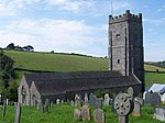
| image = Church tower, Stoke Fleming - geograph.org.uk - 535352.jpg |
|||
| commonscat= St Peter's Church, Stoke Fleming |
| commonscat= St Peter's Church, Stoke Fleming |
||
| upload_desc= Church of St Peter |
| upload_desc= Church of St Peter |
||
|image=Church tower, Stoke Fleming - geograph.org.uk - 535352.jpg |
|||
}} |
}} |
||
{{EH listed building row |
{{EH listed building row |
||
| name= Sandridge Park |
| name= Sandridge Park |
||
| location= Stoke Gabriel |
| location= [[Stoke Gabriel]] |
||
| type= Country House |
| type= Country House |
||
| completed= 1805 |
| completed= 1805 |
||
| Line 1,360: | Line 1,360: | ||
| uid= 1108493 |
| uid= 1108493 |
||
| show_img = yes |
| show_img = yes |
||
| image=Sandridge Park, Devon (geograph 1881542).jpg |
|||
| image= |
|||
| upload_desc= Sandridge Park |
| upload_desc= Sandridge Park |
||
}} |
}} |
||
{{EH listed building row |
{{EH listed building row |
||
| name= Widdicombe House |
| name= Widdicombe House |
||
| location= Stokenham |
| location= [[Stokenham]] |
||
| type= Country House |
| type= Country House |
||
| completed= 1720-5 |
| completed= 1720-5 |
||
| Line 1,379: | Line 1,379: | ||
}} |
}} |
||
{{EH listed building row |
{{EH listed building row |
||
| name= Gate-piers |
| name= Gate-piers about 100 Metres South South East of Higher Fuge |
||
| location= Strete |
| location= [[Strete]] |
||
| type= Gate Pier |
| type= Gate Pier |
||
| completed= 18th century |
| completed= 18th century |
||
| Line 1,395: | Line 1,395: | ||
{{EH listed building row |
{{EH listed building row |
||
| name= Higher Fuge |
| name= Higher Fuge |
||
| location= Strete |
| location= [[Strete]] |
||
| type= Farmhouse |
| type= Farmhouse |
||
| completed= 1726 |
| completed= 1726 |
||
| Line 1,410: | Line 1,410: | ||
{{EH listed building row |
{{EH listed building row |
||
| name= Church of All Saints |
| name= Church of All Saints |
||
| location= Thurlestone |
| location= [[Thurlestone]] |
||
| type= Parish Church |
| type= Parish Church |
||
| completed= 13th century |
| completed= 13th century |
||
| Line 1,426: | Line 1,426: | ||
{{EH listed building row |
{{EH listed building row |
||
| name= Barclay's Bank |
| name= Barclay's Bank |
||
| location= Totnes |
| location= [[Totnes]] |
||
| type= |
| type= Bank |
||
| completed= {{c.|1585}} |
| completed= {{c.|1585}} |
||
| show_listed = yes |
| show_listed = yes |
||
| Line 1,441: | Line 1,441: | ||
{{EH listed building row |
{{EH listed building row |
||
| name= Church House |
| name= Church House |
||
| location= Totnes |
| location= [[Totnes]] |
||
| type= House |
| type= House |
||
| completed= Modern |
| completed= Modern |
||
| Line 1,456: | Line 1,456: | ||
{{EH listed building row |
{{EH listed building row |
||
| name= Eastgate House |
| name= Eastgate House |
||
| location= Totnes |
| location= [[Totnes]] |
||
| type= Inn |
| type= Inn |
||
| completed= renamed in 1642 |
| completed= renamed in 1642 |
||
| Line 1,470: | Line 1,470: | ||
}} |
}} |
||
{{EH listed building row |
{{EH listed building row |
||
| name= Follaton House ( |
| name= Follaton House (South Hams District Council offices) |
||
| location= Totnes |
| location= [[Totnes]] |
||
| type= Country House |
| type= Country House |
||
| completed= Early 19th century |
| completed= Early 19th century |
||
| Line 1,481: | Line 1,481: | ||
| uid= 1235624 |
| uid= 1235624 |
||
| show_img = yes |
| show_img = yes |
||
| image=Follaton House - Totnes - geograph.org.uk - 38661.jpg |
|||
| image= |
|||
| upload_desc= Follaton House ( |
| upload_desc= Follaton House (South Hams District Council) |
||
}} |
}} |
||
{{EH listed building row |
{{EH listed building row |
||
| name= King Edward |
| name= King Edward VI School |
||
| location= Totnes |
| location= [[Totnes]] |
||
| type= House |
| type= House |
||
| completed= 17th century |
| completed= 17th century |
||
| Line 1,497: | Line 1,497: | ||
| show_img = yes |
| show_img = yes |
||
| image= |
| image= |
||
| upload_desc= King Edward |
| upload_desc= King Edward VI School |
||
}} |
}} |
||
{{EH listed building row |
{{EH listed building row |
||
| name= |
| name= Outbuilding to rear of No 39 (former Kitchen Block), Butterwalk |
||
| location= Totnes |
| location= Totnes |
||
| type= Apartment |
|||
| completed= Late 18th century |
|||
| show_listed = yes |
|||
| date_listed= {{dts|format=dmy|1969|03|25}} |
|||
| grid_ref= SX8044160375 |
|||
| lat= 50.431019 |
|||
| lon= -3.684704 |
|||
| uid= 1264900 |
|||
| show_img = yes |
|||
| image= |
|||
| upload_desc= Nos 34, 34a and 34b (flat) |
|||
}} |
|||
{{EH listed building row |
|||
| name= Outbuilding to Rear of No 39 (former Kitchen Block) |
|||
| location= Totnes, South Hams |
|||
| type= Kitchen |
| type= Kitchen |
||
| completed= Former |
| completed= Former |
||
| Line 1,530: | Line 1,515: | ||
}} |
}} |
||
{{EH listed building row |
{{EH listed building row |
||
| name= Priory Gate House |
| name= Priory Gate House, Fore Street |
||
| location= Totnes |
| location= Totnes |
||
| type= House |
| type= House |
||
| completed= possibly former |
| completed= possibly former |
||
| Line 1,546: | Line 1,531: | ||
{{EH listed building row |
{{EH listed building row |
||
| name= Priory House |
| name= Priory House |
||
| location= Totnes |
| location= Totnes |
||
| type= House |
| type= House |
||
| completed= later 17th century |
| completed= later 17th century |
||
| Line 1,561: | Line 1,546: | ||
{{EH listed building row |
{{EH listed building row |
||
| name= The Royal Seven Stars Hotel |
| name= The Royal Seven Stars Hotel |
||
| location= Totnes |
| location= Totnes |
||
| type= Courtyard |
| type= Courtyard |
||
| completed= Late 17th century |
| completed= Late 17th century |
||
| Line 1,571: | Line 1,556: | ||
| uid= 1236781 |
| uid= 1236781 |
||
| show_img = yes |
| show_img = yes |
||
| image=Royal Seven Stars Hotel, Totnes - geograph.org.uk - 1520199.jpg |
|||
| image= |
|||
| upload_desc= The Royal Seven Stars Hotel |
| upload_desc= The Royal Seven Stars Hotel |
||
}} |
}} |
||
{{EH listed building row |
{{EH listed building row |
||
| name= Totnes Bridge |
| name= Totnes Bridge |
||
| location= Bridgetown, Totnes |
| location= Bridgetown, Totnes |
||
| type= Bridge |
| type= Bridge |
||
| completed= 1826-1828 |
| completed= 1826-1828 |
||
| Line 1,590: | Line 1,575: | ||
}} |
}} |
||
{{EH listed building row |
{{EH listed building row |
||
| name= |
| name= Nos 34, 34a and 34b (flat), Fore Street |
||
| location= Totnes |
| location= Totnes |
||
| type= Apartment |
|||
| completed= Late 18th century |
|||
| show_listed = yes |
|||
| date_listed= {{dts|format=dmy|1969|03|25}} |
|||
| grid_ref= SX8044160375 |
|||
| lat= 50.431019 |
|||
| lon= -3.684704 |
|||
| uid= 1264900 |
|||
| show_img = yes |
|||
| image= |
|||
| upload_desc= Nos 34, 34a and 34b (flat) |
|||
}} |
|||
{{EH listed building row |
|||
| name= 48 Fore Street |
|||
| location= Totnes |
|||
| type= Kitchen |
| type= Kitchen |
||
| completed= 17th century |
| completed= later 16th century or early 17th century |
||
| show_listed = yes |
| show_listed = yes |
||
| date_listed= {{dts|format=dmy|1952|01|07}} |
| date_listed= {{dts|format=dmy|1952|01|07}} |
||
| grid_ref= |
| grid_ref= SX8038060391 |
||
| lat= 50. |
| lat= 50.431151 |
||
| lon= -3. |
| lon= -3.685568 |
||
| uid= |
| uid= 1264828 |
||
| show_img = yes |
| show_img = yes |
||
| image= |
| image= |
||
| Line 1,606: | Line 1,606: | ||
{{EH listed building row |
{{EH listed building row |
||
| name= 50 Fore Street |
| name= 50 Fore Street |
||
| location= Totnes |
| location= Totnes |
||
| type= House |
|||
| type= Kitchen |
|||
| completed= late 16th century or early 17th century |
| completed= late 16th century or early 17th century |
||
| show_listed = yes |
| show_listed = yes |
||
| Line 1,620: | Line 1,620: | ||
}} |
}} |
||
{{EH listed building row |
{{EH listed building row |
||
| name= |
| name= 52 Fore Street |
||
| location= Totnes |
| location= Totnes |
||
| type= House |
|||
| completed= 17th century |
|||
| type= Kitchen |
|||
| completed= later 16th century |
|||
| show_listed = yes |
| show_listed = yes |
||
| date_listed= {{dts|format=dmy|1952|01|07}} |
| date_listed= {{dts|format=dmy|1952|01|07}} |
||
| grid_ref= |
| grid_ref= SX8036660395 |
||
| lat= 50. |
| lat= 50.431184 |
||
| lon= -3. |
| lon= -3.685766 |
||
| uid= |
| uid= 1235939 |
||
| show_img = yes |
| show_img = yes |
||
| image= |
| image= |
||
| Line 1,635: | Line 1,635: | ||
}} |
}} |
||
{{EH listed building row |
{{EH listed building row |
||
| name= |
| name= 54 Fore Street |
||
| location= Totnes |
| location= Totnes |
||
| type= House |
| type= House |
||
| completed= |
| completed= {{c.|1607}} |
||
| show_listed = yes |
| show_listed = yes |
||
| date_listed= {{dts|format=dmy| |
| date_listed= {{dts|format=dmy|1952|01|07}} |
||
| grid_ref= |
| grid_ref= SX8036160396 |
||
| lat= 50. |
| lat= 50.431192 |
||
| lon= -3. |
| lon= -3.685837 |
||
| uid= |
| uid= 1264832 |
||
| show_img = yes |
| show_img = yes |
||
| image= |
| image= |
||
| Line 1,665: | Line 1,665: | ||
}} |
}} |
||
{{EH listed building row |
{{EH listed building row |
||
| name= |
| name= 68 Fore Street |
||
| location= Totnes |
| location= Totnes |
||
| type= House |
|||
| completed= Mid 18th century |
|||
| type= Kitchen |
|||
| completed= {{c.|1560}} |
|||
| show_listed = yes |
| show_listed = yes |
||
| date_listed= {{dts|format=dmy|1952|01|07}} |
| date_listed= {{dts|format=dmy|1952|01|07}} |
||
| grid_ref= |
| grid_ref= SX8031060409 |
||
| lat= 50. |
| lat= 50.431298 |
||
| lon= -3. |
| lon= -3.686559 |
||
| uid= |
| uid= 1264834 |
||
| show_img = yes |
| show_img = yes |
||
| image= |
| image= |
||
| Line 1,680: | Line 1,680: | ||
}} |
}} |
||
{{EH listed building row |
{{EH listed building row |
||
| name= |
| name= 8 High Street |
||
| location= Totnes |
| location= Totnes |
||
| type= House |
| type= House |
||
| completed= |
| completed= Extended |
||
| show_listed = yes |
|||
| date_listed= {{dts|format=dmy|1969|03|25}} |
|||
| grid_ref= SX8019460431 |
|||
| lat= 50.431472 |
|||
| lon= -3.688198 |
|||
| uid= 1264633 |
|||
| show_img = yes |
|||
| image= |
|||
| upload_desc= |
|||
}} |
|||
{{EH listed building row |
|||
| name= 54 Fore Street |
|||
| location= Totnes, South Hams |
|||
| type= Kitchen |
|||
| completed= {{c.|1607}} |
|||
| show_listed = yes |
| show_listed = yes |
||
| date_listed= {{dts|format=dmy|1952|01|07}} |
| date_listed= {{dts|format=dmy|1952|01|07}} |
||
| grid_ref= |
| grid_ref= SX8024560423 |
||
| lat= 50. |
| lat= 50.431411 |
||
| lon= -3. |
| lon= -3.687478 |
||
| uid= |
| uid= 1236315 |
||
| show_img = yes |
| show_img = yes |
||
| image= |
| image= |
||
| Line 1,710: | Line 1,695: | ||
}} |
}} |
||
{{EH listed building row |
{{EH listed building row |
||
| name= |
| name= 10, 10a and 10b High Street |
||
| location= Totnes |
| location= Totnes |
||
| type= House |
| type= House |
||
| completed= Early |
| completed= Early 17th century |
||
| show_listed = yes |
| show_listed = yes |
||
| date_listed= {{dts|format=dmy|1952|01|07}} |
| date_listed= {{dts|format=dmy|1952|01|07}} |
||
| grid_ref= |
| grid_ref= SX8023160419 |
||
| lat= 50. |
| lat= 50.431372 |
||
| lon= -3. |
| lon= -3.687674 |
||
| uid= |
| uid= 1264676 |
||
| show_img = yes |
| show_img = yes |
||
| image= |
| image= |
||
| Line 1,725: | Line 1,710: | ||
}} |
}} |
||
{{EH listed building row |
{{EH listed building row |
||
| name= |
| name= 22 High Street |
||
| location= Totnes |
| location= Totnes |
||
| type= House |
| type= House |
||
| completed= |
| completed= early to mid 19th century |
||
| show_listed = yes |
| show_listed = yes |
||
| date_listed= {{dts|format=dmy| |
| date_listed= {{dts|format=dmy|1969|03|25}} |
||
| grid_ref= |
| grid_ref= SX8019460431 |
||
| lat= 50. |
| lat= 50.431472 |
||
| lon= -3. |
| lon= -3.688198 |
||
| uid= |
| uid= 1264633 |
||
| show_img = yes |
| show_img = yes |
||
| image= |
| image= |
||
| Line 1,740: | Line 1,725: | ||
}} |
}} |
||
{{EH listed building row |
{{EH listed building row |
||
| name= |
| name= 26 High Street |
||
| location= Totnes |
| location= Totnes |
||
| type= House |
|||
| completed= Early 18th century |
|||
| type= Kitchen |
|||
| completed= Early 17th century |
|||
| show_listed = yes |
| show_listed = yes |
||
| date_listed= {{dts|format=dmy|1952|01|07}} |
| date_listed= {{dts|format=dmy|1952|01|07}} |
||
| grid_ref= |
| grid_ref= SX8018160432 |
||
| lat= 50. |
| lat= 50.431479 |
||
| lon= -3. |
| lon= -3.688381 |
||
| uid= |
| uid= 1236350 |
||
| show_img = yes |
| show_img = yes |
||
| image= |
| image= |
||
| Line 1,755: | Line 1,740: | ||
}} |
}} |
||
{{EH listed building row |
{{EH listed building row |
||
| name= |
| name= 28 High Street |
||
| location= Totnes |
| location= Totnes |
||
| type= House |
| type= House |
||
| completed= Early 18th century |
| completed= Early 18th century |
||
| show_listed = yes |
| show_listed = yes |
||
| date_listed= {{dts|format=dmy|1952|01|07}} |
| date_listed= {{dts|format=dmy|1952|01|07}} |
||
| grid_ref= |
| grid_ref= SX8017660433 |
||
| lat= 50. |
| lat= 50.431487 |
||
| lon= -3. |
| lon= -3.688452 |
||
| uid= |
| uid= 1264634 |
||
| show_img = yes |
| show_img = yes |
||
| image= |
| image= |
||
| Line 1,770: | Line 1,755: | ||
}} |
}} |
||
{{EH listed building row |
{{EH listed building row |
||
| name= |
| name= 32 High Street |
||
| location= Totnes |
| location= Totnes |
||
| type= House |
|||
| completed= {{c.|1560}} |
|||
| type= Kitchen |
|||
| completed= later 16th century or early 17th century |
|||
| show_listed = yes |
| show_listed = yes |
||
| date_listed= {{dts|format=dmy|1952|01|07}} |
| date_listed= {{dts|format=dmy|1952|01|07}} |
||
| grid_ref= |
| grid_ref= SX8016060434 |
||
| lat= 50. |
| lat= 50.431492 |
||
| lon= -3. |
| lon= -3.688678 |
||
| uid= |
| uid= 1264635 |
||
| show_img = yes |
| show_img = yes |
||
| image= |
| image= |
||
| Line 1,786: | Line 1,771: | ||
{{EH listed building row |
{{EH listed building row |
||
| name= 33 High Street |
| name= 33 High Street |
||
| location= Totnes |
| location= Totnes |
||
| type= House |
|||
| type= Kitchen |
|||
| completed= later 16th century |
| completed= later 16th century |
||
| show_listed = yes |
| show_listed = yes |
||
| Line 1,800: | Line 1,785: | ||
}} |
}} |
||
{{EH listed building row |
{{EH listed building row |
||
| name= |
| name= 39 and 41 High Street |
||
| location= Totnes |
| location= Totnes |
||
| type= House |
| type= House |
||
| completed= |
| completed= {{c.|1624}} |
||
| show_listed = yes |
| show_listed = yes |
||
| date_listed= {{dts|format=dmy|1952|01|07}} |
| date_listed= {{dts|format=dmy|1952|01|07}} |
||
| grid_ref= |
| grid_ref= SX8012260461 |
||
| lat= 50. |
| lat= 50.431727 |
||
| lon= -3. |
| lon= -3.689221 |
||
| uid= |
| uid= 1236133 |
||
| show_img = yes |
| show_img = yes |
||
| image= |
| image= |
||
| Line 1,815: | Line 1,800: | ||
}} |
}} |
||
{{EH listed building row |
{{EH listed building row |
||
| name= |
| name= 55 High Street |
||
| location= Totnes |
| location= Totnes |
||
| type= House |
|||
| completed= later 16th century |
|||
| type= Kitchen |
|||
| completed= {{c.|1624}} |
|||
| show_listed = yes |
| show_listed = yes |
||
| date_listed= {{dts|format=dmy|1952|01|07}} |
| date_listed= {{dts|format=dmy|1952|01|07}} |
||
| grid_ref= |
| grid_ref= SX8007760466 |
||
| lat= 50. |
| lat= 50.431763 |
||
| lon= -3. |
| lon= -3.689856 |
||
| uid= |
| uid= 1236135 |
||
| show_img = yes |
|||
| image= |
|||
| upload_desc= |
|||
}} |
|||
{{EH listed building row |
|||
| name= 10 Warland |
|||
| location= Totnes |
|||
| type= House |
|||
| completed= early 16th century (after 1508) |
|||
| show_listed = yes |
|||
| date_listed= {{dts|format=dmy|1978|03|16}} |
|||
| grid_ref= SX8048060177 |
|||
| lat= 50.429247 |
|||
| lon= -3.684092 |
|||
| uid= 1236977 |
|||
| show_img = yes |
| show_img = yes |
||
| image= |
| image= |
||
| Line 1,830: | Line 1,830: | ||
}} |
}} |
||
{{EH listed building row |
{{EH listed building row |
||
| name= Cross Re-used |
| name= Cross Re-used as Gate Post immediately South East of Haredon Farmhouse |
||
| location= Ugborough |
| location= [[Ugborough]] |
||
| type= Gate |
| type= Gate |
||
| completed= Medieval |
| completed= Medieval |
||
| Line 1,846: | Line 1,846: | ||
{{EH listed building row |
{{EH listed building row |
||
| name= Haredon Farmhouse |
| name= Haredon Farmhouse |
||
| location= Ugborough |
| location= [[Ugborough]] |
||
| type= Farmhouse |
| type= Farmhouse |
||
| completed= Circa late 15th century |
| completed= Circa late 15th century |
||
| Line 1,861: | Line 1,861: | ||
{{EH listed building row |
{{EH listed building row |
||
| name= Fort Bovisand |
| name= Fort Bovisand |
||
| location= Wembury |
| location= [[Wembury]] |
||
| type= Battery |
| type= Battery |
||
| completed= 1861-1869 |
| completed= 1861-1869 |
||
| Line 1,871: | Line 1,871: | ||
| uid= 1379615 |
| uid= 1379615 |
||
| show_img = yes |
| show_img = yes |
||
| image=Fort Bovisand - geograph.org.uk - 16451.jpg |
|||
| image= |
|||
| commonscat=Fort Bovisand |
|||
| upload_desc= Fort Bovisand |
| upload_desc= Fort Bovisand |
||
}} |
}} |
||
{{EH listed building row |
{{EH listed building row |
||
| name= Garden Wall, Steps and Gate Piers |
| name= Garden Wall, Steps and Gate Piers immediately South of Langdon Court Hotel |
||
| location= Langdon, Wembury |
| location= Langdon, [[Wembury]] |
||
| type= Gate Pier |
| type= Gate Pier |
||
| completed= circa early 18th century |
| completed= circa early 18th century |
||
| Line 1,891: | Line 1,892: | ||
{{EH listed building row |
{{EH listed building row |
||
| name= Hele Almshouses |
| name= Hele Almshouses |
||
| location= Wembury |
| location= [[Wembury]] |
||
| type= Almshouse |
| type= Almshouse |
||
| completed= 1682 |
| completed= 1682 |
||
| Line 1,901: | Line 1,902: | ||
| uid= 1306680 |
| uid= 1306680 |
||
| show_img = yes |
| show_img = yes |
||
| image=Hele Almshouses, Wembury - geograph.org.uk - 53850.jpg |
|||
| image= |
|||
| upload_desc= Hele Almshouses |
| upload_desc= Hele Almshouses |
||
}} |
}} |
||
{{EH listed building row |
{{EH listed building row |
||
| name= Langdon Court Hotel |
| name= Langdon Court Hotel |
||
| location= Langdon, Wembury |
| location= Langdon, [[Wembury]] |
||
| type= Country House |
| type= Country House |
||
| completed= Medieval |
| completed= Medieval |
||
| Line 1,916: | Line 1,917: | ||
| uid= 1324841 |
| uid= 1324841 |
||
| show_img = yes |
| show_img = yes |
||
| image=Langdon Court - geograph.org.uk - 53840.jpg |
|||
| image= |
|||
| commonscat= Langdon Court, Wembury |
|||
| upload_desc= Langdon Court Hotel |
| upload_desc= Langdon Court Hotel |
||
}} |
}} |
||
{{EH listed building row |
{{EH listed building row |
||
| name= Pair of Garden Houses |
| name= Pair of Garden Houses approximately 35 Metres South of Langdon Court Hotel |
||
| location= Langdon, Wembury |
| location= Langdon, [[Wembury]] |
||
| type= Gazebo |
| type= Gazebo |
||
| completed= circa early 18th century |
| completed= circa early 18th century |
||
| Line 1,935: | Line 1,937: | ||
}} |
}} |
||
{{EH listed building row |
{{EH listed building row |
||
| name= Two Pairs of Gate Piers |
| name= Two Pairs of Gate Piers adjoining South West and South East of Langdon Court Hotel |
||
| location= Langdon, Wembury |
| location= Langdon, [[Wembury]] |
||
| type= Gate Pier |
| type= Gate Pier |
||
| completed= 17th century |
| completed= 17th century |
||
| Line 1,946: | Line 1,948: | ||
| uid= 1169129 |
| uid= 1169129 |
||
| show_img = yes |
| show_img = yes |
||
| image=Gateway to Langdon Court - geograph.org.uk - 1071519.jpg |
|||
| image= |
|||
| upload_desc= Two Pairs of Gate Piers Adjoining South West and South East of Langdon Court Hotel |
| upload_desc= Two Pairs of Gate Piers Adjoining South West and South East of Langdon Court Hotel |
||
}} |
}} |
||
{{EH listed building row |
{{EH listed building row |
||
| name= Wall Approximately 90 Metres West of Wembury House |
| name= Wall Approximately 90 Metres West of Wembury House |
||
| location= Wembury |
| location= [[Wembury]] |
||
| type= Wall |
| type= Wall |
||
| completed= circa late 16th century |
| completed= circa late 16th century |
||
| Line 1,966: | Line 1,968: | ||
{{EH listed building row |
{{EH listed building row |
||
| name= Wembury House |
| name= Wembury House |
||
| location= Wembury |
| location= [[Wembury]] |
||
| type= Country House |
| type= Country House |
||
| completed= 1803-6 |
| completed= 1803-6 |
||
| Line 1,980: | Line 1,982: | ||
}} |
}} |
||
{{EH listed building row |
{{EH listed building row |
||
| name= Old Stones and School Cottage Pay Cottage |
| name= Old Stones and School Cottage & Pay Cottage |
||
| location= West Alvington |
| location= [[West Alvington]] |
||
| type= Cruck House |
| type= Cruck House |
||
| completed= Circa early 16th century |
| completed= Circa early 16th century |
||
| Line 1,992: | Line 1,994: | ||
| show_img = yes |
| show_img = yes |
||
| image= |
| image= |
||
| upload_desc= Old Stones and School Cottage Pay Cottage |
| upload_desc= Old Stones and School Cottage & Pay Cottage |
||
}} |
}} |
||
{{EH listed building row |
{{EH listed building row |
||
| name= Brook Manor House |
| name= Brook Manor House |
||
| location= West Buckfastleigh |
| location= [[West Buckfastleigh]] |
||
| type= Manor House |
| type= Manor House |
||
| completed= 1656 |
| completed= 1656 |
||
| Line 2,011: | Line 2,013: | ||
{{EH listed building row |
{{EH listed building row |
||
| name= Church of St Mary |
| name= Church of St Mary |
||
| location= Woodleigh |
| location= [[Woodleigh, Devon|Woodleigh]] |
||
| type= Sundial |
| type= Sundial |
||
| completed= 1707 |
| completed= 1707 |
||
| Line 2,021: | Line 2,023: | ||
| uid= 1108128 |
| uid= 1108128 |
||
| show_img = yes |
| show_img = yes |
||
| image=St Mary's church, Woodleigh - geograph.org.uk - 188004.jpg |
|||
| image= |
|||
| upload_desc= Church of St Mary |
| upload_desc= Church of St Mary |
||
}} |
}} |
||
{{EH listed building row |
{{EH listed building row |
||
| name= Church of St Bartholomew |
| name= Church of St Bartholomew |
||
| location= Yealmpton |
| location= [[Yealmpton]] |
||
| type= Parish Church |
| type= Parish Church |
||
| completed= 1850 |
| completed= 1850 |
||
| Line 2,037: | Line 2,039: | ||
| show_img = yes |
| show_img = yes |
||
| commonscat= St Bartholomew's Church, Yealmpton |
| commonscat= St Bartholomew's Church, Yealmpton |
||
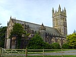
| image=St Bartholomew, Yealmpton, Devon - geograph.org.uk - 1739058.jpg |
|||
| upload_desc= Church of St Bartholomew |
| upload_desc= Church of St Bartholomew |
||
|image=St Bartholomew, Yealmpton, Devon - geograph.org.uk - 1739058.jpg |
|||
}} |
}} |
||
{{EH listed building row |
{{EH listed building row |
||
| name= Former Stables |
| name= Former Stables approximately 60 Metres North West of Lyneham House |
||
| location= Lyneham, Yealmpton |
| location= Lyneham, [[Yealmpton]] |
||
| type= Stable |
| type= Stable |
||
| completed= {{c.|1700}} |
| completed= {{c.|1700}} |
||
| Line 2,057: | Line 2,059: | ||
{{EH listed building row |
{{EH listed building row |
||
| name= Goreus Stone |
| name= Goreus Stone |
||
| location= Yealmpton |
| location= [[Yealmpton]] |
||
| type= Gravestone |
| type= Gravestone |
||
| completed= C3 |
| completed= C3 |
||
Revision as of 12:24, 3 July 2014
There are over 20,000 Grade II* listed buildings in England. This page is a list of these buildings in the district of South Hams in Devon.
South Hams
Notes
- ^ The date given is the date used by Historic England as significant for the initial building or that of an important part in the structure's description.
- ^ Sometimes known as OSGB36, the grid reference is based on the British national grid reference system used by the Ordnance Survey.
- ^ The "List Entry Number" is a unique number assigned to each listed building and scheduled monument by Historic England.
External links
![]() Media related to Grade II* listed buildings in Devon at Wikimedia Commons
Media related to Grade II* listed buildings in Devon at Wikimedia Commons


