Athurugiriya: Difference between revisions
Rescuing 1 sources and tagging 0 as dead.) #IABot (v2.0.9.5 |
|||
| Line 71: | Line 71: | ||
== History == |
== History == |
||
The history of the area dates back to at least 212 BC. The historic cave temple complex, Korathota Raja Maha Vihara, is located {{convert|3|km|abbr=on}} north of the city centre. This temple has two [[Brahmi]] inscriptions and one of them records that a cave at the site was offered to Maha Sanga (Buddhist monks) by a daughter of Mahachula Mahatissa.<ref>{{Cite web|url=https://www.lankapradeepa.com/2021/07/korathota-viharaya.html|title=Korathota Raja Maha Viharaya|access-date=2024-01-26|publisher=LankaPradeepa}}</ref> The second one says one cave was offered to Maha Sanga by a provincial leader called Sumana.<ref>{{Cite web|url=http://www.statistics.gov.lk/PopHouSat/CPH2011/index.php?fileName=P2&gp=Activities&tpl=3|title=Census of Population and Housing 2011|access-date=2016-04-06|archive-date=2015-09-24|archive-url=https://web.archive.org/web/20150924110602/http://www.statistics.gov.lk/PopHouSat/CPH2011/index.php?fileName=P2&gp=Activities&tpl=3|url-status=dead}}</ref> |
|||
This temple has two important historical inscriptions, which says this temple was offer to Maha Sanga by a daughter of Mahachula Mahatissa. Second one says one cave offered to Maha Sanga by a provincial leader call Sumana.<ref>{{Cite web|url=http://www.statistics.gov.lk/PopHouSat/CPH2011/index.php?fileName=P2&gp=Activities&tpl=3|title=Census of Population and Housing 2011|access-date=2016-04-06|archive-date=2015-09-24|archive-url=https://web.archive.org/web/20150924110602/http://www.statistics.gov.lk/PopHouSat/CPH2011/index.php?fileName=P2&gp=Activities&tpl=3|url-status=dead}}</ref> |
|||
== Transport == |
== Transport == |
||
Revision as of 15:04, 26 January 2024
Athurugiriya
අතුරුගිරිය அத்துருகிரிய | |
|---|---|
| Motto: | |
| Coordinates: 6°53′32″N 79°56′34″E / 6.89222°N 79.94278°E | |
| Country | Sri Lanka |
| Province | Western Province |
| District | Colombo District |
| Elevation | 30 m (100 ft) |
| Population | |
| • Suburb | 84,278 |
| • Urban | 5,799 |
| • Metro | 78,479 |
| Time zone | UTC+5:30 (SLT) |
| Postal Code | 10150 [1] |
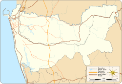
Athurugiriya is a suburb of Colombo in Colombo District, Sri Lanka. It is situated on the Kotte-Bope Road (B 240) about 15 km (9.3 mi) away from the centre of the commercial capital Colombo. This suburb is a highly sought after residential centre in Colombo.
History
The history of the area dates back to at least 212 BC. The historic cave temple complex, Korathota Raja Maha Vihara, is located 3 km (1.9 mi) north of the city centre. This temple has two Brahmi inscriptions and one of them records that a cave at the site was offered to Maha Sanga (Buddhist monks) by a daughter of Mahachula Mahatissa.[2] The second one says one cave was offered to Maha Sanga by a provincial leader called Sumana.[3]
Transport
Athurugiriya has one of the interchanges of Outer Circular Expressway, which is located at Pore, about 1 km (0.62 mi) from Colombo centre.
Athurugiriya is a major urban centre located along the road connecting Malabe on New Kandy Road, and Godagama on High Level Road. In addition, Kaduwela and Thalawathugoda are major urban centres nearby.
Residential
Athurugiriya is a highly sought after residential area in Colombo. Many important government office complexes; such as Sethsiripaya, Suhurupaya, Isurupaya and many other government institutions in Denzil Kobbekaduwa Mawatha; are situated within 10 km (6.2 mi) of Athurugiriya.
Upper-middle class housing complex Millennium City is located within 1 km (0.62 mi) from Athurugiriya.
See also
References
- ^ "Athurugiriya Post Office - Sri Lanka Postal Codes - Mohanjith". Archived from the original on 2016-04-17. Retrieved 2016-04-06.
- ^ "Korathota Raja Maha Viharaya". LankaPradeepa. Retrieved 2024-01-26.
- ^ "Census of Population and Housing 2011". Archived from the original on 2015-09-24. Retrieved 2016-04-06.

