Halmajugra: Difference between revisions
Marvanyember (talk | contribs) basicdata |
Marvanyember (talk | contribs) →Demographics: demo2022 |
||
| Line 48: | Line 48: | ||
==Demographics== |
==Demographics== |
||
According the 2022 census, 90.2% of the population were of Hungarian ethnicity, 3.8% were [[Romani people|Gypsies]], and 9.7% were did not wish to answer. The religious distribution was as follows: 7.5% [[Catholic Church in Hungary|Roman Catholic]], 1.1% [[Reformed Church in Hungary|Calvinist]], 24.3% non-denominational, and 63.8% did not wish to answer. The [[Romani people|Gypsies]] have a local nationality government. No population in farms.<ref name="2022 village data">{{cite web|url=https://www.ksh.hu/apps/hntr.telepules?p_lang=EN&p_id=11411|title=Halmajugra|publisher=[[Hungarian Central Statistical Office]]|work=ksh.hu|accessdate=26 July 2024}}</ref> |
|||
Population by years:<ref>{{cite web|title=Population number, population density|website=Hungarian Central Statistical Office|url=http://www.ksh.hu/nepszamlalas/docs/tables/regional/10/10_4_1_1_1_en.xls|accessdate=2024-02-22}}</ref> |
|||
{| class="wikitable" |
|||
|- |
|||
! Year !! 1870 !! 1880 !! 1890 !! 1900 !! 1910 !! 1920 !! 1930 !! 1941 |
|||
|- |
|||
| Population || 1040 || 966 || 1073 || 1047 || 1274 || 1382 || 1385 || 1295 |
|||
|- |
|||
! Year !! 1949 !! 1960 !! 1970 !! 1980 !! 1990 !! 2001 !! 2011 !! 2022 |
|||
|- |
|||
| Population || 1344 || 1452 || 1451 || 1359 || 1284 || 1278 || 1301 || 1297 |
|||
|} |
|||
==Politics== |
==Politics== |
||
Revision as of 15:49, 26 July 2024
Halmajugra | |
|---|---|
Village | |
 Saint Emeric Church | |
| Coordinates: 47°45′40″N 20°03′22″E / 47.76111°N 20.05611°E | |
| Country | Hungary |
| County | Heves |
| District | Gyöngyös |
| First mentioned | 1337 |
| Government | |
| • Mayor | Rozália Lakatos (Ind.) |
| Area | |
| • Total | 21.68 km2 (8.37 sq mi) |
| Population (2022) | |
| • Total | 1,297 |
| • Density | 60/km2 (150/sq mi) |
| Time zone | UTC+1 (CET) |
| • Summer (DST) | UTC+2 (CEST) |
| Postal code | 3273 |
| Area code | 37 |
| Website | www.halmajugra.hu |

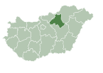
Halmajugra is a village in Heves County, Hungary, between the Bene and Sós-völgyi creeks, south from the Mátra mountain ranges. As of 2022 census, it has a population of 1297 (see Demographics). The village located beside of the main road 3, 7.8 km from (Nr. 80) Hatvan–Miskolc railway line and 10.7 km from the M3 motorway. The closest train station with public transport in Karácsond.
History
The village was formed in 1950 from the merger of Gyöngyöshalmaj and Hevesugra.
Demographics
According the 2022 census, 90.2% of the population were of Hungarian ethnicity, 3.8% were Gypsies, and 9.7% were did not wish to answer. The religious distribution was as follows: 7.5% Roman Catholic, 1.1% Calvinist, 24.3% non-denominational, and 63.8% did not wish to answer. The Gypsies have a local nationality government. No population in farms.[1]
Population by years:[2]
| Year | 1870 | 1880 | 1890 | 1900 | 1910 | 1920 | 1930 | 1941 |
|---|---|---|---|---|---|---|---|---|
| Population | 1040 | 966 | 1073 | 1047 | 1274 | 1382 | 1385 | 1295 |
| Year | 1949 | 1960 | 1970 | 1980 | 1990 | 2001 | 2011 | 2022 |
| Population | 1344 | 1452 | 1451 | 1359 | 1284 | 1278 | 1301 | 1297 |
Politics
References
- ^ "Halmajugra". ksh.hu. Hungarian Central Statistical Office. Retrieved 26 July 2024.
- ^ "Population number, population density". Hungarian Central Statistical Office. Retrieved 2024-02-22.


