
Ballina, County Mayo: Difference between revisions
→History: Local Government Act, 1898 |
|||
| Line 95: | Line 95: | ||
Ballina Bus Station is host to a [[Bus Éireann]] bus depot. |
Ballina Bus Station is host to a [[Bus Éireann]] bus depot. |
||
| ⚫ | ==== Rail ==== Ballina Train Station is located on the N26 beside the bus station. Departing trains stop at [[Foxford]] before terminating at Manulla junction where commuters can connect to trains going to [[Castlebar]], [[Westport, County Mayo|Westport]] or [[Dublin]] ([[Heuston Station]]). Trains to Dublin operate three times daily. Assholes |
||
==== Rail ==== |
|||
| ⚫ | Ballina Train Station is located on the N26 beside the bus station. Departing trains stop at [[Foxford]] before terminating at Manulla junction where commuters can connect to trains going to [[Castlebar]], [[Westport, County Mayo|Westport]] or [[Dublin]] ([[Heuston Station]]). Trains to Dublin operate three times daily. |
||
==== Air ==== |
==== Air ==== |
||
Revision as of 00:20, 23 January 2009
Template:Infobox Irish Place 54°07′00″N 9°10′00″W / 54.1167°N 9.1667°W Ballina ([Béal an Átha or Béal Átha an Fheadha, lit. mouth of the ford] Error: {{Lang-xx}}: text has italic markup (help)) is the second largest town in County Mayo in Ireland. It lies at the mouth of the River Moy near Killala Bay, in the Moy valley and Parish of Kilmoremoy, with the Ox Mountain range to the east and the Nephin Beg Mountains to the west.
The recorded population of Ballina's urban area is 10,409. Census 2006 figures released by the Central Statistics Office in September 2007 showed that Ballina had the highest rate of unemployment amongst large towns in the Republic of Ireland. Some 15.8% of Ballina's population was out of work when the 2006 census was taken.[1][2]
History
According to Encyclopaedia Britannica the first signs of settlement on the site of the town dates around 1375 an Augustinian friary was founded. Britannica refers to the "remains of an Augustinian friary, founded about 1375". Belleek, now part of the town, pre-dates the town’s formation, and can be dated back to the late 15th century, or early 16th century[citation needed]. Although, what is now known as Belleek Castle was built in 1831. Ballina was officially established as a town in 1723 by O'Hara, Lord Tyrawley.[citation needed]
Belleek Estate
The Belleek estate once occupied lands from the Moy River to the modern-day Killala Road. This included part of the ‘Old French Road’ which General Humbert marched on from Killala, and beside part of which in the Killala Road-Belleek area was Belleek’s reservoir – presumably destroyed in the construction Coca-Cola’s ‘Ballina Beverages’ factory; the ‘Old French Road’ is now closed off at that point, with what amount to diversion road signs claiming Humbert marched where he did not.[citation needed]
Old borders

Ballina is located on the west side of the Mayo-Sligo county border. Part of what is now the town was once (prior to the Local Government Act, 1898) part of County Sligo, with the border for the most part once being the River Moy, east of which was in Sligo, including Ardnaree, and Crockets Town (the Quay). [3]
General Humbert and the French Landing - 1798
The Centenary memorial (the Humbert Monument) was dedicated on May 11, 1898 commemorate the 100th Anniversary of the French landing at Killala in support of the Irish Rebellion of 1798. The monument was originally sculptured by a Dublin Craftsman but in recent years it has been restored locally. The figure on the monument is not Humbert but Mother Ireland. Maud Gonne, a famous Irish woman, unveiled the monument. At the event Maud Gonne famously poured water over another speaker's (an IRB member) head. The monumnet was moved to it's current location on Humbert Street in 1987, where is was re-dedicated by Maud Gonne's son, Seán MacBride.
Megalithic tomb
The Dolmen of the Four Maols is located on 'Primrose Hill' behind Ballina's Railway Station. The Dolmen dates from c2,000 B.C.[citation needed] and is sometimes called locally the 'Table of the Giants'. Legend has it that The Dolmen is the burial place of the four Maols. The four Maols murdered Ceallach, a 7th century Bishop of Connacht and were hung at Ardnaree - the Hill of Executions. Tradition says that their bodies were buried under the Dolmen.[4]
Architecture, planning, and housing

The town has some notable architecture, including the 15th-century Moyne Abbey, and St Muredach's Cathedral, which is the Cathedral Church of the Diocese of Killala. Work on the Cathedral began in 1827. The stone was quarried locally and the roof and ceiling were completed before the Great Famine (1845). The spire was completed in 1855 and by 1875 the organ had been commissioned. Outside Ballina, on a small hill to the west, stands a dolmen, thought to have been erected 4000 years ago. The only all-boys' secondary school in the town, St. Muredach's College, celebrated its centenary on 10 September 2006.
Infrastructure
Education
The primary schools that serve the town include Scoil Croí íosa of the Convent of Mercy (all-girls), Scoil Padraig (all-boys), the Quay NS (mixed), Culleens NS on the Killala Road (mixed), and Scoil na gCeithre Maol (mixed), a gaelscoil situated by the Ridgepool. There is also a Montessori school and many pre-schools.
There are also three secondary schools - St. Murdeachs College (all-male), Moyne College (mixed), and St Marys of the Convent of Mercy (all-female). Other local mixed secondary school options include schools in Crossmolina, Foxford and Lacken Cross (past Killala).
Communications and Media
Ballina is one of the towns due to have a MAN (Metropolitan Area Network), the ductings and fiber optic cables are in place, but with no ISP Connections. The MANs are being built for the Department of Communications, they will be run by a private operator, but will remain the property of the government.
Local media
The Western People is a local newspaper based in Ballina and until recently was also printed at its premises in the town, it is owned by the Cork-based Thomas Crosbie Holdings. Two freesheets, the Mayo Advertiser and the Mayo Echo are distributed throughout Ballina. The Connaught Telegraph, published in Castlebar and, to a lesser extent, the Mayo News published in Westport, also carry local news related to Ballina. Mid West Radio is the regional station with an office in the town.
Historically there has been a number of newspapers directly linked with the town, these include:
- Ballina Advertiser, Mayo And Sligo Commercial Gazette (Jan 10, 1840 - Nov 10, 1843)
- Ballina Chronicle (May 2, 1849 - Aug 14, 1851; M/W Connaught Watchman)
- Ballina Herald (1844 – Oct, 1961; C/A 'Ballina Herald and Mayo and Sligo Advertiser')
- Ballina Herald and Mayo and Sligo Advertiser (Oct, 1891 - Apr 28, 1962; M/W 'Western People')
- Ballina Impartial, or Tyrawly Advertiser (Jan 13, 1823 - Nov 16, 1835)
- Ballina Journal and Connaught Advertiser (C/A 1880 - Mar 11, 1895)
- Connaught Watchman (Aug 2, 1851 - Oct 3, 1863)
- Tyrawly Herald; or Mayo and Sligo Intelligencer (1844 – 1870)
- Western Gem (1843)
- Western Journal (1977 - Feb 15, 1980; C/A Sligo Journal Feb 22, 1980 - Mar 11, 1983)
- Western People (1883 - Present)
- Western Star (1835 - 1837)
[M/W = merged with; C/A = continued as |Source: National Library of Ireland
During the 1980s there were a number of short lived pirate radio stations in the town.
Transport links
Roads
The N26 is the main road to Dublin, it leaves the town south to Foxford, and after Swinford joins the N5 to Dublin. N59 comes from Belmullet and Crossmolina in the west, goes through the town to Sligo to the northeast. The R314 makes up the road to Killala, and then Ballycastle. The R294 goes to south County Sligo via 'the Windy Gap' in the Ox Mountains, this is used by some to get to Dublin, via Tubbercurry and Boyle.

There is currently a plan to build a ring road around the town, but this has been in place for a number of years. A small stretch of the N26 leaving the town to Foxford was recently modernised. An inner-relief road was completed just before Christmas 2005, it links the Killala Road (R314) and Crossmolina Road (N59) - it goes through ‘Rockville’ housing estate on the Killala Road and joins up to other roads at St Patrick's Church, near the Crossmolina Road. A section of the N59 from the town to the Sligo border is currently been upgraded.
The 'Ballina & Environs Development Plan, 2003-2009' plans for cycle lanes "on all major traffic routes leading into town”, and for the building of stage one of the "outer ring road linking the N26 (Foxford Road) with the N59 – West (Crossmolina Road), and the R314 (Killala Road)”.[5]
Bus
Ballina Bus Station is host to a Bus Éireann bus depot.
==== Rail ==== Ballina Train Station is located on the N26 beside the bus station. Departing trains stop at Foxford before terminating at Manulla junction where commuters can connect to trains going to Castlebar, Westport or Dublin (Heuston Station). Trains to Dublin operate three times daily. Assholes
Air
Ireland West Airport Knock (Knock Airport, NOC) is about 50.7 km, or 31.5 miles from Ballina. There are nine or more services a day from the airport to London, Birmingham, Bristol, Manchester, Dublin and Glasgow. Bus Éireann now runs a shuttle service about five times a day from the airport to Charlestown, from where commuters can get a connecting bus to Ballina. Sligo Airport is about 69 km, or 43 miles from Ballina and has two flights a day to Dublin, operated by Aer Arann.
Tourism, Sports & Events
Tourism
Ballina's location on the River Moy favours salmon fishing, and one of the best spots, the Ridge Pool, is situated in the heart of the town.
Sport
Ballina Stephenites, is one of the local Gaelic Athletic Association club teams. The name also refers to the town’s Gaelic Athletic Association grounds,James Stephens Park, so named after the famous Fenian from Irish history.
Ballina Town FC is one of the town's soccer clubs, playing their home matches at Belleek Park.
In basketball, Team Loftus Recycling represent the town in Men's Division 1.
Ballina also has Mayo's only Gymnastics Training Centre, Nadia Gym
Ballina Golf Club is an 18 hole parkland golf course on the outskirts of the town on the Bonniconlon Road. Ballina Golf Club is set in a scenic location overlooking the Moy Valley. The course is a Par 71 course, 5933 metres long.
Ballina Salmon Festival
The Ballina Salmon Festival is a 10-day festival held annually in July in the town. The festival includes Heritage Day, where most of the centre of the town is closed to traffic and the streets fill with arts and craft stalls and demonstrations of transport from days gone by. The festival finale is a Mardi Gras followed by a fireworks display.
The Salmon festival for 2009 shall take place between Friday the 10th of July and Sun the 19th of July.
Additional information
Prominent residents (past and present)
- Edward Whelan (1824 – December 10, 1867)
- Mary Robinson (Born May 21, 1944)
- Ray Foley, DJ on Today FM[1]
- Jack Charlton owns a holiday home in ballina and enjoys fishing in the area
Twin Towns and Sister Cities
Ballina is twinned with:
Photo gallery
-
 Gate House at Belleek Forest Park.
 -
 The concrete ship the 'SS Creteboom' in the River Moy.
 -
 A side view of the Creteboom.
 -
 The Folrette also in the Moy river.
 -
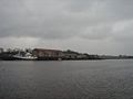
 A view of the town from a beside Leigue graveyard - one of the highest points in area.
 -
 A view of Rockwell housing estate and the Killala Road area.
 -
 The Quay, at Crocketstown, Ballina.
 -
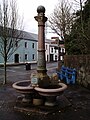 The Font, Teeling street, Ballina.


Surrounding towns and villages
- Ardagh
- Attymass
- Ballycastle
- Ballycong
- Bonniconlon
- Carra
- Cloghans
- Corroy
- Crossmolina
- Easky
- Foxford
- Inishcrone
- Knockmore
- Killala
- Lackan
- Lahardane
- Pontoon
- Rathduff
See also
External links
- Ballina railway station
- Moy Valley website of Ballina Chamber of Commerce
- Ballina Salmon Festival, including Street & Arts Festival
- Northwest Fisheries
- Ballina Rugby Club
- Ballina Golf Club
- Mount Falcon - Historical Castle, Hotel & Fishery
References
- ^ Irish Census 2006 - Principal Economic Status and Industries: Ballina, County Mayo had the highest unemployment rate among large Irish towns with 15.8% unemployed; Tralee: 14.2% and Dundalk: 13.9%
- ^ Census 2006 Volume 7 - Principal Economic Status and Industries
- ^ http://www.rootsweb.ancestry.com/~irlsli/borders.html
- ^ http://www.megalithicireland.com/Ballina.htm
- ^ http://www.mayococo.ie/en/Planning/DevelopmentAreaPlans/CountyAreaDevelopmentPlans/PDFFile,1957,en.pdf