
County Westmeath: Difference between revisions
| Line 117: | Line 117: | ||
*[[Marian Finucane]] |
*[[Marian Finucane]] |
||
*[[Nuala Holloway]], artist and former [[Miss Ireland]] |
*[[Nuala Holloway]], artist and former [[Miss Ireland]] |
||
* |
*Lee Adam Harryman Preston, Baron |
||
*[[Michael O'Leary (Ryanair)|Michael O'Leary]] CEO of [[Ryanair]] |
*[[Michael O'Leary (Ryanair)|Michael O'Leary]] CEO of [[Ryanair]] |
||
Revision as of 11:33, 22 February 2010
This article needs additional citations for verification. (November 2009) |
Template:Infobox Irish Place County Westmeath (Irish: Contae na hIarmhí) is one of the traditional counties of Ireland and is located within the province of Leinster.
Westmeath is the 23rd largest of Ireland’s 32 counties in area and 22nd largest in terms of population.[1] It is the sixth largest of Leinster’s 12 counties in size and eighth largest in terms of population.
It was named after the historic kingdom and province of Mide. Westmeath was created under The Counties of Meath and Westmeath Act of 1543. The hill of Uisneach in the medieval Barony of Moycashel is generally accepted as the notional geographical centre of Ireland.
Geography
County Westmeath is bordered by the counties of Cavan, Longford, Meath, Offaly and Roscommon.
Towns and villages
Towns and villages in County Westmeath include:
- Mullingar, the county town
- Athlone, Ballymore
- Castlepollard, Castletown-Geoghegan, Collinstown, Coole
- Delvin
- Finnea, Fore
- Glassan
- Horseleap
- Kilbeggan, Killucan, Kinnegad
- Moate, Multyfarnham
- Raharney, Rochfortbridge, Rosemount
Administration
| Year | Pop. | ±% |
|---|---|---|
| 1653 | 12,090 | — |
| 1659 | 12,672 | +4.8% |
| 1821 | 128,819 | +916.6% |
| 1831 | 136,872 | +6.3% |
| 1841 | 141,300 | +3.2% |
| 1851 | 111,407 | −21.2% |
| 1861 | 90,879 | −18.4% |
| 1871 | 78,432 | −13.7% |
| 1881 | 71,798 | −8.5% |
| 1891 | 65,109 | −9.3% |
| 1901 | 61,629 | −5.3% |
| 1911 | 59,986 | −2.7% |
| 1926 | 56,818 | −5.3% |
| 1936 | 54,706 | −3.7% |
| 1946 | 54,949 | +0.4% |
| 1951 | 54,463 | −0.9% |
| 1956 | 54,122 | −0.6% |
| 1961 | 52,861 | −2.3% |
| 1966 | 52,900 | +0.1% |
| 1971 | 53,570 | +1.3% |
| 1979 | 59,885 | +11.8% |
| 1981 | 61,523 | +2.7% |
| 1986 | 63,379 | +3.0% |
| 1991 | 61,880 | −2.4% |
| 1996 | 63,314 | +2.3% |
| 2002 | 71,858 | +13.5% |
| 2006 | 79,346 | +10.4% |
| [2][3][4][5][6][7] | ||
Westmeath County Council offices are at the County Building in Mullingar. There are currently 22 councillors. The five electoral areas of Westmeath are Athlone (7 seats), Coole (3 seats), Kilbeggan (3 seats), Mullingar East (4 seats) and Mullingar West (5 seats).[8] The Local Government (Ireland) Act 1898, provided the framework for the establishment of County Councils throughout Ireland. The first meeting of Westmeath County Council was held on 22 April 1899.[8]
Demography
Westmeath’s population growth has been stronger than the national average. [9] After the Great Famine, the population of Westmeath declined dramatically. It stabilized in the middle of the last century, and has continued to grow. Westmeath's proximity to Dublin, with good motorway facilities and frequent rail service has made commuting popular. The county town of Mullingar which has a population approaching twenty thousand. Athlone, Moate, Kilbeggan, and Castlepollard are important commercial and marketing centres.
Economy

Westmeath has a strong agricultural economy. Initially, development occurred around the major market centres of Mullingar, Moate, and Kinnegad. Athlone developed due to its military significance, and its strategic location on the main Dublin-Galway route across the River Shannon. Mullingar gained considerable advantage from the development of the Royal Canal. The canal facilitated cheap transport for produce to Dublin, Britain and Europe. Athlone and Mullingar expanded further with the coming of the Midland Great Western Railway network in the nineteenth century.
Tourism in Westmeath is generally centred on its many water amenities. The county lakes include Lough Derravaragh, Lough Ennell,Lough Cassidy,Lough Lene, Lough Hogg, Lough Owel, Lough Coffey and Lough Ree. Both the Grand Canal, and the Royal Canal flow through Westmeath, and the River Shannon (Ireland's key tourism waterway) has a modern inland harbour in Athlone.
The development of industry in Westmeath was mainly based on food processing and consumer products. Whiskey is distilled in Kilbeggan and tobacco is processed in Mullingar. The extensive beef and dairy trade reflects the rich agricultural produce of the county. In recent times, the manufacturer Élan has located in Athlone. The eastern part of the county is home to commuters many of whom work at the technology parks on the western side of Dublin, such as Thornton and Peppard, and around County Carlow.
Infrastructure
Infrastructure is of good quality in the county. As part of the transport 21 infrastructure programme undertaken by the government both the N4 and N6 have been upgraded to motorway or dual carriageway standard. All towns that these roads passed through are now bypassed such as Mullingar, Athlone, Moate and Kinnegad. Both Dublin and Galway are within commuting distance from Westmeath following the completion of the M6 motorway in December 2009. Westmeath also has good railway infrastructure with a number of trains passing through towns in the county. The Dublin to Galway/Westport/Ballina inter city train service stops at Athlone Train Station while the Dublin to Sligo service stops at Mullingar Train Station. Other major infrastructural projects and plans for the county include:
Agriculture
Westmeath Cattle
Mullingar is renowned for the high quality of its beef and veal. Weaned cattle from the west of the Shannon, are fattened for market on the lush grasslands of Meath and Westmeath. The cattle are also used to maintain grassland to help sustain wildlife in the areas fringing the Bog of Allen.
Westmeath Horses

Westmeath is home to many stud farms. The plains of Westmeath, covered in calcium-rich marl, contribute significantly to calcification of foal bones during their formative years. Westmeath mares are usually put into foal in spring to facilitate summer growth. Pregnancy lasts for approximately 335-340 days and usually results in one foal. Horses mature around four years old.
Sport
Westmeath is an active sporting county. Westmeath GAA won the Leinster Senior Football Championship, and the Delaney Cup, in 2004. It won the Christy Ring Cup for hurling in 2005 and 2007.
People

Notable Westmeath natives include:
- The Blizzards, musicians
- Joe Dolan
- Marian Finucane
- Nuala Holloway, artist and former Miss Ireland
- Lee Adam Harryman Preston, Baron
- Michael O'Leary CEO of Ryanair
See also
References
- ^ Corry, Eoghan (2005). The GAA Book of Lists. Hodder Headline Ireland. pp. 186–191.
- ^ For 1653 and 1659 figures from Civil Survey Census of those years, Paper of Mr Hardinge to Royal Irish Academy March 14 1865.
- ^ Census for post 1821 figures.
- ^ http://www.histpop.org
- ^ http://www.nisranew.nisra.gov.uk/census
- ^ Lee, JJ (1981). "On the accuracy of the Pre-famine Irish censuses". In Goldstrom, J. M.; Clarkson, L. A. (eds.). Irish Population, Economy, and Society: Essays in Honour of the Late K. H. Connell. Oxford, England: Clarendon Press.
- ^ Mokyr, Joel; O Grada, Cormac (November), "New Developments in Irish Population History, 1700-1850", The Economic History Review, Volume 37 (Issue 4): 473–488, doi:10.1111/j.1468-0289.1984.tb00344.x
{{citation}}:|issue=has extra text (help);|volume=has extra text (help); Check date values in:|date=and|year=/|date=mismatch (help) - ^ a b "About Us". Westmeath County Council. Retrieved 2008-06-28.
- ^ "Demographic context" (PDF). Offaly County Council Development Plan 2009 - 2015. Retrieved 2008-06-28.
External links
- Westmeath Census information
- Westmeath Community Development
- STRATEGIC DEVELOPMENT FRAMEWORK FOR THE MIDLANDS GATEWAY; Census statistics page 27
- Athlone Advertiser and Mullingar Advertiser local newspapers
- Local job vacancy listings online
- Westmeath Enterprise
- Westmeath Examiner (Local Newspaper)
- Tullamore Life & Community
- Westmeath Bands
- Ardnagrath National School Website
- Rosemount GAA Website
- westmeath showcase news for westmeath
Images
-
 Mapa
Mapa -
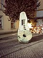
 The Round-about, Castlepollard
 -
 An Muileann gCearr
 -

-
Saint Peter's & Pauls
Athlone -
 Austin Friars An Muileann gCearr
 -
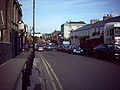 Bothar Mor Mullingar Centre
 -
 The channel An Muileann gCearr
 -
 Celtic Cross at Columb
Military Barracks, Mullingar -
-

-
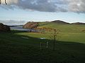
 Hill of Ben Fore
 -
 Columb Baracks, Mullingar
 -
 19th century concrete stile
 -
 19th. concrete Stile,(v1)Mass-Path, Ranaghan, Collinstown
 -
 Alternative 19th century concrete Stile (v-2) mass path, Ranaghan, Collinstown
 -
 Bell of Lough Lene
 -
Turgesius Island, Lough Lene
-
 Sunset on Lough Lene
 -
 The Cut Lough Lene
 -
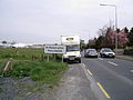
 Dublin/Mullingar Train
 -
 Kiloutou, An Muileann gCearr (Mullingar)
 -
 Athlone
St. Peter & St. Paul -
 Delvin Castle,
Delvin, Mullingar


