
Tirumala: Difference between revisions
mNo edit summary |
|||
| Line 81: | Line 81: | ||
==Transport== |
==Transport== |
||
=== |
===By Foot=== |
||
There are two paths to travel on foot from Tirupati to Tirumala: |
There are two paths to travel on foot from Tirupati to Tirumala: |
||
* Alipiri Mettu - It originates at [[Alipiri]], situated at the foothills of Tirumala. It is {{convert|11|km}} |
* Alipiri Mettu - It originates at [[Alipiri]], situated at the foothills of Tirumala. It is {{convert|11|km}} long and passes through Tirumala deer park.<ref name="tirumala footway">{{cite web|title=Tirupati to Tirumala on Foot|url=http://www.mytraveltalk.com/2011/03/pedestrian-path-foot-way-to-tirumal.html|work=Pedestrian path (foot way) to Tirumala|accessdate=19 December 2012}}</ref> |
||
* Srivari Mettu - It originates at Srinivasa Mangapuram, about {{convert|15|km}} from Tirupati. It is {{convert|2.1|km}} |
* Srivari Mettu - It originates at Srinivasa Mangapuram, about {{convert|15|km}} from Tirupati. It is {{convert|2.1|km}} long.<ref name="tirumala footway"/> |
||
===Road=== |
===Road=== |
||
Revision as of 13:59, 20 March 2014
This article includes a list of general references, but it lacks sufficient corresponding inline citations. (April 2012) |
Tirumala
తిరుమల | |
|---|---|
Hill town | |
 Tirumala Venkateswara Temple | |
| Country | India |
| State | Andhra Pradesh |
| District | Chittoor |
| Area | |
| • Total | 27 km2 (10 sq mi) |
| Elevation | 976 m (3,202 ft) |
| Population (2001) | |
| • Total | 17,789 |
| • Density | 660/km2 (1,700/sq mi) |
| Time zone | UTC+5:30 (IST) |
| PIN | 517504 |
| Telephone code | 0877 |
| Vehicle registration | AP 03 |
| Nearest city | Tirupati |
Tirumala (Telugu:తిరుమల) is the home of lord Balaji/Venkateswara/Srinivasa/Govinda is a hill town in Chittoor district of Andhra Pradesh, India. The town is home to Sri Venkateswara temple, dedicated to the Lord Venkateswara Swamy and one of the major pilgrimage center for Hindus. On an average 30 Million people visit the Temple situated here. Tirumala is situated 26 kilometres (16 mi) north of Tirupati, 86 kilometres (53 mi) north-east of Chittoor, 160 kilometres (99 mi) north-west of Chennai and 573 kilometres (356 mi) south-east of Hyderabad.
Geography
Tirumala is located 3,200 feet (980 m) above sea level and covers an area of approximately 10.33 square miles (26.8 km2). Surrounding the hills are seven peaks of Seshachalam range, Eastern Ghats namely Seshadri, Neeladri, Garudadri, Anjanadri, Vrushabadri, Narayanadri and Venkatadri. The temple of Sri Venkateswara[1] is on the seventh peak (Venkatadri).
Etymology
Tirumala is the combination of two words: Tiru meaning 'holy' or 'sacred' and mala meaning 'hill' in Tamil, translating to holy mountain.[2]
History
In ancient literature Tirupati is mentioned to as Aadhi varaha kshetra. The Puranas associate the site with Lord Varaha, one of the Dashavatara of Lord Vishnu. The Varaha shrine is said to be older than the main sanctum of Venkateswara. In the Puranas, Venkatadri is believed to be a part of Mount Meru, which was brought on to the earth from Vishnu's abode Vaikuntam by his mount Garuda. The seven peaks represent supposedly represent the seven heads of Adisesha. Tirumala is one of the 108 divya desams.[3]
Demographics
As of 2001[update] India census,[4] Tirumala has a population of 17,789. Males constitute 52 percent of the population and females 48 percent. Tirumala has an average literacy rate of 72.8 percent, higher than the national average of 59.5 percent. The male literacy rate is 57.1 percent and the female rate is 42.9 percent. In Tirumala, 11 percent of the population is under six years of age.
Culture
Telugu is the major language. Hinduism is the major religion in Tirumala. Dhotis and Sarees are the traditional popular attire. The practices of tonsure and using tilaka are popular among devotees of Lord Venkateswara.
Transport
By Foot
There are two paths to travel on foot from Tirupati to Tirumala:
- Alipiri Mettu - It originates at Alipiri, situated at the foothills of Tirumala. It is 11 kilometres (6.8 mi) long and passes through Tirumala deer park.[5]
- Srivari Mettu - It originates at Srinivasa Mangapuram, about 15 kilometres (9.3 mi) from Tirupati. It is 2.1 kilometres (1.3 mi) long.[5]
Road
Tirumala can be accessed by road from Alipiri. There are two roads from Alipiri to Tirumala, one each dedicated to up and down traffic. APSRTC operates frequent buses from Tirupati and Alipiri. Tirumala Tirupati Devasthanams (TTD) runs free buses for transit within Tirumala.
Rail
The nearest railway station is at Tirupati, about 26 kilometres (16 mi) from Tirumala. Tirupati is a major railway station in the South Central Railway zone of the Indian Railways, providing rail connectivity to major parts of India.
Air
The nearest airport is Tirupati Airport, about 40 kilometres (25 mi) from Tirumala. It is a domestic airport with direct flights to Hyderabad, Visakhapatnam, New Delhi and Mumbai. The nearest major airport is the Chennai International Airport, located about 162 kilometres (101 mi) from Tirumala.
Places of Interest
Akaasa Ganga
Akaasa Ganga is a natural waterfall believed to originate from Lord Vishnu's feet.[citation needed] Its waters are used daily in |Srivari temple's activities.
Srivaari Paadamulu
Srivari Paadamulu (the Lord's footprints) are believed to be the footprints of Lord Venkateswara formed when he first stood on Tirumala Hills.[citation needed] The footprints are located on the highest point of the hill, about 15 kilometres (9.3 mi) from the temple.
Natural stone arch
The Natural Arch is located 1 km (0.6 mi) north of the temple. The arch measures 8 m (26.2 ft) wide and 3 m (9.8 ft) high. It was naturally formed from the quartz.
Sri Ramanuja Shrine
The Shrine of Sri Ramanuja is located adjacent to the in the northern corridor of the Vimana Pradakshinam. It is also known as the Bhashyakara Sannidhi. The shrine was built around in 13th century A.D. and overlooks the western end of the Tirumamani Mandapam. The emblem of Pandyas (two fish and a hook) is carved on the wall next to the entrance.
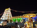
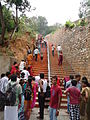
Gallery
-
 A View of Tirumala Venkateswara Temple
 -
 Windmills at Tirumala
 -
 Lord Venkateswara on Gaja vahanam
 -
 Tirumala overview
 -
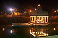 Swami Pushkarini at Tirumala
 -
 Spotted deer at deer park
 -
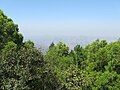 Greenery in Tirumala
 -
 Hanuman statue at Tirumala
 -
 Gopuram
 -
 Mokalla parvatam
 -
 Foot way to Tirumala hills
 -
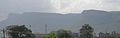 Panorama of Tirumala
 -
 Panorama of Tirumala from Srivari Paadalu


References
- ^ http://www.rediff.com/news/2007/jun/08ap.htm
- ^ http://books.google.co.in/books?id=_fi1AAAAIAAJ&q=tirupathi+tamil+name&dq=tirupathi+tamil+name&hl=en&sa=X&ei=BFUFT_n6N4G0rAe3nv3YDw&ved=0CFwQ6AEwBA
- ^ http://www.srivaishnava.org/ddesam/ddesam.htm
- ^ Template:GR
- ^ a b "Tirupati to Tirumala on Foot". Pedestrian path (foot way) to Tirumala. Retrieved 19 December 2012.