Martijanec: Difference between revisions
Appearance
Content deleted Content added
2011 census update |
No edit summary Tags: Mobile edit Mobile app edit |
||
| Line 1: | Line 1: | ||
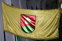
[[Image:Flag of Martijanec.jpg|thumb|right|200px|Flag of Municipality of Martijanec]] |
[[Image:Flag of Martijanec.jpg|thumb|right|200px|Flag of Municipality of Martijanec]] |
||
'''Martijanec''' is a village and municipality in |
'''Martijanec''' is a [[Croatia|Croatian]] village and municipality in [[Varaždin County]]. According to the 2001 census, there are 3,843 inhabitants in the municipality.<ref>{{Croatian Census 2011|S|05|0850}}</ref> |
||
==References== |
==References== |
||
Revision as of 23:17, 19 November 2015

Martijanec is a Croatian village and municipality in Varaždin County. According to the 2001 census, there are 3,843 inhabitants in the municipality.[1]
References
- ^ "Population by Age and Sex, by Settlements, 2011 Census: Martijanec". Census of Population, Households and Dwellings 2011. Zagreb: Croatian Bureau of Statistics. December 2012.

