
Kuttippuram: Difference between revisions
m (GR) File renamed: File:Shareef 089.jpg → File:Kuttippuram89.jpg File renaming criterion #1: At the original uploader's request. |
|||
| Line 78: | Line 78: | ||
==Image gallery== |
==Image gallery== |
||
<gallery> |
<gallery> |
||
File: |
File:Kuttippuram89.jpg|Perashannoor Railway Station, Kuttippuram |
||
File:Kuttippuram, Kerala,India.jpg|Kuttippuram Greenery |
File:Kuttippuram, Kerala,India.jpg|Kuttippuram Greenery |
||
File:Kuttippuram Bharathapuzha 10 Image0329.jpg|Overbridge |
File:Kuttippuram Bharathapuzha 10 Image0329.jpg|Overbridge |
||
Revision as of 08:09, 10 February 2016
Kuttippuram
കുറ്റിപ്പുറം | |
|---|---|
town | |
 Kuttippuram | |
| Country | |
| State | Kerala |
| District | Malappuram |
| Languages | |
| • Official | Malayalam, English |
| Time zone | UTC+5:30 (IST) |
Kuttippuram is a town and is situated in the Malappuram district of Kerala state, India. The town is located 34 kilometres south-west of Malappuram. The Bharathappuzha river flows through Kuttippuram. Kuttippuram railway station is an important railway station in Malappuram district. The railway line takes a diversion to the west from Kuttippuram, so this railway station serves people belonging to a vast geographical area including Guruvayur, the western parts of Palakkad district, Ponnani Juma Masjid, Puthanpally Jaram and pilgrims going to the Kadampuzha temple. Considering ticket revenues, Kuttippuram railway station is the leading railway station between Shoranur and Kozhikode.
Geography
Kuttippuram is located at 10°50′N 76°04′E / 10.83°N 76.07°E.[1] It has an average elevation of 15 m (49 ft).
Villages in Kuttippuram Area
- Athavanad, Edayoor and Irimbilayam
- Kuttippuram, Marakkara and Valancherry
- Thrkkannapuram and Kazhuthalloor
Politics
Kuttippuram panchayat is currently part of Kottakkal assembly constituency
Important Landmarks
- KMCT Group of Institutions, Kuttippuram
- Bramhsthan Temple, Kuttippuram
- Taluk HQ Hospital, Aspathrippadi
- St. Joseph Catholic Church, Kuttippuram
- Nottanalukkal Temple ,
Image gallery
-
 Perashannoor Railway Station, Kuttippuram
 -
 Kuttippuram Greenery
 -
 Overbridge
 -
 ROB
ROB -
 Flooded river
 -
 Bus Station
 -
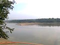 Bharathapuzha
 -
 Railway Station
 -
 Thottu Varambu


.jpg)


References
External links
This article related to a location in Malappuram district, Kerala, India is a stub. You can help Wikipedia by expanding it. |