Canindé de São Francisco: Difference between revisions
Appearance
Content deleted Content added
→top: park |
Rescuing 1 sources and tagging 0 as dead. #IABot (v1.2.7.1) |
||
| Line 44: | Line 44: | ||
|footnotes = |
|footnotes = |
||
|blank_name = '''[[Human Development Index|HDI]]''' (2000) |
|blank_name = '''[[Human Development Index|HDI]]''' (2000) |
||
|blank_info = 0.580 – <span style="color:#fc0">medium</span><ref> |
|blank_info = 0.580 – <span style="color:#fc0">medium</span><ref>{{cite web|url=http://www.pnud.org.br/atlas/ranking/IDH-M%2091%2000%20Ranking%20decrescente%20(pelos%20dados%20de%202000).htm |title=Archived copy |accessdate=2009-12-17 |deadurl=yes |archiveurl=https://web.archive.org/web/20091003103229/http://www.pnud.org.br/atlas/ranking/IDH-M%2091%2000%20Ranking%20decrescente%20(pelos%20dados%20de%202000).htm |archivedate=2009-10-03 |df= }} - [[UNDP]]</ref> |
||
|website = |
|website = |
||
}} |
}} |
||
Revision as of 06:59, 14 November 2016
Canindé de São Francisco | |
|---|---|
Municipality | |
| The Municipality of Canindé de São Francisco | |
 São Francisco River in Canindé de São Francisco | |
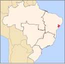
 Location of Canindé de São Francisco in the State of Sergipe | |
| Country | |
| Region | Northeast |
| State | |
| Founded | 1953 |
| Government | |
| • Mayor | José Heleno da Silva |
| Area | |
| • Total | 902.2 km2 (348.3 sq mi) |
| Elevation | 68 m (223 ft) |
| Population (2016) | |
| • Total | 28,832 |
| • Density | 32/km2 (83/sq mi) |
| [1] | |
| Time zone | UTC-3 (UTC-3) |
| • Summer (DST) | UTC-2 (UTC-2) |
| HDI (2000) | 0.580 – medium[2] |
Canindé de São Francisco is a municipality located in the Brazilian state of Sergipe. Its population was 28,832 (2016) and its area is 902.2 km2 (348.3 sq mi).[1]
Conservation
The municipality holds part of the 26,736 hectares (66,070 acres) Rio São Francisco Natural Monument, which protects the spectacular canyons of the São Francisco River between the Paulo Afonso Hydroelectric Complex and the Xingó Dam.[3] The municipality also contains the 279 hectares (690 acres) Lagoa do Frio Municipal Nature Park, created in 2001.[4]
References
- ^ a b "Canindé de São Francisco" (in Portuguese). Brasília, Brazil: Instituto Brasileiro de Geografia e Estatística. 2016. Retrieved 2016-10-28.
- ^ "Archived copy". Archived from the original on 2009-10-03. Retrieved 2009-12-17.
{{cite web}}: Unknown parameter|deadurl=ignored (|url-status=suggested) (help)CS1 maint: archived copy as title (link) - UNDP - ^ Unidade de Conservação: Monumento Natural do Rio São Francisco (in Portuguese), MMA: Ministério do Meio Ambiente, retrieved 2016-05-21
- ^ Lagoa do Frio (in Portuguese), CNIP, retrieved 2016-11-02


