
Dollymount Township, Traverse County, Minnesota: Difference between revisions
m →top: http→https for Google Books and Google News using AWB |
Rescuing 1 sources and tagging 0 as dead. #IABot (v1.2.7.1) |
||
| Line 77: | Line 77: | ||
|area_code = |
|area_code = |
||
|blank_name = [[Federal Information Processing Standard|FIPS code]] |
|blank_name = [[Federal Information Processing Standard|FIPS code]] |
||
|blank_info = 27-16012<ref name="GR2">{{cite web|url=http://factfinder2.census.gov|publisher=[[United States Census Bureau]]|accessdate=2008-01-31|title=American FactFinder}}</ref> |
|blank_info = 27-16012<ref name="GR2">{{cite web|url=http://factfinder2.census.gov |publisher=[[United States Census Bureau]] |accessdate=2008-01-31 |title=American FactFinder |deadurl=yes |archiveurl=https://web.archive.org/web/20130911234518/http://factfinder2.census.gov |archivedate=2013-09-11 |df= }}</ref> |
||
|blank1_name = [[Geographic Names Information System|GNIS]] feature ID |
|blank1_name = [[Geographic Names Information System|GNIS]] feature ID |
||
|blank1_info = 0663987<ref name="GR3">{{cite web|url=http://geonames.usgs.gov|accessdate=2008-01-31|title=US Board on Geographic Names|publisher=[[United States Geological Survey]]|date=2007-10-25}}</ref> |
|blank1_info = 0663987<ref name="GR3">{{cite web|url=http://geonames.usgs.gov|accessdate=2008-01-31|title=US Board on Geographic Names|publisher=[[United States Geological Survey]]|date=2007-10-25}}</ref> |
||
Revision as of 20:02, 14 December 2016
Dollymount Township, Minnesota | |
|---|---|
| Country | United States |
| State | Minnesota |
| County | Traverse |
| Area | |
| • Total | 38.4 sq mi (99.4 km2) |
| • Land | 38.4 sq mi (99.4 km2) |
| • Water | 0.0 sq mi (0.0 km2) |
| Elevation | 1,050 ft (320 m) |
| Population (2000) | |
| • Total | 83 |
| • Density | 2.2/sq mi (0.8/km2) |
| Time zone | UTC-6 (Central (CST)) |
| • Summer (DST) | UTC-5 (CDT) |
| FIPS code | 27-16012[1] |
| GNIS feature ID | 0663987[2] |
Dollymount Township is a township in Traverse County, Minnesota, United States. The population was 83 at the 2000 census.
Dollymount Township was organized in 1881, and named after Dollymount, Ireland, although the name also alludes to Anthony Doll, an early settler in the area.[3]
Geography
According to the United States Census Bureau, the township has a total area of 38.4 square miles (99 km2), all of it land.
Demographics
As of the census[1] of 2000, there were 83 people, 27 households, and 25 families residing in the township. The population density was 2.2 people per square mile (0.8/km²). There were 33 housing units at an average density of 0.9/sq mi (0.3/km²). The racial makeup of the township was 95.18% White, 1.20% Pacific Islander, and 3.61% from two or more races. Hispanic or Latino of any race were 9.64% of the population.
There were 27 households out of which 44.4% had children under the age of 18 living with them, 88.9% were married couples living together, 3.7% had a female householder with no husband present, and 7.4% were non-families. 7.4% of all households were made up of individuals and 3.7% had someone living alone who was 65 years of age or older. The average household size was 3.07 and the average family size was 3.24.
In the township the population was spread out with 31.3% under the age of 18, 6.0% from 18 to 24, 24.1% from 25 to 44, 19.3% from 45 to 64, and 19.3% who were 65 years of age or older. The median age was 39 years. For every 100 females there were 112.8 males. For every 100 females age 18 and over, there were 111.1 males.
The median income for a household in the township was $42,083, and the median income for a family was $47,813. Males had a median income of $23,750 versus $25,625 for females. The per capita income for the township was $14,587. There were no families and 3.8% of the population living below the poverty line, including no under eighteens and none of those over 64.
References
- ^ a b "American FactFinder". United States Census Bureau. Archived from the original on 2013-09-11. Retrieved 2008-01-31.
{{cite web}}: Unknown parameter|deadurl=ignored (|url-status=suggested) (help) - ^ "US Board on Geographic Names". United States Geological Survey. 2007-10-25. Retrieved 2008-01-31.
- ^ Upham, Warren (1920). Minnesota Geographic Names: Their Origin and Historic Significance. Minnesota Historical Society. p. 551.
Municipalities and communities of Traverse County, Minnesota, United States | ||
|---|---|---|
| Cities | 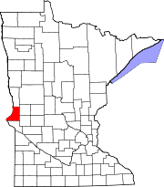 | |
| Townships | ||
| Unincorporated communities | ||
| Footnotes | ‡This populated place also has portions in an adjacent county or counties | |