
Kent, Minnesota: Difference between revisions
JJMC89 bot (talk | contribs) Migrate {{Infobox settlement}} coordinates parameters to {{Coord}}, see Wikipedia:Coordinates in infoboxes |
Rescuing 5 sources and tagging 0 as dead. #IABot (v1.3beta8) |
||
| Line 53: | Line 53: | ||
|population_est = 80 |
|population_est = 80 |
||
|pop_est_as_of = 2014 |
|pop_est_as_of = 2014 |
||
|pop_est_footnotes = <ref name="2014 Pop Estimate">{{cite web|title=Population Estimates|url=http://www.census.gov/popest/data/cities/totals/2014/SUB-EST2014-3.html|publisher=[[United States Census Bureau]]|accessdate=June 25, 2015}}</ref> |
|pop_est_footnotes = <ref name="2014 Pop Estimate">{{cite web|title=Population Estimates |url=http://www.census.gov/popest/data/cities/totals/2014/SUB-EST2014-3.html |publisher=[[United States Census Bureau]] |accessdate=June 25, 2015 |deadurl=yes |archiveurl=https://web.archive.org/web/20150522132816/http://www.census.gov/popest/data/cities/totals/2014/SUB-EST2014-3.html |archivedate=May 22, 2015 |df= }}</ref> |
||
|population_footnotes = <ref name ="FactFinder"/> |
|population_footnotes = <ref name ="FactFinder"/> |
||
|population_total = 81 |
|population_total = 81 |
||
| Line 79: | Line 79: | ||
}} |
}} |
||
'''Kent''' is a city in [[Wilkin County, Minnesota|Wilkin County]], [[Minnesota]], [[United States]]. The population was 81 at the [[2010 United States Census|2010 census]].<ref name="2010 Census">{{cite web|title=2010 Census Redistricting Data (Public Law 94-171) Summary File|url=http://factfinder2.census.gov/faces/tableservices/jsf/pages/productview.xhtml?pid=DEC_10_PL_GCTPL2.ST13&prodType=table|work=American FactFinder|publisher=U.S. Census Bureau, 2010 Census|accessdate=23 April 2011}}</ref> It is part of the [[Wahpeton, North Dakota|Wahpeton]], [[North Dakota|ND]]-[[Minnesota|MN]] [[Wahpeton micropolitan area|Micropolitan Statistical Area]]. |
'''Kent''' is a city in [[Wilkin County, Minnesota|Wilkin County]], [[Minnesota]], [[United States]]. The population was 81 at the [[2010 United States Census|2010 census]].<ref name="2010 Census">{{cite web|title=2010 Census Redistricting Data (Public Law 94-171) Summary File |url=http://factfinder2.census.gov/faces/tableservices/jsf/pages/productview.xhtml?pid=DEC_10_PL_GCTPL2.ST13&prodType=table |work=American FactFinder |publisher=U.S. Census Bureau, 2010 Census |accessdate=23 April 2011 |deadurl=yes |archiveurl=https://web.archive.org/web/20110721034521/http://factfinder2.census.gov/faces/tableservices/jsf/pages/productview.xhtml?pid=DEC_10_PL_GCTPL2.ST13&prodType=table |archivedate=21 July 2011 |df= }}</ref> It is part of the [[Wahpeton, North Dakota|Wahpeton]], [[North Dakota|ND]]-[[Minnesota|MN]] [[Wahpeton micropolitan area|Micropolitan Statistical Area]]. |
||
==History== |
==History== |
||
| Line 85: | Line 85: | ||
==Geography== |
==Geography== |
||
According to the [[United States Census Bureau]], the city has a total area of {{convert|0.19|sqmi|sqkm|2}}, all of it land.<ref name |
According to the [[United States Census Bureau]], the city has a total area of {{convert|0.19|sqmi|sqkm|2}}, all of it land.<ref name="Gazetteer files">{{cite web|title=US Gazetteer files 2010 |url=http://www.census.gov/geo/www/gazetteer/files/Gaz_places_national.txt |publisher=[[United States Census Bureau]] |accessdate=2012-11-13 |deadurl=yes |archiveurl=http://www.webcitation.org/699nOulzi?url=http://www.census.gov/geo/www/gazetteer/files/Gaz_places_national.txt |archivedate=2012-07-14 |df= }}</ref> |
||
==Demographics== |
==Demographics== |
||
| Line 102: | Line 102: | ||
|estyear=2015 |
|estyear=2015 |
||
|estimate=79 |
|estimate=79 |
||
|estref=<ref name="USCensusEst2015">{{cite web|url=http://www.census.gov/popest/data/cities/totals/2015/SUB-EST2015.html|title=Annual Estimates of the Resident Population for Incorporated Places: April 1, 2010 to July 1, 2015|accessdate=July 2, 2016}}</ref> |
|estref=<ref name="USCensusEst2015">{{cite web|url=http://www.census.gov/popest/data/cities/totals/2015/SUB-EST2015.html |title=Annual Estimates of the Resident Population for Incorporated Places: April 1, 2010 to July 1, 2015 |accessdate=July 2, 2016 |deadurl=yes |archiveurl=https://archive.is/20160602200744/http://www.census.gov/popest/data/cities/totals/2015/SUB-EST2015.html |archivedate=June 2, 2016 |df= }}</ref> |
||
|align-fn=center |
|align-fn=center |
||
|footnote=U.S. Decennial Census<ref>{{cite web|url=http://www.census.gov/prod/www/decennial.html|title=Census of Population and Housing|author=[[United States Census Bureau]]|accessdate=September 10, 2013}}</ref><br>2014 Estimate<ref name="2014 Pop Estimate"/> |
|footnote=U.S. Decennial Census<ref>{{cite web|url=http://www.census.gov/prod/www/decennial.html |title=Census of Population and Housing |author=[[United States Census Bureau]] |accessdate=September 10, 2013 |deadurl=yes |archiveurl=http://www.webcitation.org/6YSasqtfX?url=http://www.census.gov/prod/www/decennial.html |archivedate=May 12, 2015 |df= }}</ref><br>2014 Estimate<ref name="2014 Pop Estimate"/> |
||
}} |
}} |
||
Revision as of 12:57, 4 May 2017
Kent, Minnesota | |
|---|---|
 Location of Kent, Minnesota | |
| Coordinates: 46°26′12″N 96°41′8″W / 46.43667°N 96.68556°W | |
| Country | United States |
| State | Minnesota |
| County | Wilkin |
| Area | |
| • Total | 0.19 sq mi (0.49 km2) |
| • Land | 0.19 sq mi (0.49 km2) |
| • Water | 0 sq mi (0 km2) |
| Elevation | 945 ft (288 m) |
| Population | |
| • Total | 81 |
| • Estimate (2014)[3] | 80 |
| • Density | 426.3/sq mi (164.6/km2) |
| Time zone | UTC-6 (Central (CST)) |
| • Summer (DST) | UTC-5 (CDT) |
| ZIP code | 56553 |
| Area code | 218 |
| FIPS code | 27-32786 |
| GNIS feature ID | 0646108[4] |
Kent is a city in Wilkin County, Minnesota, United States. The population was 81 at the 2010 census.[5] It is part of the Wahpeton, ND-MN Micropolitan Statistical Area.
History
A post office called Kent has been in operation since 1888.[6] The city was named by railroad officials.[7]
Geography
According to the United States Census Bureau, the city has a total area of 0.19 square miles (0.49 km2), all of it land.[1]
Demographics
| Census | Pop. | Note | %± |
|---|---|---|---|
| 1910 | 238 | — | |
| 1920 | 150 | −37.0% | |
| 1930 | 137 | −8.7% | |
| 1940 | 146 | 6.6% | |
| 1950 | 178 | 21.9% | |
| 1960 | 134 | −24.7% | |
| 1970 | 139 | 3.7% | |
| 1980 | 121 | −12.9% | |
| 1990 | 131 | 8.3% | |
| 2000 | 120 | −8.4% | |
| 2010 | 81 | −32.5% | |
| 2015 (est.) | 79 | [8] | −2.5% |
| U.S. Decennial Census[9] 2014 Estimate[3] | |||
2010 census
As of the census[2] of 2010, there were 81 people, 36 households, and 24 families residing in the city. The population density was 426.3 inhabitants per square mile (164.6/km2). There were 39 housing units at an average density of 205.3 per square mile (79.3/km2). The racial makeup of the city was 100.0% White.
There were 36 households of which 25.0% had children under the age of 18 living with them, 55.6% were married couples living together, 11.1% had a male householder with no wife present, and 33.3% were non-families. 25.0% of all households were made up of individuals and 8.4% had someone living alone who was 65 years of age or older. The average household size was 2.25 and the average family size was 2.75.
The median age in the city was 42.3 years. 22.2% of residents were under the age of 18; 2.6% were between the ages of 18 and 24; 30.8% were from 25 to 44; 33.3% were from 45 to 64; and 11.1% were 65 years of age or older. The gender makeup of the city was 54.3% male and 45.7% female.
2000 census
As of the census of 2000, there were 120 people, 41 households, and 28 families residing in the city. The population density was 624.2 people per square mile (243.9/km²). There were 47 housing units at an average density of 244.5 per square mile (95.5/km²). The racial makeup of the city was 95.83% White, 0.83% from other races, and 3.33% from two or more races. Hispanic or Latino of any race were 7.50% of the population.
There were 41 households out of which 39.0% had children under the age of 18 living with them, 48.8% were married couples living together, 7.3% had a female householder with no husband present, and 31.7% were non-families. 26.8% of all households were made up of individuals and 12.2% had someone living alone who was 65 years of age or older. The average household size was 2.93 and the average family size was 3.46.
In the city, the population was spread out with 39.2% under the age of 18, 7.5% from 18 to 24, 25.8% from 25 to 44, 17.5% from 45 to 64, and 10.0% who were 65 years of age or older. The median age was 28 years. For every 100 females there were 114.3 males. For every 100 females age 18 and over, there were 121.2 males.
The median income for a household in the city was $30,417, and the median income for a family was $36,875. Males had a median income of $24,375 versus $20,750 for females. The per capita income for the city was $10,595. There were no families and 4.7% of the population living below the poverty line, including no under eighteens and none of those over 64.
Churches
- Saint Thomas Aquinas Catholic Church
References
- ^ a b "US Gazetteer files 2010". United States Census Bureau. Archived from the original on 2012-07-14. Retrieved 2012-11-13.
{{cite web}}: Unknown parameter|deadurl=ignored (|url-status=suggested) (help) - ^ a b "American FactFinder". United States Census Bureau. Retrieved 2012-11-13.
- ^ a b "Population Estimates". United States Census Bureau. Archived from the original on May 22, 2015. Retrieved June 25, 2015.
{{cite web}}: Unknown parameter|deadurl=ignored (|url-status=suggested) (help) - ^ "US Board on Geographic Names". United States Geological Survey. 2007-10-25. Retrieved 2008-01-31.
- ^ "2010 Census Redistricting Data (Public Law 94-171) Summary File". American FactFinder. U.S. Census Bureau, 2010 Census. Archived from the original on 21 July 2011. Retrieved 23 April 2011.
{{cite web}}: Unknown parameter|deadurl=ignored (|url-status=suggested) (help) - ^ "Wilkin County". Jim Forte Postal History. Retrieved 14 August 2015.
- ^ Upham, Warren (1920). Minnesota Geographic Names: Their Origin and Historic Significance. Minnesota Historical Society. p. 578.
- ^ "Annual Estimates of the Resident Population for Incorporated Places: April 1, 2010 to July 1, 2015". Archived from the original on June 2, 2016. Retrieved July 2, 2016.
{{cite web}}: Unknown parameter|deadurl=ignored (|url-status=suggested) (help) - ^ United States Census Bureau. "Census of Population and Housing". Archived from the original on May 12, 2015. Retrieved September 10, 2013.
{{cite web}}: Unknown parameter|deadurl=ignored (|url-status=suggested) (help)
Municipalities and communities of Wilkin County, Minnesota, United States | ||
|---|---|---|
| Cities | 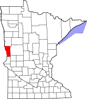 | |
| Townships | ||
| Unincorporated communities | ||
| Footnotes | ‡This populated place also has portions in an adjacent county or counties | |