
Lisman, Alabama: Difference between revisions
Inserted the mayor of lisman Alabama Tags: Visual edit Mobile edit Mobile web edit |
Rescuing 2 sources and tagging 0 as dead. #IABot (v1.3.1.1) |
||
| Line 73: | Line 73: | ||
|estyear=2015 |
|estyear=2015 |
||
|estimate=505 |
|estimate=505 |
||
|estref=<ref name="USCensusEst2015">{{cite web|url=http://www.census.gov/popest/data/cities/totals/2015/SUB-EST2015.html|title=Annual Estimates of the Resident Population for Incorporated Places: April 1, 2010 to July 1, 2015|accessdate=July 2, 2016}}</ref> |
|estref=<ref name="USCensusEst2015">{{cite web|url=http://www.census.gov/popest/data/cities/totals/2015/SUB-EST2015.html |title=Annual Estimates of the Resident Population for Incorporated Places: April 1, 2010 to July 1, 2015 |accessdate=July 2, 2016 |deadurl=yes |archiveurl=https://archive.is/20160602200744/http://www.census.gov/popest/data/cities/totals/2015/SUB-EST2015.html |archivedate=June 2, 2016 |df= }}</ref> |
||
|align-fn=center |
|align-fn=center |
||
|footnote=U.S. Decennial Census<ref>{{cite web|url=http://www.census.gov/prod/www/decennial.html|title=U.S. Decennial Census|publisher=Census.gov|accessdate=June 6, 2013}}</ref><br>2013 Estimate<ref>{{cite web|url=http://www.census.gov/popest/data/cities/totals/2013/SUB-EST2013-3.html|title=Annual Estimates of the Resident Population: April 1, 2010 to July 1, 2013|accessdate=June 3, 2014}}</ref> |
|footnote=U.S. Decennial Census<ref>{{cite web|url=http://www.census.gov/prod/www/decennial.html|title=U.S. Decennial Census|publisher=Census.gov|accessdate=June 6, 2013}}</ref><br>2013 Estimate<ref>{{cite web|url=http://www.census.gov/popest/data/cities/totals/2013/SUB-EST2013-3.html |title=Annual Estimates of the Resident Population: April 1, 2010 to July 1, 2013 |accessdate=June 3, 2014 |deadurl=yes |archiveurl=https://web.archive.org/web/20140522161634/http://www.census.gov/popest/data/cities/totals/2013/SUB-EST2013-3.html |archivedate=May 22, 2014 |df= }}</ref> |
||
}} |
}} |
||
Revision as of 21:22, 16 May 2017
Lisman, Alabama | |
|---|---|
 Location in Choctaw County and the state of Alabama | |
| Coordinates: 32°10′20″N 88°17′22″W / 32.17222°N 88.28944°W | |
| Country | United States |
| State | Alabama |
| County | Choctaw |
| Area | |
| • Total | 2.6 sq mi (6.7 km2) |
| • Land | 2.6 sq mi (6.7 km2) |
| • Water | 0 sq mi (0 km2) |
| Elevation | 164 ft (50 m) |
| Population (2010) | |
| • Total | 539 |
| • Density | 208/sq mi (80.5/km2) |
| Time zone | UTC-6 (Central (CST)) |
| • Summer (DST) | UTC-5 (CDT) |
| ZIP codes | 36906, 36910, 36912 |
| Area code | 205 |
| FIPS code | 01-43384 |
| GNIS feature ID | 0121683 |
Lisman is a town in Choctaw County, Alabama, United States. At the 2010 census, the population was 539.[1] Lisman was named after a 19th-century railroad investor at the time of construction of the nearby rail line. The mayor of Lisman, Alabama is Jason Q.Ward.
Geography
Lisman is located in northern Choctaw County at 32°10'19.978" North, 88°17'21.667" West (32.172216, -88.289352).[2]
According to the U.S. Census Bureau, the town has a total area of 2.6 square miles (6.7 km2), all land.[1]
Demographics
| Census | Pop. | Note | %± |
|---|---|---|---|
| 1920 | 521 | — | |
| 1930 | 521 | 0.0% | |
| 1940 | 545 | 4.6% | |
| 1950 | 606 | 11.2% | |
| 1960 | 909 | 50.0% | |
| 1970 | 636 | −30.0% | |
| 1980 | 638 | 0.3% | |
| 1990 | 481 | −24.6% | |
| 2000 | 653 | 35.8% | |
| 2010 | 539 | −17.5% | |
| 2015 (est.) | 505 | [3] | −6.3% |
| U.S. Decennial Census[4] 2013 Estimate[5] | |||
As of the census[6] of 2000, there were 653 people, 245 households, and 171 families residing in the town. The population density was 257.6 people per square mile (99.3/km²). There were 269 housing units at an average density of 106.1 per square mile (40.9/km²). The racial makeup of the town was 91.42% Black or African American, 7.20% White and 1.38% from two or more races. 0.15% of the population were Hispanic or Latino of any race.
There were 245 households out of which 33.1% had children under the age of 18 living with them, 42.4% were married couples living together, 24.5% had a female householder with no husband present, and 29.8% were non-families. 28.2% of all households were made up of individuals and 10.6% had someone living alone who was 65 years of age or older. The average household size was 2.67 and the average family size was 3.28.
In the town, the population was spread out with 31.1% under the age of 18, 6.9% from 18 to 24, 25.4% from 25 to 44, 23.3% from 45 to 64, and 13.3% who were 65 years of age or older. The median age was 36 years. For every 100 females there were 82.9 males. For every 100 females age 18 and over, there were 83.7 males.
The median income for a household in the town was $20,333, and the median income for a family was $22,750. Males had a median income of $31,719 versus $14,375 for females. The per capita income for the town was $11,295. About 36.4% of families and 36.7% of the population were below the poverty line, including 40.7% of those under age 18 and 37.9% of those age 65 or over.
References
- ^ a b "Geographic Identifiers: 2010 Demographic Profile Data (G001): Lisman town, Alabama". U.S. Census Bureau, American Factfinder. Retrieved June 5, 2014.
- ^ "US Gazetteer files: 2010, 2000, and 1990". United States Census Bureau. 2011-02-12. Retrieved 2011-04-23.
- ^ "Annual Estimates of the Resident Population for Incorporated Places: April 1, 2010 to July 1, 2015". Archived from the original on June 2, 2016. Retrieved July 2, 2016.
{{cite web}}: Unknown parameter|deadurl=ignored (|url-status=suggested) (help) - ^ "U.S. Decennial Census". Census.gov. Retrieved June 6, 2013.
- ^ "Annual Estimates of the Resident Population: April 1, 2010 to July 1, 2013". Archived from the original on May 22, 2014. Retrieved June 3, 2014.
{{cite web}}: Unknown parameter|deadurl=ignored (|url-status=suggested) (help) - ^ "American FactFinder". United States Census Bureau. Retrieved 2008-01-31.
External links
32°10′20″N 88°17′22″W / 32.172216°N 88.289352°W
Municipalities and communities of Choctaw County, Alabama, United States | ||
|---|---|---|
| Towns | 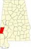 | |
| CDP | ||
| Unincorporated communities | ||
| Footnotes | ‡This populated place also has portions in an adjacent county or counties | |