
Satpuli: Difference between revisions
Vromneg1234 (talk | contribs) m Provided references for satpuli villages, THF Hospital reference, spelling correction, and space corrections. Tags: Visual edit Mobile edit Mobile web edit |
|||
| Line 68: | Line 68: | ||
==Location== |
==Location== |
||
Satpuli is situated on the banks of River Purvi Nayar Ghati (Madhu Ganga). It is located between Kotdwara and Pauri Garhwal. Distance |
Satpuli is situated on the banks of River Purvi Nayar Ghati (Madhu Ganga). It is located between Kotdwara and Pauri Garhwal. Distance from here to Bhaunsal is only about 2 km. It also connects to [[Banghat]], a small market through the [[National Highway 119 (India)|National Highway 119]]. The Satpuli block is a center location of the district Pauri Garhwal that includes 263 villages.<ref>{{Cite web|url=https://villageinfo.in/uttarakhand/garhwal/satpuli.html|title=List of Villages in Satpuli Tehsil {{!}} villageinfo.in|website=villageinfo.in|access-date=2018-01-25}}</ref> It is 52 km from Pauri and 54 km from Kotdwara. |
||
==History== |
==History== |
||
It is said that Satpuli |
It is said that Satpuli got its name from the fact that it has seven bridges (sat-pul) on its way from Kotdwara. Long ago this place used to be a farmland. However, there were some little hut-like shops at the other bank of river. In the year 1952 Satpuli witnessed a great flood in which many people lost their life and the old shops including some G.M.O.U. Ltd. owned buses swept away. Later shopkeepers resettled at the present location. At the hydle power station there has been erected a monument in the memory of deceased people in this biggest flood of nayar valley. Popularly known for its Macchi Bhat (Fish curry and Rice) Satpuli was a famous stop for the travelers to rest and have their lunch and dinner on their way. |
||
Satpuli is now growing and expanded very much as compared to the other villages nearby. It is prime place for the shopping. Villagers from nearby villages come to Satpuli for their FMCG. |
Satpuli is now growing and expanded very much as compared to the other villages nearby. It is prime place for the shopping. Villagers from nearby villages come to Satpuli for their FMCG. |
||
It has four banks SBI, SYNDICATE BANK, ZILA SAHKARI BANK AND UGB. SYNDICATE BANK |
It has four banks SBI, SYNDICATE BANK, ZILA SAHKARI BANK AND UGB. SYNDICATE BANK |
||
is opened here |
is opened here since 2014 and that is the main finance driven body in the village. Ex-army persons and old people used to get their pension from here only. |
||
Satpuli is emerging as new institution area of Uttarakhand as Government Polytechnic College and Degree College,Navodya Vidhyalya,Sriverm ITI and Public school has been established here. |
Satpuli is emerging as new institution area of Uttarakhand as Government Polytechnic College and Degree College, Navodya Vidhyalya, Sriverm ITI and Public school has been established here. |
||
THF Satpuli Hospital is also opened to bring healthcare to the rural area around the satpuli. |
THF Satpuli Hospital is also opened to bring healthcare to the rural area around the satpuli.<ref>{{Cite news|url=http://billionsinchange.in/en/about/hans-foundation-hospitals/|title=The Hans Foundation Hospitals - Billions In Change|work=Billions In Change|access-date=2018-01-25|language=en-US}}</ref> |
||
This place is a shopping centre for many peoples of near by villages. |
This place is a shopping centre for many peoples of near by villages. |
||
Revision as of 04:06, 25 January 2018
Satpuli | |
|---|---|
Town | |
 Satpuli Location in Uttarakhand, India  Satpuli Satpuli (India) | |
| Coordinates: 29°55′0″N 78°42′0″E / 29.91667°N 78.70000°E | |
| Country | |
| State | Uttarakhand |
| District | Pauri Garhwal |
| Elevation | 657 m (2,156 ft) |
| Population | |
| • Total | >10,000 |
| Languages | |
| • Official | Garhwali |
| Time zone | UTC+5:30 (IST) |
| PIN | 246172 |
| Telephone code | 01386 |
| Vehicle registration | UK |
| Nearest city | Pauri & Kotdwar |
| Lok Sabha constituency | Garhwal (P.C No. 2) |
| Avg. summer temperature | 30–47 °C (86–117 °F) |
| Avg. winter temperature | 4–28 °C (39–82 °F) |
| Website | uk |
Satpuli is a town en route from Kotdwar to Pauri, in Pauri Garhwal district of Uttarakhand.
Location
Satpuli is situated on the banks of River Purvi Nayar Ghati (Madhu Ganga). It is located between Kotdwara and Pauri Garhwal. Distance from here to Bhaunsal is only about 2 km. It also connects to Banghat, a small market through the National Highway 119. The Satpuli block is a center location of the district Pauri Garhwal that includes 263 villages.[1] It is 52 km from Pauri and 54 km from Kotdwara.
History
It is said that Satpuli got its name from the fact that it has seven bridges (sat-pul) on its way from Kotdwara. Long ago this place used to be a farmland. However, there were some little hut-like shops at the other bank of river. In the year 1952 Satpuli witnessed a great flood in which many people lost their life and the old shops including some G.M.O.U. Ltd. owned buses swept away. Later shopkeepers resettled at the present location. At the hydle power station there has been erected a monument in the memory of deceased people in this biggest flood of nayar valley. Popularly known for its Macchi Bhat (Fish curry and Rice) Satpuli was a famous stop for the travelers to rest and have their lunch and dinner on their way. Satpuli is now growing and expanded very much as compared to the other villages nearby. It is prime place for the shopping. Villagers from nearby villages come to Satpuli for their FMCG. It has four banks SBI, SYNDICATE BANK, ZILA SAHKARI BANK AND UGB. SYNDICATE BANK is opened here since 2014 and that is the main finance driven body in the village. Ex-army persons and old people used to get their pension from here only. Satpuli is emerging as new institution area of Uttarakhand as Government Polytechnic College and Degree College, Navodya Vidhyalya, Sriverm ITI and Public school has been established here. THF Satpuli Hospital is also opened to bring healthcare to the rural area around the satpuli.[2] This place is a shopping centre for many peoples of near by villages.
Attractions
An idle place for angling and fishing Satpuli also has very beautiful surrounding blessed by nature. One can enjoy the scenic beauty of the place. The nearest tourist destination to Satpuli is Lansdowne, which is most popularly known for its Jungle Safari, along with other attractions like Kanvashram and Tarkeshwar Mahadev Temple. Satpuli also lies near places like Tungnath, Pauri and Devprayag.
One can visit Dangleshwar Mandir, Shri Radha Krishna Mandir, Jwalpa Devi Maa Mandir (18 km from here), Bhuveneshwari Devi Mandir, Bhairav Garhi and others. Lansdowne (Abode of Veer Garhwalis) is 34 km away from here.
Satpuli celebrates Ramleela, Girishmotsava, Sharadotsava and many festive occasions.
Geography
It is located at an elevation of 657 m above MSL.[3] Satpuli google map [4]
References
- ^ "List of Villages in Satpuli Tehsil | villageinfo.in". villageinfo.in. Retrieved 25 January 2018.
- ^ "The Hans Foundation Hospitals - Billions In Change". Billions In Change. Retrieved 25 January 2018.
- ^ http://www.fallingrain.com/world/IN/39/Satpuli.Its beauty attracts here tourists. html Map and weather of Satpuli
- ^ http://www.maplandia.com/india/uttar-pradesh/garhwal/satpuli/ Satpuli google map
External links
Gallery
-
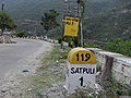 Satpuli On NH-119
 -
 Dangleshwar Mahadev
 -
 Maa Bhuvneshwari Temple
 -
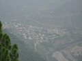 Satpuli Aerial View
 -
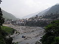 View of Satpuli from Bhanghat Road


