Dar es Salaam Region
Dar es Salaam | |
|---|---|
|
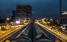
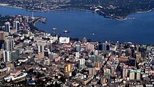
From top to bottom: Dar Rapid Bus Transit System, National Museum of Tanzania, & Bird's eye view of Dar es Salaam | |
| Nickname(s): The brain of Tanzania, Bongo | |
 Location in Tanzania | |
| Coordinates: 6°47′32.64″S 39°12′29.88″E / 6.7924000°S 39.2083000°E | |
| Country | |
| Zone | Coastal |
| Named for | City of Dar es Salaam |
| Capital | Ilala |
| Districts | |
| Area | |
| • Total | 1,393 km2 (538 sq mi) |
| • Rank | 26th of 31 |
| Highest elevation (Pande Hill) | 192 m (630 ft) |
| Population (2012) | |
| • Total | 4,364,541 |
| • Rank | 1st of 31 |
| • Density | 3,100/km2 (8,100/sq mi) |
| Demonym | Darlite |
| Ethnic groups | |
| • Settler | Swahili |
| • Native | Zaramo |
| Time zone | UTC+3 (EAT) |
| Postcode | 11xxx |
| Area code | 026 |
| ISO 3166 code | TZ-02 |
| HDI (2018) | 0.631[1] medium · 2nd |
| Website | Official website |
| Symbols of Tanzania | |
| Bird | |
| Butterfly | |
| Fish | |
| Mammal | Dar es Salaam Pipistrelle |
| Tree |  |
| Mineral |  |
Dar es Salaam Region (Mkoa wa Dar es Salaam in Swahili) is one of Tanzania's 31 administrative regions and is located in the east coast of the country. The region covers an area of 1,393 km2 (538 sq mi).[2] The region is comparable in size to the combined land and water areas of the nation state of Mauritius[3] Dar es Salaam Region is bordered to the east by Indian Ocean and it is entirely surrounded by Pwani Region. The Pwani districts that border Dar es Salaam region are Bagamoyo District to the north, Kibaha Urban District to the west, Kisarawe District to the south west and Mkuranga District to the south of the region. The region's seat (capital) is located inside the ward of Ilala. The region is named after the city of Dar es Salaam itself. The region is home to Tanzania's major finance, administration and industries, thus the making it the country's richest region. According to the 2022 census, the region has a total population of 5,383,728 and national census of 2012 had 4,364,541. The region has the highest population in Tanzania followed by Mwanza Region.[4]
History
Demographics
The area that is now Dar es Salaam Region has been inhabited by humans for thousands of years. The area is the ancestral home to the Zaramo people who are the majority ethnic group in the outskirts of the region.[5] As the region holding the highest population in the country,[6] the region is home to every tribe in the country due to mass migration over the years as well as the largest foreign immigrant population in the country. The region is home to all of the international embassies in the country. The region's city is one of the fastest-growing cities in the world.[7] According to the 2012 national census, the Dar es Salaam Region had a population of 4,364,541.[8]
Districts
Dar es Salaam Region is divided into five administrative districts,[9] four of which are governed by municipal councils[a] that are affiliated with the city's suburbs or wards.
| Districts of Dar es Salaam Region | ||
|---|---|---|
| District | Population (2012) | Area km2 |
| Ilala District | 1,220,611 | 210 |
| Kinondoni District | 1,775,049 | 527 |
| Temeke District | 1,368,881 | 656 |
| Kigamboni District | N/A | N/A |
| Ubungo District | N/A | N/A |
| Dar es Salaam Region | 4,364,541 | 1,393 |
Education and health
As of 2022, there were 987 schools in Dar es Salaam Region, 663 of are primary schools and 324 are secondary schools.[12] In terms of healthcare facilities, as of 2022 Dar es Salaam Region is home to 4 national hospitals, 38 hospitals, 58 health centers and 436 clinics.[13]
Notes
References
- ^ "Sub-national HDI - Area Database - Global Data Lab". hdi.globaldatalab.org. Retrieved 2020-02-26.
- ^ "Dar es Salaam Region".
- ^ 2,040 km2 (790 sq mi) for Mauritius at "Area size comparison". Nation master. 2022. Retrieved 7 July 2022.
1,393 km2 (538 sq mi) for Dar es Salaam. - ^ Matokeo ya Mwanzo ya Sensa ya Watu na Makazi (Report). Government of Tanzania. Retrieved 2023-02-02.
- ^ "The Zaramao". Britannica. 2022. Retrieved 7 July 2022.
- ^ "Largest Population in Tanzania". Statistica. 2021. Retrieved 7 July 2022.
- ^ "Dar es Salaam City popualtion". National geographic. 2019. Retrieved 7 July 2022.
- ^ Population Distribution by Administrative Units, United Republic of Tanzania, 2013, page 1 Archived May 2, 2013, at the Wayback Machine
- ^ "Govt creates new region, 6 districts". Archived from the original on 2018-08-15. Retrieved 2017-05-21.
- ^ "President Magufuli to dissolve Dar es Salaam City Council". The Citizen. Archived from the original on 2021-02-27. Retrieved 2021-03-15.
- ^ "President Magufuli officially dissolves Dar es Salaam City Council". The Citizen. 25 February 2021. Archived from the original on 2021-02-25. Retrieved 2021-03-15.
- ^ "Education Dar es Salaam Region". Retrieved 2022-07-07.
- ^ "Health Dar es Salaam Region". Retrieved 2022-07-07.


