2022–23 Australian region cyclone season
| 2022–23 Australian region cyclone season | |
|---|---|
 Season summary map | |
| Seasonal boundaries | |
| First system formed | 26 July 2022 |
| Last system dissipated | Season ongoing |
| Strongest storm | |
| Name | Darian |
| • Maximum winds | 220 km/h (140 mph) (10-minute sustained) |
| • Lowest pressure | 920 hPa (mbar) |
| Seasonal statistics | |
| Tropical lows | 23 |
| Tropical cyclones | 6 |
| Severe tropical cyclones | 4 |
| Total fatalities | None |
| Total damage | None |
| Related articles | |
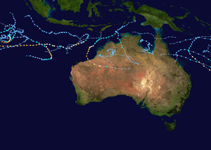
The 2022–23 Australian region cyclone season is the period of the year when most tropical cyclones form in the Southern Indian Ocean and Pacific Oceans between 90°E and 160°E. The season officially started on 1 November 2022 and will finish on 30 April 2023, however, a tropical cyclone could form at any time between 1 July 2022 and 30 June 2023 and would count towards the season total. During the season, tropical cyclones will be officially monitored by one of the three tropical cyclone warning centres (TCWCs) for the region which are operated by the Australian Bureau of Meteorology, National Weather Service of Papua New Guinea and the Indonesian Agency for Meteorology, Climatology and Geophysics. The United States Joint Typhoon Warning Center (JTWC) and other national meteorological services including Météo-France and the Fiji Meteorological Service will also monitor the basin during the season.
Season forecasts
| Region | Chance of more |
Average number | ||
|---|---|---|---|---|
| Whole | 73% | 11 | ||
| Western | 69% | 7 | ||
| North-Western | 70% | 5 | ||
| Northern | 61% | 3 | ||
| Eastern | 74% | 4 | ||
| Western South Pacific | 65% | 4 | ||
| Eastern South Pacific | 43% | 6 | ||
| Source: BoM's Seasonal Outlooks for Tropical Cyclones.[1][2] | ||||
During October 2022, Bureau of Meteorology (BoM), New Zealand's MetService, and the National Institute of Water and Atmospheric Research (NIWA) issued its tropical cyclone outlook for the 2022–23 season.[3] The outlook called for an above-average number of tropical cyclones for the 2022–23 season, with eleven tropical cyclones, predicted to occur.[1] For the Australian region, the BoM predicted that the season would feature, only a 73% chance of more tropical cyclones.[1] For the Western region, it was predicted that activity would be above average, with a 69% chance of tropical cyclone activity.[1] The northern region and northwestern subregion would also see fewer tropical cyclones, with only a 61% and 70% chance of more tropical cyclones than average.[1]
The BoM issued two seasonal forecasts for the Southern Pacific Ocean, for their self-defined eastern and western regions of the South Pacific Ocean.[2] They predicted that the South-West Pacific region between 142.5°E and 165°E, had a 65% chance of seeing activity above its average of 4 tropical cyclones.[2] The BoM also predicted that the South-East Pacific region between 165°E and 120°W, had a 43% chance of seeing activity above its average of 6 tropical cyclones.[2]
Climate models also suggest that El Niño Southern Oscillation (ENSO) will return to neutral conditions in 2023.[1] The BoM noted that sea surface temperature anomalies across the equatorial Indian Ocean.[4] Warmer-than-average waters are expected to persist to the north of Australia for the next three months, increasing the likelihood of tropical cyclones.[1] The BoM also predicted that the Eastern Region had a 74% chance of seeing activity above its average of 4 tropical cyclones.[1] These outlooks accounted included the state of the ENSO.[1] A higher average risk of tropical cyclones was also predicted by NIWA for nations east of the International Date Line.[3]
Season summary

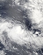
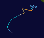
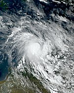
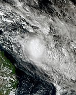
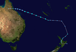
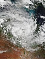
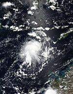
A tropical low formed on 26 July and was later designated as 01U, an exceptionally early start to the season.[5] The system attained tropical-storm-force winds and persistent deep convection for a couple of days before wind shear began to increase. In-post analysis, 01U was upgraded to a Category 1 tropical cyclone (Australian scale). In November, tropical low 02U was designated by the BoM and encountered marginally favorable conditions. The low was upgraded to Tropical Cyclone 04S by JTWC after tropical-storm-force winds were found.[6] Later in the month, a tropical low formed and was a long-lived system before dissipating on 26 November.[7] There was also another tropical low that formed in the Gulf of Carpentaria but did not develop further.[8] In December, tropical low 05U formed, and was given the name Darian after intensifying into a Category 1 Tropical Cyclone. On 19 December, it became the first Severe Tropical Cyclone of the season. Throughout the day, the storm unexpectedly entered very favorable conditions, and underwent rapid intensification. It reached Category 5 on the BoM's scale the next day, and peaked as a Category 4 on the SSHWS scale, later exiting into the South-west Indian Ocean Basin. Later that month, a tropical low formed, later intensifying into a Category 1 Tropical Cyclone and was named Ellie. Ellie then later crossed the Northern Territory coast, making landfall at a sparsely populated location southwest of Daly River at 13:30 UTC (11:00 pm ACST).[9][10] Shortly after the landfall, the JTWC discontinued warnings on the system.[11]
The next day, the BoM's released its last bulletin on Ellie, as the system weakened into a tropical low.[12] However, Ellie remained traceable,[13] as it moved southwest towards the Western Australia region throughout the rest of December.[14] The BoM then gave the tropical low a moderate chance of redeveloping into a tropical cyclone on 1 January.[15] The storm then moved southeast and further weakened as it moved inland once again.[16] On 6 January, the BoM stated that Tropical Low 07U formed from a monsoon trough over northeastern Australia. The JTWC later upgraded it to a Category 1 Tropical Cyclone (Australian Scale), and dubbed it as Cyclone 07P. However, the BoM did not upgrade the system due to lacking a well-defined center. 07U later moved into the South Pacific basin and was named Hale. Later in January, a tropical low become 06F in the South Pacific basin, and Tropical Lows 10U and 12U remained weak. In February, activity increased across the basin, with the formations of Tropical Low 11U, Freddy, and Gabrielle.[17][18] Freddy took advantage of the favorable conditions and intensified to a Category 3 severe tropical cyclone.[19] Gabrielle also steadily intensified to a severe tropical cyclone as the cyclone headed southeast and moved into the South Pacific basin on 10 February. 11U exited the Australian Region basin and was named Dingani in the Southwest Indian Ocean basin. Freddy later rapidly intensified to a Category 4 on both the Australian and SSHWS scales.[20] Another tropical low, 15U, formed on 11 February and lasted until 17 February. After 15U, a weak tropical low formed, followed by tropical lows 16U and 17U. Another weak tropical low, 18U, formed on 27 February. 17U was last noted on 27 February, and on 1 March, 18U moved into the South Pacific basin, where it became Kevin.
Systems
Tropical Cyclone 01U
| Category 1 tropical cyclone (Australian scale) | |
| Tropical storm (SSHWS) | |
| Duration | 26 July – 31 July |
|---|---|
| Peak intensity | 85 km/h (50 mph) (10-min); 993 hPa (mbar) |
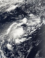
On 26 July, the Bureau of Meteorology (BoM) reported that a tropical low had formed due to an increase in monsoonal storm activity during the Madden–Julian Oscillation (MJO).[21][5] Deep convection became more pronounced and organized with an upper-level trough around the center.[5] By 15:00 UTC on 28 July, the Joint Typhoon Warning Center (JTWC) issued a Tropical Cyclone Formation Alert (TCFA) for the disturbance.[22] The system was located in a favorable environment, with sea surface temperatures ranging from 28 to 30 degrees Celsius, and the JTWC issued their first warning on the storm six hours later as Tropical Cyclone 01S.[23] During post-storm analysis from the BoM, the system was upgraded into a Category 1 tropical cyclone on 29 July, although it remained unnamed.[5] 01U reached peak intensity with maximum 10-sustained winds of 85 km/h (50 mph).[5] At 09:00 UTC on 31 July, the JTWC issued their final warning on the system.[24] Later that day, 01U completely dissipated.[5] The cyclone did not have any impacts on the Cocos Islands despite its period of strong winds, which were less than gale-force.[5]
Tropical Low 02U
| Tropical low (Australian scale) | |
| Tropical storm (SSHWS) | |
| Duration | 1 November – 5 November (Exited basin) |
|---|---|
| Peak intensity | 65 km/h (40 mph) (1-min); 1004 hPa (mbar) |
On 1 November, the BoM began tracking a tropical low to the northwestern of the region.[25] Satellite imagery revealed that the system was displaced from its center of circulation.[26] Environmental conditions were assessed by the BoM as being unfavorable for significant intensification of the system.[27] The system was assigned the official identifier code 02U.[28] Over the past twelve hours, the system has improved.[28] At 03:00 UTC on 3 November, the JTWC issued a TCFA, after noting its obscure low-level circulation center (LLCC).[29] Later that day, the JTWC subsequently initiated advisories on the system and classified it as Tropical Cyclone 04S.[30][6] The system had a broad and fully exposed LLCC, although there has been some increased thunderstorm activity associated with the system.[31] The BoM's stopped tracking the system.[32][33] The system briefly crossed into the South-West Indian Ocean basin on 5 November.[34]
Severe Tropical Cyclone Darian
| Category 5 severe tropical cyclone (Australian scale) | |
| Category 4 tropical cyclone (SSHWS) | |
| Duration | 13 December – 21 December (Exited basin) |
|---|---|
| Peak intensity | 220 km/h (140 mph) (10-min); 920 hPa (mbar) |
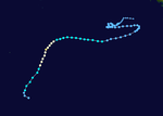
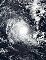
On 13 December, the BoM reported that Tropical Low 05U had formed approximately 170 km (110 mi) north of Cocos Islands, initially forecast to not develop further due to not conducive conditions.[35] However, over the next 5 days, conditions improved, with vertical wind shear decreasing.[36] At 11:30 UTC on 17 December, satellite imagery showed a partially exposed low-level center embedded in deep convection, prompting the JTWC's to issue a TCFA.[37] On the next day, the system strengthened into a Category 1-cyclone on the Australian scale, with BoM naming it Darian.[38] Later that day, the JTWC initiated advisories on the system and classified it as Tropical Cyclone 05S.[39] The BoM's assessed the cyclone to have strengthened into a Category 2 cyclone on 19 December and later to Category 3 cyclone on the Australian scale.[40][41] By 15:00 UTC, the JTWC upgraded Darian to a Category 1-equivalent cyclone on the Saffir–Simpson hurricane wind scale (SSHWS), with maximum 1-sustained winds of 140 km/h (85 mph).[42]
Darian then strengthened to a Category 3 equivalent cyclone on the SSHWS in an environment of low wind shear, warm sea surface temperatures and good upper-level poleward outflow, which led to the storm having a symmetric 23 nautical miles (43 km; 26 mi) eye.[43] The cyclone quickly intensified, and was upgraded to a Category 4 cyclone by the BoM.[44] Similarly, the JTWC's further upgraded Darian to a Category 4-equivalent cyclone around 21:00 UTC, while exhibiting some annular characteristics.[45] Darian continued to rapidly intensify, and reached Category 5 intensity on the Australian scale at 00:00 UTC on 21 December.[46][47] Later that day, it exited the basin and moved into the South-West Indian Ocean basin.[48]
Tropical Cyclone Ellie
| Category 1 tropical cyclone (Australian scale) | |
| Tropical storm (SSHWS) | |
| Duration | 20 December – 8 January |
|---|---|
| Peak intensity | 75 km/h (45 mph) (10-min); 986 hPa (mbar) |
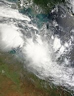
On 20 December, the BoM reported that a tropical low was slowly developing over the Timor Sea.[49] Initially located in a favorable environment for intensification, the disturbance began to encounter somewhat improved conditions.[50] Satellite imagery indicated an improvement in the structure of the disturbance, with the system displaying an increase in flaring deep convection.[51] The JTWC issued a TCFA for the system at 02:00 UTC on 22 December.[52] The low was assigned the official identifier code 06U.[53] By 09:00 UTC, the JTWC subsequently designated the storm as Tropical Cyclone 06S, citing that convection quickly became better organized and more concentrated around the broad center.[54] Later that day, the BoM's reported that the tropical low had developed into a Category 1-cyclone on the Australian scale and named it Ellie.[55] Ellie then later crossed the Northern Territory (NT) coast, making landfall at a sparsely populated location southwest of Daly River at 13:30 UTC (11:00 pm ACST).[56][57] Shortly after the landfall, the JTWC discontinued warnings on the system.[58] The next day, the BoM's released its last bulletin on Ellie, as the system weakened into a tropical low.[59] However, Ellie remained traceable,[60] as it moved southwest towards the Western Australia region throughout the rest of December.[61] The BoM then gave the tropical low a moderate chance of redeveloping into a tropical cyclone on 1 January.[62] However, they later downgraded its chances of redeveloping into very low, as the storm turned southeast further inland and was weakening.[63] The cyclone, then referred to as "ex-Tropical Cyclone Ellie", turned back into the Northern Territory on around 7 January,[64] and was then last noted on 8 January, well inland about 130 km (81 mi) southeast of Rabbit Flat.[65]
In anticipation of Ellie, the BoM issued a tropical cyclone warning for the coast of Western Australia and Northern Territory.[66] The cyclone mainly caused torrential rainfall and gale-force wind gusts along the Top End as it became a tropical cyclone.[67] Timber Creek experienced "once-in-50-year" flooding as the cyclone moved through the town by 24 December.[68] Heavy rainfall led to water levels within the Fitzroy River reaching 15.81 m (51.9 ft), surpassing its 2002 record of 13.95 m (45.8 ft).[69][70] By January, the river was 50 km (31 mi) wide in some parts.[71] Flooding continued into January, with WA Emergency Services Minister, Stephen Dawson, saying that it was a "once in a century" flood crisis.[72] Infrastructure was damaged and remote Indigenous communities completely cut off. Defence personnel were deployed to the Kimberley region in WA, three RAAF aircraft were provided to evacuate residents, and five helicopters were despatched to help with the crisis.[71] Hardship payments were made by the state, territory and Commonwealth governments,[64] and Prime Minister Anthony Albanese promised "massive infrastructure investment" when he visited the area afterwards.[71]
Tropical Low 07U (Hale)
| Tropical low (Australian scale) | |
| Tropical storm (SSHWS) | |
| Duration | 6 January – 7 January (Exited basin) |
|---|---|
| Peak intensity | 75 km/h (45 mph) (10-min); 994 hPa (mbar) |
By 31 December, the BoM noted the potential of a tropical low forming over the Coral Sea, as the monsoon was forecast to strengthen further over the region.[73] Three days later, the agency put a low chance for the potential low to develop into a tropical cyclone in the region.[74] By 6 January, the BoM reported that Tropical Low 07U had developed approximately 190 km (120 mi) to the north-northeast of Townsville in Queensland.[75] The JTWC gave it a medium chance to develop into a tropical cyclone,[76] before issuing a TCFA saying that the chance for the system to develop into a tropical cyclone was high 8 hours later.[77] With a favorable environment of low wind shear, warm sea surface temperatures, and good radial outflow, the system intensified into a tropical cyclone late on the same day according to the JTWC, and designating it as 07P.[78] The BoM did not upgrade 07U as such, citing that its center was elongated northwest to the southeast.[79] 07U then later exited the basin and moved into the South Pacific basin.[80]
Tropical Low 10U
| Tropical low (Australian scale) | |
| Duration | 22 January – 26 January |
|---|---|
| Peak intensity | Winds not specified; 1001 hPa (mbar) |
On 19 January, the BoM noted that a tropical low may form within a monsoon trough that was forming over the Gulf of Carpentaria, and was expected to extend into the Arafura Sea.[81] Over the next few days, the low slowly formed within the trough,[82] and by 22 January, the agency reported that Tropical Low 10U had formed, approximately 170 km (110 mi) to the north of Nhulunbuy.[83] The tropical low moved generally westwards,[84] and was last noted on 26 January while being located about 470 km (290 mi) west-northwest of Kalumburu.[85]
Tropical Low 11U (Dingani)
| Tropical low (Australian scale) | |
| Duration | 27 January – 9 February (Exited basin) |
|---|---|
| Peak intensity | 55 km/h (35 mph) (10-min); 997 hPa (mbar) |
On 24 January, the BoM noted that a tropical low may form within a trough in the central Indian Ocean.[86] Three days later, as the tropical low was forming, the agency designated it as 11U.[17] The low embedded within the monsoon trough on 28 January.[87] By 13:00 UTC on 29 January, the JTWC had also began monitoring the area of disturbance.[88] Later on 4 February, the BoM later issued advisories for the system as it approached Cocos Islands.[89] Six hours later, the system was poorly organised with deep atmospheric convection.[90] 11U exited the basin towards the South-West Indian Ocean on 9 February.[91]
Tropical Low 12U
| Tropical low (Australian scale) | |
| Duration | 31 January – 4 February |
|---|---|
| Peak intensity | Winds not specified; 1002 hPa (mbar) |
On 30 January, the BoM highlighted that a weak low could form near Christmas Island, as the monsoon trough began to be more active across the tropics.[92] By the next day, the weak low formed within the trough, and the agency classified it as 12U.[93] For the next few days, the low moved slowly,[94] before encountering unfavorable conditions for development by 3 February.[95] The BoM last noted 12U about 740 km (460 mi) to the south of Christmas Island on the next day.[96]
Severe Tropical Cyclone Freddy
| Category 4 severe tropical cyclone (Australian scale) | |
| Category 4 tropical cyclone (SSHWS) | |
| Duration | 5 February – 14 February (Exited basin) |
|---|---|
| Peak intensity | 185 km/h (115 mph) (10-min); 941 hPa (mbar) |
Early on 5 February, a tropical low was initially located south of Bali, Indonesia.[97] Initially, the circulation was elongated and poorly defined, but during the evening and overnight, persistent convection occurred and started to show signs of improvement in the organization.[97] On 6 February, the JTWC issued a TCFA on the system.[98] By 09:00 UTC, the JTWC initiated advisories on the system and classified it as Tropical Cyclone 11S.[99] The BoM upgraded the system to Tropical Cyclone Freddy, citing a period of fast development while moving slowly south-southwest.[97][100][101]
Throughout the next day, feeder bands were covering its very broad and central dense overcast (CDO), prompting the JTWC to upgrade the system to a Category 1-equivalent cyclone.[102] The BoM subsequently followed suit and upgraded Freddy into a Category 2 tropical cyclone.[103] Freddy began showing an eye feature first seen in microwave imaging, with Freddy later becoming a Category 2-equivalent cyclone.[19] Freddy weakened slightly due to CDO and a persistent area of cold cloud tops.[104] Freddy weakened back into a tropical storm, and the BoM's estimated winds of 100 km/h (65 mph) due to its easterly winds, which resulted in moderate wind shear.[105][106]
During 11 February, Freddy had intensified to a Category 4 severe tropical cyclone due to the presence of a well-defined eye surrounded by deep cold convection.[107] Freddy underwent rapid deepening and reached a Category 4-equivalent cyclone with a symmetric CDO.[20] The storm continued to weakening due to strong wind shear, the BoM's estimated winds of 155 km/h (100 mph).[108] During 14 February, it exited the basin and entered the South-West Indian Ocean basin.[109] Freddy did not directly affect the Australian coast with wind or rain, but the system's swell reached the Northwest Shelf, with reporting 2 m (6.6 ft) to 2.5 m (8.2 ft).[97]
Severe Tropical Cyclone Gabrielle
| Category 3 severe tropical cyclone (Australian scale) | |
| Category 2 tropical cyclone (SSHWS) | |
| Duration | 5 February – 10 February (Exited basin) |
|---|---|
| Peak intensity | 130 km/h (80 mph) (10-min); 969 hPa (mbar) |
On 5 February, the BoM reported that Tropical Low 14U was forming within a monsoonal trough of low pressure over the northeastern Coral Sea near the Solomon Islands.[110][111] At around the same time, the system's LLCC was exposed with persistent disorganized convection.[112] Over the next day, as the system moved southwards, it developed further, with satellite imagery showing an increase in the cyclonic curvature of the convection.[113] Later at 06:00 UTC, the JTWC issued a TCFA, after noting its obscure LLC.[114] By 03:00 UTC on 8 February, the JTWC initiated advisories on the system and classified it as Tropical Cyclone 12P, when the fragmented banding was wrapping broadly into the exposed consolidating LLC.[115] Late on the same day, the BoM reported that the tropical low had developed into a Category 1 tropical cyclone and named it Gabrielle.[18] The cyclone slowly drifted southwards while deep convection consolidated,[116] and the system was upgraded into a Category 2 tropical cyclone, while the JTWC upgraded Gabrielle to the equivalent of a low-end Category 1-equivalent cyclone with winds of 120 km/h (75 mph).[117] By 18:00 UTC on 9 February, the storm continued to intensify and soon became a Category 3 severe tropical cyclone.[118] Later the next day, it exited the basin and moved into the South Pacific basin,[119] where it became a Category 2-equivalent cyclone.[120][121]
Tropical Low 15U
| Tropical low (Australian scale) | |
| Duration | 11 February – 17 February |
|---|---|
| Peak intensity | 45 km/h (30 mph) (10-min); 997 hPa (mbar) |
On 11 February, the BoM reported that Tropical Low 15U was forming over the eastern Top End.[122] The JTWC had also begun monitoring the disturbance, which the agency classified it by the code identifier Invest 91P, and gave it a low chance for development.[123] The next day, the JTWC later upgraded the system's chance for development to medium.[124] The BoM later assessed 15U to still be a weak tropical low, and gave it a low chance for development.[125] The low then moved slowly southeastwards, before moving inland on 16 February and being last noted on the BoM's tropical cyclone outlooks by the next day.[126][127]
Tropical Low 16U
| Tropical low (Australian scale) | |
| Duration | 23 February – 10 March |
|---|---|
| Peak intensity | Winds not specified; 995 hPa (mbar) |
On 17 February, the BoM noted that a tropical low may form to the north of Pilbara.[128] It was designated as 16U three days later.[129] On 23 February, the BoM reported that 16U had formed to the north of the coast of Pilbara.[130] It eventually merged with 17U and moved over land to the NT/WA border, prompting the BoM to issue heavy rain and wind warnings.[131] On 5 March, it emerged over into the Gulf of Carpentaria, where the BoM upgraded its chance of formation to low.[132] However, as 16U moved over land once again, the BoM lowered its chance again to very low.[133] 16U was last noted on 10 March, about 155 kilometres (96 mi) to the south-southeast of Burketown in Queensland.[134]
Tropical Low 17U
| Tropical low (Australian scale) | |
| Duration | 24 February – 27 February |
|---|---|
| Peak intensity | Winds not specified; 999 hPa (mbar) |
On 24 February, the BoM reported that a weak tropical low which they classified as 17U was located over land to the south of the Joseph Bonaparte Gulf.[135] 17U was last noted on 27 February.[136]
Tropical Low 18U (Kevin)
| Tropical low (Australian scale) | |
| Duration | 27 February – 1 March (Exited basin) |
|---|---|
| Peak intensity | 55 km/h (35 mph) (10-min); 998 hPa (mbar) |
On 27 February, a weak tropical low formed off the coast in Queensland. The BoM designated it as 18U.[137][138] The JTWC began monitoring the tropical low and setting the chance of tropical cyclone development as low.[139] On 1 March, the JTWC issued a TCFA on the system due to the system having much improved structure.[140] The tropical low entered the South Pacific basin the same day where it became designated as Tropical Depression 09F by the FMS.[141]
Tropical Low 20U
| Tropical low (Australian scale) | |
| Duration | 25 March – 30 March |
|---|---|
| Peak intensity | Winds not specified; |
Severe Tropical Cyclone Herman
| Category 5 severe tropical cyclone (Australian scale) | |
| Category 3 tropical cyclone (SSHWS) | |
| Duration | 29 March – 5 April |
|---|---|
| Peak intensity | 205 km/h (125 mph) (10-min); 935 hPa (mbar) |
On 27 March, the JTWC began monitoring an area of convection.[142] Satellite imagery showed that flaring convection which was circulating over the obscured LLCC.[142] During 29 March, the BoM subsequently initiated advisories on the system and classified it as Tropical Low 21U.[143] By 02:00 UTC that day, the JTWC issued a TCFA, and upgraded the system to a Tropical Cyclone 17S.[144][145] Later that day, the BoM's reported that the tropical low had developed into a Category 1 tropical cyclone on the Australian scale and named it Herman.[146] Later, the BoM's assessed the cyclone to have strengthened into a 95 km/h (60 mph).[147] Herman intensified further with an eye feature starting to appear on microwave imagery.[148]
Multispectral animated satellite imagery revealed an exposed LLCC with deep convection persisting along the western periphery of the LLCC and reaching 1-minute maximum sustained winds of 130 km/h (80 mph).[149] Herman had further intensified to a Category 4-cyclone due to the presence of a well-defined eye.[150] Continuing to rapidly intensify, Herman then strengthened into a Category 5 severe tropical cyclone,[151] while the JTWC upgraded Herman with 10-minute average winds of 205 km/h (125 mph).[152] During this time, JTWC was following RSMC guidance as they were holding a conference, rather than issuing their own 1-minute wind estimates. A 10-minute windspeed of 125 mph can be roughly equated to a 1-minute windspeed of 145 mph using a conversion factor of 1.14, equivalent to Category 4 hurricane strength.[153] Herman was highly compact, with a distinct eye surrounded by cold cloud tops.[154] The storm continued to weaken, the BoM's estimated winds of 195 km/h (120 mph).[155] Herman became increasingly ragged and elongated as deep convection diminished and started to become displaced.[156] During 2 April, while continuing to weaken, both the BoM and JTWC ceased issuing advisories.[157][158] The JTWC stopped tracking the system on 5 April.[159]
Tropical Low 22U
| Tropical low (Australian scale) | |
| Duration | 30 March – 2 April |
|---|---|
| Peak intensity | Winds not specified; |
Tropical Low 23U
| |||
|---|---|---|---|
Current storm status Tropical low cyclone (Australian scale) | |||
| |||
| As of: | Technical bulletin released to 2:00 a.m. AWST 9 April 2023 (Or 12:00 UTC 8 April 2023) | ||
| Location: | 11°00′S 128°36′E / 11°S 128.6°E Approximately to 425 km (265 mi) NNW of Kalumburu, and approximately to 295 km (185 mi) WNW of Darwin | ||
| Sustained winds: | About 30 kn (55 km/h; 35 mph) (10-min mean) gusting to 40 kn (75 km/h; 45 mph) 35 kn (65 km/h; 40 mph) (1-min mean) | ||
| Pressure: | 1000 hPa (29.53 inHg) | ||
| Movement: | Moves to 7 kn (13 km/h; 8.1 mph) for SSW | ||
| See more detailed information. | |||
On 5 April, the BoM noted a tropical low forming in the Arafura Sea and designated it as 23U.[160] The JTWC later issued a TCFA on 7 April, designating it as Invest 98S.[161] Two days later, the JTWC upgraded the cyclone's status to a "tropical storm" and designated it 18S. [162]
For more information about the storm, see:
- BoM's: tropical cyclone forecast track map of tropical low 23U
- BoM's: tropical cyclone advice of tropical low 23U
- BoM's: tropical cyclone technical bulletin of tropical low 23U
- BoM's: ocean wind warning of tropical low 23U
Other systems
On 15 November, the BoM reported a weak tropical low near southern Indonesia.[163] The JTWC released a TCFA stating that the low could intensify soon and called it Invest 94S.[7] The next day, the JTWC canceled its TCFA and lowered its chances to low.[164] It continued to move eastwards before being last noted on 24 November.[165]
On 30 November, the BoM reported that a weak tropical low had developed along a trough over central Gulf of Carpentaria.[8] It generally moved southeast before being last noted by BoM on 2 December, near the western Cape York Peninsula.[166]
On 13 January, the BoM noted the potential of a tropical low forming in the eastern Coral Sea.[167] By the next day, the Fiji Meteorological Service (FMS) designated the potential low as Tropical Disturbance 05F, while it was still in the BoM's area of responsibility.[168] 05F briefly entered the South Pacific basin on 15 January,[169] before subsequently moving back into the region late by the same day.[170] On 16 January, the BoM upgraded 05F into a weak tropical low.[171] The JTWC issued a TCFA on the system on 17 January, stating its chance to develop into a tropical cyclone was high.[172] Later that day, it exited the basin again and moved into the South Pacific basin.[173]
On 15 January, the BoM noted the potential of another tropical low forming, this time in the northern Coral Sea, within a monsoon trough that was expected to form.[174] Two days later, the agency reported that the tropical low had formed, and gave it a high chance of developing into a tropical cyclone within the basin.[175] The JTWC subsequently issued a TCFA the next day.[176] Continuing southeastwards,[177] the tropical low then exited the basin and into the South Pacific basin on 20 January, where it was immediately designated as Tropical Depression 06F by the FMS.[178]
On 17 February, the BoM reported that a weak tropical low had formed, within a trough, to the south of Indonesia.[179] It was last noted the next day.[180]
Storm names
Bureau of Meteorology
The Australian Bureau of Meteorology (TCWC Melbourne) monitors all tropical cyclones that form within the Australian region, including any within the areas of responsibility of TCWC Jakarta or TCWC Port Moresby.[181] Should a tropical low reach tropical cyclone strength within the BoM's area of responsibility, it will be assigned the next name from the following naming list.
|
|
TCWC Jakarta
TCWC Jakarta monitors Tropical Cyclones from the Equator to 11S and from 90E to 145E. Should a Tropical Depression reach Tropical Cyclone strength within TCWC Jakarta's Area of Responsibility then it will be assigned the next name from the following list.[181]
|
|
|
TCWC Port Moresby
Tropical cyclones that develop north of 11°S between 151°E and 160°E are assigned names by the Tropical Cyclone Warning Centre in Port Moresby, Papua New Guinea. Tropical cyclone formation in this area is rare, with no cyclones being named in it since 2007.[182] As names are assigned in a random order, the whole list is shown below:
|
|
Season effects
| Name | Dates | Peak intensity | Areas affected | Damage (US$) |
Deaths | |||
|---|---|---|---|---|---|---|---|---|
| Category | Wind speed (km/h (mph)) |
Pressure (hPa) | ||||||
| 01U | 26–31 Jul | Category 1 tropical cyclone | 85 (50) | 993 | Cocos Islands | None | 0 | |
| 02U | 1–5 Nov | Tropical low | Not specified | 1004 | None | None | 0 | |
| TL | 15–26 Nov | Tropical low | Not specified | 1004 | Christmas Island | None | 0 | |
| TL | 30 Nov – 2 Dec | Tropical low | Not specified | 1001 | Cape York Peninsula | None | 0 | |
| Darian | 13–21 Dec | Category 5 severe tropical cyclone | 220 (140) | 920 | Cocos Islands | None | 0 | |
| Ellie | 20 Dec – 8 Jan | Category 1 tropical cyclone | 75 (45) | 986 | Northern Territory, Western Australia | Unknown | 0 | |
| Hale | 6–7 Jan | Tropical low | 75 (45) | 994 | None | None | 0 | |
| Irene | 16–17 Jan | Tropical low | Not specified | 999 | None | None | 0 | |
| 06F | 18–20 Jan | Tropical low | Not specified | 996 | None | None | 0 | |
| 10U | 22–26 Jan | Tropical low | Not specified | 1001 | Northern Territory | None | 0 | |
| Dingani | 27 Jan – 9 Feb | Tropical low | 55 (35) | 997 | Cocos Islands | None | 0 | |
| 12U | 31 Jan – 4 Feb | Tropical low | Not specified | 1002 | None | None | 0 | |
| Freddy | 5–14 Feb | Category 4 severe tropical cyclone | 185 (115) | 941 | Lesser Sunda Islands | None | 0 | |
| Gabrielle | 6–10 Feb | Category 3 severe tropical cyclone | 130 (80) | 969 | None | None | 0 | |
| 15U | 11–17 Feb | Tropical low | 45 (30) | 997 | Northern Territory | None | 0 | |
| TL | 17–18 Feb | Tropical low | Not specified | 1004 | None | None | 0 | |
| 16U | 23 Feb – 10 Mar | Tropical low | Not specified | 995 | Western Australia, Northern Territory | None | 0 | |
| 17U | 24–27 Feb | Tropical low | Not specified | 999 | Northern Territory | None | 0 | |
| Kevin | 27 Feb – 1 Mar | Tropical low | 55 (35) | 998 | Louisiade Archipelago | None | 0 | |
| 20U | 25–30 Mar | Tropical low | Not specified | Not specified | None | None | 0 | |
| Herman | 28 Mar – 2 Apr | Category 5 severe tropical cyclone | 205 (125) | 935 | Cocos Islands | None | 0 | |
| 22U | 30 Mar – 2 Apr | Tropical low | Not specified | Not specified | None | None | 0 | |
| 23U | 5 Apr – Present | Tropical low | 65 (40) | 996 | None | None | 0 | |
| Season aggregates | ||||||||
| 23 systems | 26 Jul – Present | 220 (140) | 920 | Unknown | 0 | |||
See also
- Weather of 2022 and 2023
- List of Southern Hemisphere cyclone seasons
- List of off-season Australian region tropical cyclones
- Tropical cyclones in 2022, 2023
- Atlantic hurricane seasons: 2022, 2023
- Pacific hurricane seasons: 2022, 2023
- Pacific typhoon seasons: 2022, 2023
- North Indian Ocean cyclone seasons: 2022, 2023
- 2022–23 South-West Indian Ocean cyclone season
- 2022–23 South Pacific cyclone season
References
- ^ a b c d e f g h i "Australian Tropical Cyclone Outlook for 2022 to 2023". Bureau of Meteorology. 10 October 2022. Archived from the original on 1 November 2022. Retrieved 1 November 2022.
- ^ a b c d "South Pacific Tropical Cyclone Outlook for 2022 to 2023". Bureau of Meteorology. 12 October 2022. Archived from the original on 1 November 2022. Retrieved 1 November 2022.
- ^ a b "2022-23 Southwest Pacific Tropical Cyclone Outlook" (PDF). National Institute of Water and Atmospheric Research. 11 October 2022. Archived (PDF) from the original on 1 November 2022. Retrieved 1 November 2022.
- ^ "Tropical Cyclone Seasonal Outlook for Northwest Australia". Bureau of Meteorology. 10 October 2022. Archived from the original on 1 November 2022. Retrieved 1 November 2022.
- ^ a b c d e f g Courtney, Joe; Boterhoven, Matt. Unnamed Tropical Cyclone 01U (PDF) (Report). Bureau of Meteorology. Archived (PDF) from the original on 31 October 2022. Retrieved 31 October 2022.
- ^ a b Prognostic Reasoning for Tropical Cyclone 04S (Four) Warning No. 2 (Report). United States Joint Typhoon Warning Center. 4 November 2022. Archived from the original on 4 November 2022. Retrieved 4 November 2022.
- ^ a b "Current Southern Hemisphere Tropical Systems Tropical Cyclone Formation Alert WTXS21 Issued at 16/0300Z (Invest 94S)". JTWC. 16 November 2022. Archived from the original on 16 November 2022. Retrieved 16 November 2022.
- ^ a b Tropical Cyclone Outlook for the Northern Region, including the Gulf of Carpentaria issued at 2:15 pm CST on Wednesday 30 November 2022 (Report). Australian Bureau of Meteorology. 30 November 2022.
- ^ Tropical Cyclone Advice No. 7 (NT) (Report). Australian Bureau of Meteorology. 22 December 2022. Archived from the original on 22 December 2022. Retrieved 22 December 2022.
- ^ "Tropical Cyclone Ellie expected to weaken after crossing Northern Territory coastline overnight". ABC News. 22 December 2022. Archived from the original on 23 December 2022. Retrieved 23 December 2022.
- ^ Tropical Cyclone 06S (Ellie) Warning No. 3 (Report). United States Joint Typhoon Warning Center. 22 December 2022. Archived from the original on 22 December 2022. Retrieved 22 December 2022.
- ^ Tropical Cyclone Technical Bulletin (Northern Region) (Report). Australian Bureau of Meteorology. 23 December 2022. Archived from the original on 23 December 2022. Retrieved 23 December 2022.
- ^ Miskelly, Jess (2 January 2023). "What's going on with Ex-Tropical Cyclone Ellie?". Weatherzone. Archived from the original on 2 January 2023. Retrieved 3 January 2023.
- ^ Tropical Cyclone Outlook for the Western Region issued at 2:00 pm WST on Thursday 29 December 2022 (Report). Australian Bureau of Meteorology. 29 December 2022. Archived from the original on 29 December 2022. Retrieved 3 January 2023.
- ^ Tropical Cyclone Outlook for the Western Region issued at 2:00 pm WST on Sunday 1 January 2023 (Report). Australian Bureau of Meteorology. 1 January 2023. Archived from the original on 1 January 2023. Retrieved 3 January 2023.
- ^ Updated Tropical Cyclone Outlook for the Western Region Issued at 2:28 pm WST on Wednesday 4 January 2023 (Report). Australian Bureau of Meteorology. 4 January 2023. Archived from the original on 5 January 2023. Retrieved 5 January 2023.
- ^ a b Tropical Cyclone Outlook for the Western Region issued at 2:07 pm WST on Friday 27 January 2023 (Report). Australian Bureau of Meteorology. 27 January 2023. Archived from the original on 27 January 2023. Retrieved 27 January 2023.
- ^ a b Tropical Cyclone Forecast Track Map for Tropical Cyclone Gabriellie (13U) (Report). Australian Bureau of Meteorology. 8 February 2023. Archived from the original on 6 February 2023. Retrieved 8 February 2023.
{{cite report}}:|archive-date=/|archive-url=timestamp mismatch; 8 February 2023 suggested (help) - ^ a b Prognostic Reasoning for Tropical Cyclone 11S (Freddy) Warning No. 6 (Report). United States Joint Typhoon Warning Center. 7 February 2023. Archived from the original on 7 February 2023. Retrieved 7 February 2023.
- ^ a b Prognostic Reasoning for Tropical Cyclone 11S (Freddy) Warning No. 19 (Report). United States Joint Typhoon Warning Center. 12 February 2023. Archived from the original on 12 February 2023. Retrieved 12 February 2023.
- ^ "Australian Tropical Cyclone Database" (CSV). Australian Bureau of Meteorology. 30 June 2023. Retrieved 30 June 2023. A guide on how to read the database is available here.
- ^ Tropical Cyclone Formation Alert (Invest 95S) (Report). United States Joint Typhoon Warning Center. 28 July 2022. Archived from the original on 28 July 2021. Retrieved 28 July 2022.
- ^ Prognostic Reasoning for Tropical Cyclone 01S (One) Warning No. 1 (Report). United States Joint Typhoon Warning Center. 28 July 2022. Archived from the original on 22 July 2022. Retrieved 28 July 2022.
- ^ Tropical Cyclone 01S (One) Warning No. 6 (Report). United States Joint Typhoon Warning Center. 31 July 2022. Archived from the original on 31 October 2022. Retrieved 31 July 2022.
- ^ "Tropical Cyclone Outlook for the Western Region". Australian Bureau of Meteorology. 1 November 2022. Archived from the original on 2 November 2022. Retrieved 2 November 2022.
- ^ Significant Tropical Weather Advisory for the Indian Ocean, 02Z 2 November 2022 (Report). United States Joint Typhoon Warning Center. 2 November 2022. Retrieved 2 November 2022.
{{cite report}}:|archive-url=requires|archive-date=(help) - ^ "Tropical Cyclone Outlook for the Western Region". Australian Bureau of Meteorology. 2 November 2022. Archived from the original on 2 November 2022. Retrieved 2 November 2022.
- ^ a b "Tropical Cyclone Outlook for the Western Region". Australian Bureau of Meteorology. 3 November 2022. Archived from the original on 3 November 2022. Retrieved 3 November 2022.
- ^ Tropical Cyclone Formation Alert (Invest 93S) (Report). United States Joint Typhoon Warning Center. 3 November 2022. Archived from the original on 3 November 2022. Retrieved 3 November 2022.
- ^ Tropical Cyclone 04S (Four) Warning No. 1 (Report). United States Joint Typhoon Warning Center. 3 November 2022. Archived from the original on 3 November 2022. Retrieved 3 November 2022.
- ^ "Tropical Cyclone Outlook for the Western Region". Australian Bureau of Meteorology. 4 November 2022. Archived from the original on 4 November 2022. Retrieved 4 November 2022.
- ^ "Tropical Cyclone Outlook for the Western Region". Australian Bureau of Meteorology. 5 November 2022. Archived from the original on 5 November 2022. Retrieved 2 November 2022.
- ^ Tropical Depression 03 Warning Number (1/3/20222023) (PDF) (Report). Météo-France. 5 November 2022. Archived (PDF) from the original on 5 November 2022. Retrieved 6 November 2022.
{{cite report}}:|archive-date=/|archive-url=timestamp mismatch; 6 November 2022 suggested (help) - ^ Bulletin for Cyclonic Activity and Significant Tropical Weather in the Southwest Indian Ocean (PDF) (Report). Météo-France. 5 November 2022. Archived (PDF) from the original on 5 November 2022. Retrieved 5 November 2022.
- ^ Tropical Cyclone Outlook for the Western Region issued at 2:00 pm WST on Tuesday 13 December 2022 (Report). Australian Bureau of Meteorology. 13 December 2022. Archived from the original on 13 December 2022. Retrieved 13 December 2022.
- ^ Tropical Cyclone Technical Bulletin for Tropical Low 05U issued at 04:10 UTC on Sunday 18 December 2022 (Report). Australian Bureau of Meteorology. 18 December 2022. Archived from the original on 18 December 2022. Retrieved 18 December 2022.
- ^ Tropical Cyclone Formation Alert (Invest 98S) (Report). United States Joint Typhoon Warning Center. 17 December 2022. Retrieved 18 December 2022.
{{cite report}}:|archive-url=requires|archive-date=(help) - ^ Tropical Cyclone Outlook for the Western Region issued at 2:00 pm WST on Sunday 18 December 2022 (Report). Australian Bureau of Meteorology. 18 December 2022. Archived from the original on 18 December 2022. Retrieved 18 December 2022.
- ^ Tropical Cyclone 05S (Darian) Warning No. 1 (Report). United States Joint Typhoon Warning Center. 18 December 2022. Archived from the original on 18 December 2022. Retrieved 18 December 2022.
- ^ Tropical Cyclone Technical Bulletin (Western Region) (Report). Australian Bureau of Meteorology. 19 December 2022. Archived from the original on 19 December 2022. Retrieved 19 December 2022.
- ^ Tropical Cyclone Technical Bulletin (Western Region) (Report). Australian Bureau of Meteorology. 19 December 2022. Archived from the original on 19 December 2022. Retrieved 19 December 2022.
- ^ Prognostic Reasoning for Tropical Cyclone 05S (Darian) Warning No. 4 (Report). United States Joint Typhoon Warning Center. 19 December 2022. Archived from the original on 19 December 2022. Retrieved 19 December 2022.
- ^ Prognostic Reasoning for Tropical Cyclone 05S (Darian) Warning No. 6 (Report). United States Joint Typhoon Warning Center. 20 December 2022. Archived from the original on 20 December 2022. Retrieved 20 December 2022.
- ^ Tropical Cyclone Technical Bulletin (Western Region) (Report). Australian Bureau of Meteorology. 20 December 2022. Archived from the original on 19 December 2022. Retrieved 20 December 2022.
- ^ Prognostic Reasoning for Tropical Cyclone 05S (Darian) Warning No. 7 (Report). United States Joint Typhoon Warning Center. 20 December 2022. Archived from the original on 20 December 2022. Retrieved 20 December 2022.
- ^ Tropical Cyclone Technical Bulletin (Western Region) (Report). Australian Bureau of Meteorology. 21 December 2022. Archived from the original on 21 December 2022. Retrieved 21 December 2022.
- ^ Very Intense Tropical Cyclone 04 (Darian) Warning Number (2/4/20222023) (PDF) (Report). Météo-France. 21 December 2022. Archived from the original (PDF) on 21 December 2022. Retrieved 21 December 2022.
- ^ Tropical Cyclone Technical Bulletin (Western Region) (Report). Australian Bureau of Meteorology. 21 December 2022. Archived from the original on 21 December 2022. Retrieved 21 December 2022.
- ^ Tropical Cyclone Outlook for the Northern Region, including the Gulf of Carpentaria issued at 2:15 pm CST on Tuesday 20 December 2022 (Report). Australian Bureau of Meteorology. 20 December 2022. Archived from the original on 20 December 2022. Retrieved 20 December 2022.
- ^ Significant Tropical Weather Advisory for the Indian Ocean, 02Z 21 December 2022 (Report). United States Joint Typhoon Warning Center. 21 December 2022. Retrieved 21 December 2022.
{{cite report}}:|archive-url=requires|archive-date=(help) - ^ Significant Tropical Weather Advisory for the Indian Ocean, 18Z 21 December 2022 (Report). United States Joint Typhoon Warning Center. 21 December 2022. Retrieved 21 December 2022.
{{cite report}}:|archive-url=requires|archive-date=(help) - ^ Tropical Cyclone Formation Alert (Invest 90S) (Report). United States Joint Typhoon Warning Center. 22 December 2022. Retrieved 22 December 2022.
{{cite report}}:|archive-url=requires|archive-date=(help) - ^ Tropical Cyclone Technical Bulletin (Northern Region) (Report). Australian Bureau of Meteorology. 22 December 2022. Archived from the original on 22 December 2022. Retrieved 22 December 2022.
- ^ Prognostic Reasoning for Tropical Cyclone 06S (Six) Warning No. 1 (Report). United States Joint Typhoon Warning Center. 22 December 2022. Archived from the original on 22 December 2022. Retrieved 22 December 2022.
- ^ Tropical Cyclone Forecast Track Map (Tropical Cyclone Ellie) (Report). Australian Bureau of Meteorology. 22 December 2022. Archived from the original on 22 December 2022. Retrieved 22 December 2022.
- ^ Tropical Cyclone Advice No. 7 (NT) (Report). Australian Bureau of Meteorology. 22 December 2022. Archived from the original on 22 December 2022. Retrieved 22 December 2022.
- ^ "Tropical Cyclone Ellie expected to weaken after crossing Northern Territory coastline overnight". ABC News. 22 December 2022. Archived from the original on 23 December 2022. Retrieved 23 December 2022.
- ^ Tropical Cyclone 06S (Ellie) Warning No. 3 (Report). United States Joint Typhoon Warning Center. 22 December 2022. Archived from the original on 22 December 2022. Retrieved 22 December 2022.
- ^ Tropical Cyclone Technical Bulletin (Northern Region) (Report). Australian Bureau of Meteorology. 23 December 2022. Archived from the original on 23 December 2022. Retrieved 23 December 2022.
- ^ Miskelly, Jess (2 January 2023). "What's going on with Ex-Tropical Cyclone Ellie?". Weatherzone. Archived from the original on 2 January 2023. Retrieved 3 January 2023.
- ^ Tropical Cyclone Outlook for the Western Region issued at 2:00 pm WST on Thursday 29 December 2022 (Report). Australian Bureau of Meteorology. 29 December 2022. Archived from the original on 29 December 2022. Retrieved 3 January 2023.
- ^ Tropical Cyclone Outlook for the Western Region issued at 2:00 pm WST on Sunday 1 January 2023 (Report). Australian Bureau of Meteorology. 1 January 2023. Archived from the original on 1 January 2023. Retrieved 3 January 2023.
- ^ Updated Tropical Cyclone Outlook for the Western Region Issued at 2:28 pm WST on Wednesday 4 January 2023 (Report). Australian Bureau of Meteorology. 4 January 2023. Archived from the original on 5 January 2023. Retrieved 5 January 2023.
- ^ a b Spina-Matthews, Sarah (9 January 2023). "Remote NT communities remain cut off by floodwaters as Timber Creek region mayor calls for new evacuation plan". ABC News. Australian Broadcasting Corporation. Archived from the original on 12 January 2023. Retrieved 12 January 2023.
- ^ Tropical Cyclone Outlook for the Northern Region, including the Gulf of Carpentaria Issued at 2:15 pm CST on Sunday 8 January 2023 (Report). Australian Bureau of Meteorology. 8 January 2023. Archived from the original on 9 January 2023. Retrieved 9 January 2023.
- ^ Spina-Matthews, Sarah (22 December 2022). "Bureau of Meteorology issues tropical cyclone warning for Northern Territory and Western Australia". ABC News. Archived from the original on 22 December 2022. Retrieved 22 December 2022.
- ^ Davis, Miriah (22 December 2022). "Tropical Cyclone Ellie makes NT landfall". skynews. Archived from the original on 23 December 2022. Retrieved 23 December 2022.
- ^ Australian Associated Press (24 December 2022). "One in 50-year flood lashes remote NT town". Yahoo! News. Archived from the original on 4 January 2023. Retrieved 4 January 2023.
- ^ Ciccarelli, Rafaella (3 January 2023). "Emergency situation declared in Western Australia as outback transforms into inland sea". Nine News. Archived from the original on 3 January 2023. Retrieved 3 January 2023.
- ^ "Flooding impacts continue in Western Australia as Ex-Tropical Cyclone Ellie moves to the southern Kimberley region". Bureau of Meteorology. 5 January 2023. Archived from the original on 6 January 2023. Retrieved 7 January 2023.
- ^ a b c Eccles, David (9 January 2023). "'Massive' cost to repair flood damage". InDaily. Archived from the original on 12 January 2023. Retrieved 12 January 2023.
- ^ "Australia flood crisis: 'Once in a century'" (video + text). BBC News. 9 January 2023. Archived from the original on 12 January 2023. Retrieved 12 January 2023.
- ^ Tropical Cyclone Outlook for the Coral Sea issued at 2:30 pm EST on Saturday 31 December 2022 (Report). Australian Bureau of Meteorology. 31 December 2022. Archived from the original on 6 January 2023. Retrieved 6 January 2023.
- ^ Tropical Cyclone Outlook for the Coral Sea issued at 2:34 pm EST on Tuesday 3 January 2023 (Report). Australian Bureau of Meteorology. 3 January 2023. Archived from the original on 6 January 2023. Retrieved 6 January 2023.
- ^ Tropical Cyclone Outlook for the Coral Sea issued at 2:30 pm EST on Friday 6 January 2023 (Report). Australian Bureau of Meteorology. 6 January 2023. Archived from the original on 6 January 2023. Retrieved 6 January 2023.
- ^ Significant Tropical Weather Advisory for the Western and South Pacific Oceans Reissued (Report). Joint Typhoon Warning Center. 6 January 2023. Archived from the original on 16 February 2023. Retrieved 6 January 2023.
{{cite report}}: CS1 maint: bot: original URL status unknown (link) - ^ Tropical Cyclone Formation Alert (Invest 93P) (Report). United States Joint Typhoon Warning Center. 6 January 2023. Retrieved 6 January 2023.
{{cite report}}:|archive-url=requires|archive-date=(help) - ^ Prognostic Reasoning for Tropical Cyclone 07P (Seven) Warning No. 1 (Report). United States Joint Typhoon Warning Center. 6 January 2023. Retrieved 7 January 2023.
{{cite report}}:|archive-url=requires|archive-date=(help) - ^ Eastern Region Tropical Cyclone Technical Bulletin (Tropical Low 07U) (Report). Australian Bureau of Meteorology. 7 January 2023. Archived from the original on 7 January 2023. Retrieved 7 January 2023.
- ^ Eastern Region Tropical Cyclone Technical Bulletin (Tropical Low 07U) (Report). Australian Bureau of Meteorology. 7 January 2023. Archived from the original on 7 January 2023. Retrieved 7 January 2023.
- ^ Tropical Cyclone Outlook for the Northern Region, including the Gulf of Carpentaria issued at 2:15 pm CST on Thursday 19 January 2023 (Report). Australian Bureau of Meteorology. 19 January 2023. Archived from the original on 23 January 2023. Retrieved 23 January 2023.
- ^ Tropical Cyclone Outlook for the Northern Region, including the Gulf of Carpentaria issued at 2:17 pm CST on Saturday 21 January 2023 (Report). Australian Bureau of Meteorology. 21 January 2023. Archived from the original on 23 January 2022. Retrieved 23 January 2023.
{{cite report}}:|archive-date=/|archive-url=timestamp mismatch; 23 January 2023 suggested (help) - ^ Tropical Cyclone Outlook for the Northern Region, including the Gulf of Carpentaria issued at 2:29 pm CST on Sunday 22 January 2023 (Report). Australian Bureau of Meteorology. 22 January 2023. Archived from the original on 23 January 2022. Retrieved 23 January 2023.
{{cite report}}:|archive-date=/|archive-url=timestamp mismatch; 23 January 2023 suggested (help) - ^ Tropical Cyclone Outlook for the Northern Region, including the Gulf of Carpentaria issued at 2:15 pm CST on Tuesday 24 January 2023 (Report). Australian Bureau of Meteorology. 24 January 2023. Archived from the original on 24 January 2023. Retrieved 23 January 2023.
- ^ Tropical Cyclone Outlook for the Western Region issued at 2:00 pm WST on Thursday 26 January 2023 (Report). Australian Bureau of Meteorology. 26 January 2023. Archived from the original on 27 January 2023. Retrieved 26 January 2023.
- ^ Updated Tropical Cyclone Outlook for the Western Region issued at 3:00 pm WST on Tuesday 24 January 2023 (Report). Australian Bureau of Meteorology. 24 January 2023. Archived from the original on 24 January 2023. Retrieved 6 February 2023.
- ^ Tropical Cyclone Outlook for the Western Region Issued at 2:00 pm WST on Saturday 28 January 2023 for the period until midnight WST Tuesday 31 January 2023 (Report). Australian Bureau of Meteorology. 28 January 2023. Archived from the original on 3 February 2023. Retrieved 8 February 2023.
- ^ Significant Tropical Weather Advisory for the Indian Ocean, 29 January 2023 (Report). United States Joint Typhoon Warning Center. 29 January 2023. Retrieved 29 January 2023.
{{cite report}}:|archive-url=requires|archive-date=(help) - ^ Tropical Cyclone Forecast Track Map 1 for Tropical Low (Report). Australian Bureau of Meteorology. 4 February 2023. Archived from the original on 4 February 2023. Retrieved 4 February 2023.
- ^ "Tropical Cyclone Technical Bulletin (Western Region)". Australian Bureau of Meteorology. 7 February 2023. Archived from the original on 7 February 2023. Retrieved 7 February 2023.
- ^ "Tropical Cyclone Technical Bulletin (Western Region)". Australian Bureau of Meteorology. 7 February 2023. Archived from the original on 9 February 2023. Retrieved 9 February 2023.
- ^ Tropical Cyclone Outlook for the Western Region issued at 2:00 pm WST on Monday 30 January 2023 (Report). Australian Bureau of Meteorology. 30 January 2023. Archived from the original on 3 February 2023. Retrieved 6 February 2023.
- ^ Tropical Cyclone Outlook for the Western Region issued at 2:00 pm WST on Tuesday 31 January 2023 (Report). Australian Bureau of Meteorology. 31 January 2023. Archived from the original on 3 February 2023. Retrieved 6 February 2023.
- ^ Tropical Cyclone Outlook for the Western Region issued at 2:00 pm WST on Wednesday 1 February 2023 (Report). Australian Bureau of Meteorology. 1 February 2023. Archived from the original on 3 February 2023. Retrieved 6 February 2023.
- ^ Tropical Cyclone Outlook for the Western Region issued at 2:00 pm WST on Friday 3 February 2023 (Report). Australian Bureau of Meteorology. 3 February 2023. Archived from the original on 3 February 2023. Retrieved 6 February 2023.
- ^ Tropical Cyclone Outlook for the Western Region issued at 2:00 pm WST on Sarurday 4 February 2023 (Report). Australian Bureau of Meteorology. 4 February 2023. Archived from the original on 4 February 2023. Retrieved 6 February 2023.
- ^ a b c d Tropical Cyclone Report: Severe Tropical Cyclone Freddy (Report). Australian Bureau of Meteorology. Archived from the original on 23 March 2023. Retrieved 1 April 2023.
- ^ Tropical Cyclone Formation Alert (Invest 97S) (Report). United States Joint Typhoon Warning Center. 6 February 2023. Retrieved 6 February 2023.
{{cite report}}:|archive-url=requires|archive-date=(help) - ^ Tropical Cyclone 11S (Eleven) Warning No. 1 (Report). United States Joint Typhoon Warning Center. 6 February 2023. Retrieved 6 February 2023.
{{cite report}}:|archive-url=requires|archive-date=(help) - ^ Tropical Cyclone Forecast Track Map 2 for Tropical Cyclone Freddy (Report). Australian Bureau of Meteorology. 6 February 2023. Archived from the original on 6 February 2023. Retrieved 6 February 2023.
- ^ Tropical Cyclone Technical Bulletin (Western Region) (Report). Australian Bureau of Meteorology. 6 February 2023. Archived from the original on 6 February 2023. Retrieved 6 February 2023.
- ^ Prognostic Reasoning for Tropical Cyclone 11S (Freddy) Warning No. 4 (Report). United States Joint Typhoon Warning Center. 7 February 2023. Archived from the original on 7 February 2023. Retrieved 7 February 2023.
- ^ "Tropical Cyclone Forecast Track Map for Tropical Cyclone Freddy". Australian Bureau of Meteorology. 7 February 2023. Archived from the original on 7 February 2023. Retrieved 7 February 2023.
- ^ Prognostic Reasoning for Tropical Cyclone 11S (Freddy) Warning No. 8 (Report). United States Joint Typhoon Warning Center. 8 February 2023. Archived from the original on 8 February 2023. Retrieved 8 February 2023.
- ^ "Tropical Cyclone Technical Bulletin (Western Region)". Australian Bureau of Meteorology. 9 February 2023. Archived from the original on 9 February 2023. Retrieved 9 February 2023.
- ^ Prognostic Reasoning for Tropical Cyclone 13S (Freddy) Warning No. 13 (Report). United States Joint Typhoon Warning Center. 9 February 2023. Archived from the original on 9 February 2023. Retrieved 9 February 2023.
- ^ "Tropical Cyclone Technical Bulletin (Western Region)". Australian Bureau of Meteorology. 11 February 2023. Archived from the original on 11 February 2023. Retrieved 11 February 2023.
- ^ "Tropical Cyclone Technical Bulletin (Western Region)". Australian Bureau of Meteorology. 13 February 2023. Archived from the original on 13 February 2023. Retrieved 13 February 2023.
- ^ "Tropical Cyclone Forecast Track Map for Severe Tropical Cyclone Freddy (13U)". Australian Bureau of Meteorology. 14 February 2023. Archived from the original on 14 February 2023. Retrieved 14 February 2023.
- ^ Tropical Cyclone Outlook for The Coral Sea February 6, 2023 00:47 UTC (Report). Australian Bureau of Meteorology. 6 February 2023. Archived from the original on 11 February 2023. Retrieved 11 February 2023.
- ^ Tropical Climate Update February 7, 2023 (Report). Australian Bureau of Meteorology. 7 February 2023. Archived from the original on 13 February 2023. Retrieved 11 February 2023.
- ^ Significant Tropical Weather Advisory for the Western and South Pacific Oceans, 6 February 2023 (Report). United States Joint Typhoon Warning Center. 6 February 2023. Retrieved 6 February 2023.
{{cite report}}:|archive-url=requires|archive-date=(help) - ^ "Tropical Cyclone Technical Bulletin (Eastern Region)". Australian Bureau of Meteorology. 7 February 2023. Archived from the original on 7 February 2023. Retrieved 7 February 2023.
- ^ Tropical Cyclone Formation Alert (Invest 99P) (Report). United States Joint Typhoon Warning Center. 7 February 2023. Retrieved 7 February 2023.
{{cite report}}:|archive-url=requires|archive-date=(help) - ^ Prognostic Reasoning for Tropical Cyclone 12P (Twelve) Warning No. 01 (Report). United States Joint Typhoon Warning Center. 8 February 2023. Retrieved 8 February 2023.
{{cite report}}:|archive-url=requires|archive-date=(help) - ^ "Tropical Cyclone Technical Bulletin (Eastern Region)". Australian Bureau of Meteorology. 8 February 2023. Archived from the original on 8 February 2023. Retrieved 8 February 2023.
- ^ Prognostic Reasoning for Tropical Cyclone 12P (Gabrielle) Warning No. 6 (Report). United States Joint Typhoon Warning Center. 9 February 2023. Archived from the original on 9 February 2023. Retrieved 9 February 2023.
- ^ "Tropical Cyclone Technical Bulletin (Eastern Region)". Australian Bureau of Meteorology. 9 February 2023. Archived from the original on 8 February 2023. Retrieved 9 February 2023.
- ^ "Hurricane Warning 05 for Severe Tropical Cyclone Gabrielle". Fiji Meteorological Service. 10 February 2023. Archived from the original on 10 February 2023. Retrieved 10 February 2023.
- ^ "Tropical Cyclone Technical Bulletin (Eastern Region)". Australian Bureau of Meteorology. 10 February 2023. Archived from the original on 10 February 2023. Retrieved 10 February 2023.
- ^ Prognostic Reasoning for Tropical Cyclone 12P (Gabrielle) Warning No. 10 (Report). United States Joint Typhoon Warning Center. 10 February 2023. Retrieved 10 February 2023.
{{cite report}}:|archive-url=requires|archive-date=(help) - ^ Tropical Cyclone Outlook for the Northern Region, including the Gulf of Carpentaria issued at 2:15 pm CST on Saturday 11 February 2023 (Report). Australian Bureau of Meteorology. 11 February 2023. Archived from the original on 11 February 2023. Retrieved 11 February 2023.
- ^ Significant Tropical Weather Advisory for the Western and South Pacific Oceans, 12 February 2023 (Report). United States Joint Typhoon Warning Center. 12 February 2023. Retrieved 12 February 2023.
{{cite report}}:|archive-url=requires|archive-date=(help) - ^ Significant Tropical Weather Advisory for the Western and South Pacific Oceans, 13 February 2023 (Report). United States Joint Typhoon Warning Center. 13 February 2023. Retrieved 13 February 2023.
{{cite report}}:|archive-url=requires|archive-date=(help) - ^ Tropical Cyclone Outlook for the Northern Region, including the Gulf of Carpentaria issued at 5:11 pm CST on Monday 13 February 2023 (Report). Australian Bureau of Meteorology. 13 February 2023. Archived from the original on 13 February 2023. Retrieved 13 February 2023.
{{cite report}}:|archive-date=/|archive-url=timestamp mismatch; 11 February 2023 suggested (help) - ^ Tropical Cyclone Outlook for the Northern Region, including the Gulf of Carpentaria issued at 2:15 pm CST on Wednesday 15 February 2023 (Report). Australian Bureau of Meteorology. 15 February 2023. Archived from the original on 15 February 2023. Retrieved 22 February 2023.
- ^ Tropical Cyclone Outlook for the Northern Region, including the Gulf of Carpentaria issued at 2:15 pm CST on Friday 17 February 2023 (Report). Australian Bureau of Meteorology. 17 February 2023. Archived from the original on 22 February 2023. Retrieved 22 February 2023.
- ^ Tropical Cyclone Outlook for the Western Region issued at 2:00 pm WST on Friday 17 February 2023 (Report). Australian Bureau of Meteorology. 17 February 2023. Archived from the original on 22 February 2023. Retrieved 22 February 2023.
- ^ Tropical Cyclone Outlook for the Western Region issued at 2:00 pm WST on Monday 20 February 2023 (Report). Australian Bureau of Meteorology. 20 February 2023. Archived from the original on 23 February 2023. Retrieved 23 February 2023.
- ^ Tropical Cyclone Outlook for the Western Region issued at 2:00 pm WST on Thursday 23 February 2023 (Report). Australian Bureau of Meteorology. 23 February 2023. Archived from the original on 23 February 2023. Retrieved 23 February 2023.
- ^ Updated Tropical Cyclone Outlook for the Western Region issued at 4:46 pm WST on Monday 27 February 2023 (Report). Australian Bureau of Meteorology. 4 March 2023. Archived from the original on 22 February 2023. Retrieved 16 March 2023.
{{cite report}}:|archive-date=/|archive-url=timestamp mismatch; 4 March 2023 suggested (help) - ^ Updated Tropical Cyclone Outlook for the Northern Region, including the Gulf of Carpentaria issued at 8:40 am CST on Sunday 5 March 2023 (Report). Australian Bureau of Meteorology. 5 March 2023. Archived from the original on 12 March 2023. Retrieved 16 March 2023.
- ^ Tropical Cyclone Outlook for the Northern Region, including the Gulf of Carpentaria issued at 2:15 pm CST on Tuesday 7 March 2023 (Report). Australian Bureau of Meteorology. 7 March 2023. Archived from the original on 12 March 2023. Retrieved 16 March 2023.
- ^ Tropical Cyclone Outlook for the Northern Region, including the Gulf of Carpentaria issued at 2:15 pm CST on Friday 10 March 2023 (Report). Australian Bureau of Meteorology. 10 March 2023. Archived from the original on 12 March 2023. Retrieved 16 March 2023.
- ^ Tropical Cyclone Outlook for the Western Region issued at 6:54 am WST on Sunday 26 February 2023 (Report). Australian Bureau of Meteorology. 26 February 2023. Archived from the original on 25 February 2023. Retrieved 25 February 2023.
- ^ Tropical Cyclone Outlook for the Northern Region, including the Gulf of Carpentaria issued at 6:01 pm CST on Monday 27 February 2023 (Report). Australian Bureau of Meteorology. 27 February 2023. Archived from the original on 28 February 2023. Retrieved 28 February 2023.
- ^ Tropical Cyclone Outlook for Coral Sea issued at 2:30 pm EST on Monday 27 February 2023 (Report). Australian Bureau of Meteorology. 27 February 2023. Archived from the original on 28 February 2023. Retrieved 28 February 2023.
{{cite report}}:|archive-date=/|archive-url=timestamp mismatch; 27 February 2023 suggested (help) - ^ Solomon Islands Special Advisory Number 4 issued at 0255 UTC on 27 February 2023 (Report). Australian Bureau of Meteorology. 27 February 2023. Archived from the original on 27 February 2023. Retrieved 27 February 2023.
- ^ Significant Tropical Weather Advisory for the Western and South Pacific Oceans, 1830Z 27 February 2023 Reissued (Report). United States Joint Typhoon Warning Center. 27 February 2023. Archived from the original on 27 February 2023. Retrieved 27 February 2023.
- ^ Tropical Cyclone Formation Alert (Invest 96P) (Report). United States Joint Typhoon Warning Center. 1 March 2023. Retrieved 1 March 2023.
{{cite report}}:|archive-url=requires|archive-date=(help) - ^ Tropical Disturbance Summary For area Equator to 25S, 160E to 120W issued at Mar 011502 UTC (Report). Fiji Meteorological Service. 1 March 2023. Archived from the original on 1 March 2023. Retrieved 1 March 2023.
- ^ a b Significant Tropical Weather Advisory for the Indian Ocean, 20Z 27 March 2023 (Report). United States Joint Typhoon Warning Center. 27 March 2023. Retrieved 27 March 2023.
{{cite report}}:|archive-url=requires|archive-date=(help) - ^ "Tropical Cyclone Technical Bulletin (Western Region)". Australian Bureau of Meteorology. 29 March 2023. Archived from the original on 8 February 2023. Retrieved 29 March 2023.
- ^ Tropical Cyclone Formation Alert (Invest 96S) (Report). United States Joint Typhoon Warning Center. 29 March 2023. Retrieved 29 March 2023.
{{cite report}}:|archive-url=requires|archive-date=(help) - ^ Tropical Cyclone 17S (Herman) Warning No. 01 (Report). United States Joint Typhoon Warning Center. 29 March 2023. Retrieved 29 March 2023.
{{cite report}}:|archive-url=requires|archive-date=(help) - ^ "Tropical Cyclone Technical Bulletin (Western Region)". Australian Bureau of Meteorology. 29 March 2023. Archived from the original on 8 February 2023. Retrieved 29 March 2023.
- ^ "Tropical Cyclone Technical Bulletin (Western Region)". Australian Bureau of Meteorology. 29 March 2023. Archived from the original on 2 April 2023. Retrieved 2 April 2023.
- ^ "Tropical Cyclone Technical Bulletin (Western Region)". Australian Bureau of Meteorology. 30 March 2023. Archived from the original on 2 April 2023. Retrieved 2 April 2023.
- ^ Prognostic Reasoning for Tropical Cyclone 17S (Herman) Warning No. 15 (Report). United States Joint Typhoon Warning Center. 1 April 2023. Retrieved 1 April 2023.
{{cite report}}:|archive-url=requires|archive-date=(help) - ^ "Tropical Cyclone Technical Bulletin (Western Region)". Australian Bureau of Meteorology. 30 March 2023. Archived from the original on 2 April 2023. Retrieved 2 April 2023.
- ^ "Tropical Cyclone Technical Bulletin (Western Region)". Australian Bureau of Meteorology. 31 March 2023. Archived from the original on 2 April 2023. Retrieved 2 April 2023.
- ^ Tropical Cyclone 17S (Herman) Warning No. 09 (Report). United States Joint Typhoon Warning Center. 31 March 2023. Retrieved 31 March 2023.
{{cite report}}:|archive-url=requires|archive-date=(help) - ^ "Guidelines for converting between various wind averaging periods in tropical cyclone conditions". World Meteorological Organization. 27 August 2010. Retrieved 7 April 2023.
- ^ "Tropical Cyclone Technical Bulletin (Western Region)". Australian Bureau of Meteorology. 31 March 2023. Archived from the original on 2 April 2023. Retrieved 2 April 2023.
- ^ "Tropical Cyclone Technical Bulletin (Western Region)". Australian Bureau of Meteorology. 1 April 2023. Archived from the original on 2 April 2023. Retrieved 2 April 2023.
- ^ "Tropical Cyclone Technical Bulletin (Western Region)". Australian Bureau of Meteorology. 2 April 2023. Archived from the original on 2 April 2023. Retrieved 2 April 2023.
- ^ "Tropical Cyclone Technical Bulletin (Western Region)". Australian Bureau of Meteorology. 2 April 2023. Archived from the original on 2 April 2023. Retrieved 2 April 2023.
- ^ Tropical Cyclone 17S (Herman) Warning No. 17 (Report). United States Joint Typhoon Warning Center. 2 April 2023. Retrieved 2 April 2023.
{{cite report}}:|archive-url=requires|archive-date=(help) - ^ "Herman best track data". NRL. 5 April 2023. Retrieved 7 April 2023.
- ^ Tropical Cyclone Outlook for the Northern Region, including the Gulf of Carpentaria issued at 2:15 pm CST on Wednesday 5 April 2023 (Report). Australian Bureau of Meteorology. 5 April 2023. Archived from the original on 7 April 2023. Retrieved 7 April 2023.
- ^ Tropical Cyclone Formation Alert (Invest 98S) (Report). United States Joint Typhoon Warning Center. 7 April 2023. Archived from the original on 7 April 2023. Retrieved 7 April 2023.
- ^ "Tropical Cyclone 18S (Eighteen) Warning #01 Prognostic Resoaning Issued at 08/2100Z". JTWC. 8 April 2023. Archived from the original on 8 April 2023. Retrieved 8 April 2023.
- ^ "Tropical cyclone outlook for the Western Region (15 November 2022)". Bureau Of Meteorology. 15 November 2022. Archived from the original on 16 November 2022. Retrieved 16 November 2022.
- ^ Significant Tropical Weather Advisory for the Indian Ocean, 18 November 2022 (Report). United States Joint Typhoon Warning Center. 18 November 2022. Retrieved 18 November 2022.
{{cite report}}:|archive-url=requires|archive-date=(help) - ^ Significant Tropical Weather Advisory for the Indian Ocean, 24 November 2022 (Report). United States Joint Typhoon Warning Center. 24 November 2022. Retrieved 24 November 2022.
{{cite report}}:|archive-url=requires|archive-date=(help) - ^ Tropical Cyclone Outlook for the Northern Region, including the Gulf of Carpentaria issued at 2:15 pm CST on Friday 2 December 2022 (Report). Australian Bureau of Meteorology. 2 December 2022.
- ^ Tropical Cyclone Outlook for the Coral Sea issued at 2:30 pm EST on Friday 13 January 2023 (Report). Australian Bureau of Meteorology. 13 January 2023. Archived from the original on 16 January 2023. Retrieved 16 January 2023.
- ^ Tropical Disturbance Summary for area Equator to 25S, 160E to 120W (Report). Fiji Meteorological Service. 14 January 2023. Archived from the original on 14 January 2023. Retrieved 14 January 2023.
- ^ Tropical Disturbance Summary for area Equator to 25S, 160E to 120W (Report). Fiji Meteorological Service. 15 January 2023. Archived from the original on 16 January 2023. Retrieved 16 January 2023.
- ^ Tropical Disturbance Summary for area Equator to 25S, 160E to 120W (Report). Fiji Meteorological Service. 15 January 2023. Archived from the original on 16 January 2023. Retrieved 16 January 2023.
- ^ Tropical Cyclone Outlook for the Coral Sea issued at 2:36 pm EST on Monday 16 January 2023 (Report). Australian Bureau of Meteorology. 16 January 2023. Archived from the original on 16 January 2023. Retrieved 16 January 2023.
- ^ Tropical Cyclone Formation Alert (Invest 91P) (Report). United States Joint Typhoon Warning Center. 17 January 2023. Retrieved 17 January 2023.
{{cite report}}:|archive-url=requires|archive-date=(help) - ^ Tropical Depression 05F Tropical Disturbance Advisory Number A1 (Report). Fiji Meteorological Service. 8 January 2023. Archived from the original on 17 January 2023. Retrieved 17 January 2023.
- ^ Tropical Cyclone Outlook for the Coral Sea issued at 2:30 pm EST on Sunday 15 January 2023 (Report). Australian Bureau of Meteorology. 15 January 2023. Archived from the original on 16 January 2023. Retrieved 20 January 2023.
- ^ Updated Tropical Cyclone Outlook for the Coral Sea issued at 1:50 pm EST on Wednesday 18 January 2023 (Report). Australian Bureau of Meteorology. 18 January 2023. Archived from the original on 20 January 2023. Retrieved 20 January 2023.
- ^ Tropical Cyclone Formation Alert (Invest 92P) (Report). United States Joint Typhoon Warning Center. 19 January 2023. Retrieved 19 January 2023.
- ^ Tropical Cyclone Outlook for the Coral Sea (20 January 2023). Bureau of Meteorology (Report). Archived from the original on 20 January 2023. Retrieved 6 January 2023.
- ^ Tropical Depression 06F Tropical Disturbance Advisory Number B1 (Report). Fiji Meteorological Service. 20 January 2023. Archived from the original on 20 January 2023. Retrieved 20 January 2023.
- ^ Tropical Cyclone Outlook for the Western Region issued at 2:00 pm WST on Friday 17 February 2023 (Report). Australian Bureau of Meteorology. 17 February 2023. Archived from the original on 22 February 2023. Retrieved 22 February 2023.
- ^ Tropical Cyclone Outlook for the Western Region issued at 2:00 pm WST on Saturday 18 February 2023 (Report). Australian Bureau of Meteorology. 18 February 2023. Archived from the original on 22 February 2023. Retrieved 22 February 2023.
- ^ a b RA V Tropical Cyclone Committee (2024). Tropical Cyclone Operational Plan for the South-East Indian Ocean and the Southern Pacific Ocean 2024 (PDF) (Report). World Meteorological Organization. Retrieved 14 October 2024.
- ^ Gary Padgett (2008). "Monthly Global Tropical Cyclone Summary October". Australian Severe Weather. Archived from the original on 4 July 2013. Retrieved 1 July 2013.


