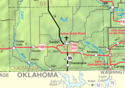
Hewins, Kansas
Appearance
Hewins, Kansas | |
|---|---|
 | |
| Coordinates: 37°2′27″N 96°24′30″W / 37.04083°N 96.40833°W[1] | |
| Country | United States |
| State | Kansas |
| County | Chautauqua |
| Named for | Edwin Hewins |
| Elevation | 886 ft (270 m) |
| Time zone | UTC-6 (CST) |
| • Summer (DST) | UTC-5 (CDT) |
| Area code | 620 |
| FIPS code | 20-31625 |
| GNIS ID | 484429 [1] |
Hewins is an unincorporated community in Chautauqua County, Kansas, United States.[1]
History[edit]
Hewins was named after Edwin M. Hewins, a rancher and member of the Kansas Legislature.[2]
The post office was established April 4, 1906, and closed April 8, 1966.[3]
References[edit]
- ^ a b c d U.S. Geological Survey Geographic Names Information System: Hewins, Kansas
- ^ Rydjord, John (1972). Kansas Place-Names. University of Oklahoma Press, Norman, Oklahoma. p. 338. ISBN 0-8061-0994-7.
- ^ From Whence They Came: A Little History of Hewins, Kansas, Ester Leonard, Arrow Press, San Antonio, 1983.
Further reading[edit]
- Heer, Esther Leonard. From Whence We Came: A Little History of Hewins, Kansas. Arrow Press: San Antonio, 1983.
External links[edit]


