Jump to content

Voghjaberd

Coordinates: 40°09′59″N 44°38′54″E / 40.16639°N 44.64833°E / 40.16639; 44.64833
From Wikipedia, the free encyclopedia

This is the current revision of this page, as edited by Spino-Soar-Us (talk | contribs) at 05:55, 7 April 2024. The present address (URL) is a permanent link to this version.

(diff) ← Previous revision | Latest revision (diff) | Newer revision → (diff)

40°09′59″N 44°38′54″E / 40.16639°N 44.64833°E / 40.16639; 44.64833

Voghjaberd
Ողջաբերդ
Voghjaberd and the cave settlement
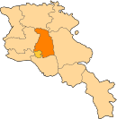
Voghjaberd is located in Armenia
Voghjaberd
Voghjaberd
Coordinates: 40°09′59″N 44°38′54″E / 40.16639°N 44.64833°E / 40.16639; 44.64833
CountryArmenia
Marz (Province)Kotayk
Elevation
1,700 m (5,600 ft)
Population
 (2001)
 • Total957
Time zoneUTC+4 ( )
 • Summer (DST)UTC+5 ( )

Voghjaberd (Armenian: Ողջաբերդ, also Romanized as Vokhchaberd) is a village in the Kotayk Province of Armenia.

Panorama from Charents Arch in Voghjaberd

See also

[edit]

References

[edit]