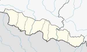
Kalaiya
Appearance
Kalaiya, Nepal
कलैया | |
|---|---|
|
Ghantaghar of Kalaiya | |
| Coordinates: 27°2′N 85°0′E / 27.033°N 85.000°E | |
| Country | Nepal |
| Province | Madhesh |
| District | Bara |
| Government | |
| • Mayor | Binod Prasad Shah (CPN-UML) |
| • Deputy mayor | Rausan Parwin (CPN-UML) |
| Area | |
| • Total | 108.94 km2 (42.06 sq mi) |
| Population (2021)[1] | |
| • Total | 141,179 |
| • Density | 1,300/km2 (3,400/sq mi) |
| Time zone | UTC+5:45 (NST) |
| Postal code | 44400 |
| Area code | 053 |
| Website | kalaiyamun |
Kalaiya is a sub-metropolitan city and serves as the headquarters of Bara District in Madhesh Province, Nepal. At the time of the 2021 Nepal census, it had a population of 141,179 people residing in 28,645 individual households.
Kalaiya is considered to be the gateway to the Gadhimai temple.
See also
[edit]References
[edit]- ^ General Bureau of Statistics, Kathmandu, Nepal, Nov. 2012


