Abasár
Appearance
Abasár | |
|---|---|
Village | |
 St. Peter and Paul Church | |
| Coordinates: 47°48′09″N 20°00′27″E / 47.80250°N 20.00750°E | |
| Country | |
| County | Heves |
| District | Gyöngyös |
| First mentioned | 1261 |
| Government | |
| • Mayor | Attila Kazsu (Ind.) |
| Area | |
| • Total | 20.82 km2 (8.04 sq mi) |
| Population (2022) | |
| • Total | 2,501 |
| • Density | 120/km2 (310/sq mi) |
| Time zone | UTC+1 (CET) |
| • Summer (DST) | UTC+2 (CEST) |
| Postal code | 3261 |
| Area code | 37 |
| Website | www.abasar.hu |
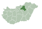
Abasár is a village in Heves County, Hungary, under the Sár mountain (500 m), in the Mátra mountain ranges. As of 2022 census, it has a population of 2501 (see Demographics). The village located 7.4 km from (Nr. 85) Vámosgyörk–Gyöngyös railway line, 4.3 km from the main road 3 and 11.7 km from the M3 motorway. The closest train station with public transport in Gyöngyös.
History
Demographics
Politics
References


