
Cairngorms
The Cairngorms are a mountain range in the eastern Highlands of Scotland closely associated with the mountain of the same name - Cairn Gorm.

Name
Usually referred to as The Cairngorms - this 'modern' use of Cairn Gorm to represent the whole range is misleading - Watson (1975) refers to it as a nickname explaining that the range's former name is Am Monadh Ruadh - the red hills distinguishing them from Am Monadh Liath - the grey hills to the west of the River Spey.
If you look from Aviemore on a clear evening, the granite screes of Lairig Ghru and Braeriach do glow a warm red in the sun. The name Am Monadh Ruadh still lives among the oldest folk of Strath Spey, but long ago, outsiders had replaced it with 'the Cairngorms', on maps and in guide books
— Watson (1975)
Ironically - naming the range after Cairn Gorm creates a contradiction since Cairn Gorm means Blue Cairn - taking that literally would make the red hills the blue hills changing the old name entirely. This irony appears to have been missed by many for both names were used in the naming of the National Park that incorporates the range. Its official English name Cairngorms National Park loosely translates into Gaelic as the Blue Hills National Park, with its Gaelic strap-line - Pairc Naiseanta a Mhonaidh Ruaidh loosely translating into English as the Red Hills National Park.
In Alexander (1928) the author refers to Colonel T. Thornton visiting the area about 1786, and his book Sporting Tour published in 1804 in which he refers to the range as the Cairngorms - continuing:
The use of the term "Cairngorms" as applied to the group must have become well established early in the nineteenth century, for we find it in Col Thornton's Sporting Tour (1804), where there is a reference to "Aurora peeping over the immense Cairngorms"
— Alexander (1928) (p21)
Both Alexander (1928) and Watson (1975) appear to suggest that Colonel Thornton's book was the first time the term Cairngorms was used in print to refer to whole group.
Location and area

Although The Cairngorms are within the Cairngorms National Park - they are only a part of it. In Watson (1975) the author delineates the main Cairngorm massif as being between Aviemore in the north-west, Glen Gairn, and Braemar in the south-east, and Glen Feshie in the south-west.
Roughly speaking - then - the southern-boundary of the range runs from slightly east of Braemar - west along Glen Dee to White Bridge, through Glen Geldie to the head of Glen Feshie. The western-boundary runs down Glen Feshie (northward) and the River Spey to Aviemore. The northern-boundary runs roughly eastward from Aviemore through Glen More to Glen Avon. The eastern-boundary then runs (southward) up Glen Avon, and over Am Bealach Dearg to slightly east of Braemar again - see sketch map.
To the south of The Cairngorms are a separate distinct range - The Grampians - in Watson (1975) the author describes them as running from Drumochter in the west almost to the sea just south of Aberdeen - continuing:
Some map-makers have confused the issue by printing 'Grampians' over the Cairngorms and Strath Don hills as well! As it has often been used on maps to take in the Ben Alder and Perthshire hills far to the W of our area, it is unsuitable for this book.
— Watson (1975)
In Gordon (1925) - the area of the Cairngorms is even more tightly drawn - the end-papers show a map where Aviemore, River Feshie, River Dee, and Creag Choinnich just make it onto the map, and Glen Geldie, and Glen Gairn do not.
Historically - before the Regionalisation of Scotland in 1975 - most of The Cairngorms were within the county of Aberdeenshire with the rest reaching into Inverness-shire in the west, and Banffshire in the north.
Access
Granting the tight delineation of The Cairngorms above - there are no public roads through The Cairngorms. All the public roads in the general area either skirt The Cairngorms or stop short - providing access to them only. Historically - pedestrians have been able to cross The Cairngorms by following the traditional routes of the Lairig Ghru, and the Lairig Laoigh, or around them by following Glen Dee - Glen Feshie, and Bealach Dearg.
From the south, and south-east motorised access ends at Linn of Dee, or Allanaquoich. From the north-west it ends at Coylumbridge or the car park at the Cairn Gorm ski area.
Topography
The Cairngorms consist of a large elevated plateau adorned with low, rounded glacial mountains.
Although not strictly a single plateau - The Cairngorms give the sense of being a single plateau, because the passes that cut through them do not cut them very deeply. In Watson (1975) the author gives the summit of Lairig Ghru as 835 metres, and the summit of Lairig an Laoigh at 740 metres, and The Sneck at 970 metres. Topographically - this means a walker could cross between the Cairntoul (1293m) - Braeriach (1296m) massif to the Ben Macdui (1309m) - Cairn Gorm (1245m) massif and onto the Beinn a' Bhùird (1196m) - Ben Avon (1171m) massif without descending below the 740 metre summit of the Lairig an Laoigh.
The Cairngorms became part of Scotland's second national park (see Cairngorms National Park) on 1st September 2003. The national park is in the Scottish council areas of Aberdeenshire, Moray, Angus, Perth and Kinross and Highland.
Geography
The Cairngorms feature the highest, coldest and snowiest plateaux in the British Isles and are home to five of the six highest mountains in Scotland:
- Ben Macdhui (1309 m)
- Braeriach (1296 m)
- Cairn Toul (1293 m)
- Sgor an Lochain Uaine (1258 m)
- Cairn Gorm (1245 m)
These mountains are all Munros, and there are a further 13 mountains with this categorisation across the area, of which another five are among the twenty highest peaks in the country.
After she had climbed to the top of Ben Macdui on October 7 1859, Queen Victoria wrote: "It had a sublime and solemn effect, so wild, so solitary — no one but ourselves and our little party there . . . I had a little whisky and water, as the people declared pure water would be too chilling."
They were created at the end of the last ice age, when the ice caps that covered most of northern Scotland remained static and formed the rounded summits of the mountains of the area. The many valleys are littered with glacial deposits from the period of glacial retreat. The most famous valley is the Lairig Ghru pass, a gouge through the centre of the mountains - a u-shaped valley, that was extensively used by drovers in the 19th Century herding their cattle to market in the Lowlands, from their smallholdings in the Highlands.
The region is drained by the Rivers Dee and Spey; and the latter's two tributaries: the Rivers Feshie and Avon.
The area is sparsely populated due to the extreme nature of the climate. Snow patches remain on the hills until August while in the Garbh Coire Mòr of Braeriach the snow melted just thrice in the last century. In the last few years - a possible indicator of climate change - the quantity and longevity of Cairngorm snow patches has declined significantly. The lowest recorded temperature in the UK has twice been recorded in the Cairngorms, at Braemar, where a temperature of -27.2oC, was recorded on February 11, 1895 and January 10, 1982.
Wildlife
The national park is known for its wildlife. The area also features a primeval forest, one of the last in the British Isles, known as the Caledonian Forest. Much of the remains of this forest are found within the national park.
The Cairngorms provide a unique alpine semi-tundra moorland habitat, home to many rare plants, birds and animals. Speciality bird species on the platuex include breeding Ptarmigan, Dotterel, Snow Bunting, Golden Eagle, Ring Ouzel, Twite and Red Grouse, with Snowy Owl, Purple Sandpiper and Lapland Bunting seen on occasion. In the forests, Capercaillie, Black Grouse, Scottish Crossbill, Parrot Crossbill, Crested Tit amongst many more speciality birds are found.
Of particular fame is the RSPB (Royal Society for the Protection of Birds) reserve at Abernethy Forest and Loch Garten. A famous pair of Ospreys are present in the summer months, and they often attract large crowds to see them. The forest is home to the endangered Capercaillie and endemic Scottish Crossbill.
Red Deer, Roe Deer, Mountain Hare, Pine Marten, Red Squirrel, Wild Cat and Otter are all present, as well as the only wild herd of Reindeer in the British Isles. They now roam the high Cairngorm plateux, after being re-introduced in the 1950's by a Swedish herdsman. The herd is now stable at around 150 individuals, all born in the wild in Scotland.
Man-made Threats
Recently in the Cairngorms, humans have introduced deer, which can trample rare plant species. Additionally, due to pollution caused by humans, acid rain has been found to contribute to the destruction of rare plants and some rock formations.
Leisure
A skiing and winter sports industry is concentrated in the Cairngoms, with three of Scotland's five resorts situated here. They are the Cairn Gorm Ski Centre, Glenshee Ski Centre and The Lecht Ski Centre.
A funicular railway opened here in late 2001, running from a base station at 637 metres up to the Ptarmigan Centre, situated at 1097 metres, 150 metres from the summit of Cairn Gorm. It was built amidst some controversy, with supporters of the scheme claiming that it would bring valuable tourist income into the area, whilst opponents argued that such a development was unsuitable for a supposedly protected area.
The mountains are also very popular for hill-walking, winter sports, cycling, birdwatching, climbing, deer stalking, gliding and fly fishing. However, the area can be very hazardous at times, with dangerous and unpredictable weather conditions. Because of this, all safety precautions must be taken whilst out in the mountains.
In 1964, physicist Peter Higgs of Edinburgh was walking in the Cairngorms when he had his famous idea about symmetry-breaking in the electroweak theory, now a key element of the standard model of particle physics. If the so-called Higgs boson is eventually detected by experiment, this will give the Cairngorms a special place in the history of science.
Settlements in the Cairngorms
Gallery
-
 Cairn Gorm
 -
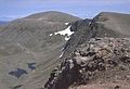
 Ben Macdhui seen from Càrn a' Mhàim
 -
Càrn Eilrig, at the entrance to the Lairig Ghru, Cairngorms, Scotland. Taken from Badeguish
-
 Ptarmigan are commonplace in the Cairngorms


Sources
Visitor attractions
- Cairngorm Mountain
- Ben Macdui
- Cairn Gorm Ski Centre
- Loch Morlich
- Strathspey Steam Railway
- Loch Garten Osprey Centre
- Abernethy Forest RSPB
- Beinn a' Bhùird
- Highland Wildlife Park
- Glenshee Ski Centre
- Lecht Ski Centre
- The Cairngorm Reindeer Centre
See also
- Cairn Gorm
- Cairngorms National Park
- Caledonian Forest
- RSPB
- National Parks of Scotland
- World Heritage Sites in Scotland
- Beinn a' Bhùird
Further Reading
- Walking in the Cairngorms, Ronald Turnball. Cicerone ISBN 978 1 85284 452 3
External links
- Cairngorms National Park
- Cairngorm Mountain
- Ski Scotland
- Highland-Instinct
- Loch Morlich Watersports
- RSPB Abernethy Forest
- Strathspey Steam Railway
- Highland Native Wildife Park
- WinterHighland
- Ski Scotland - latest Cairngorm snow conditions
- Glenshee Ski Centre
- The Lecht Ski Centre
- Birdwatching Guide to the Scottish Highlands
- Fishing Guide to Scotland
- Images of the Cairngorms
- The Independent - Eco-catastrophe: The Cairngorms - 02/12/06
- Cairngorm Gliding Club
- geography, geology, geomorphology
- Mountains and hills of the Eastern Highlands
- Mountains and hills of Aberdeenshire
- Mountains and hills of the Highland council area
- Mountains and hills of Moray
- Ski areas and resorts in Scotland
- Conservation in Scotland
- Scottish coast and countryside
- Visitor attractions in Highland
- Sites of Special Scientific Interest in Badenoch and Strathspey
- Sites of Special Scientific Interest in Kincardine and Deeside
- Sites of Special Scientific Interest in Moray and Nairn