
Prattville, Alabama
Prattville | |
|---|---|
 | |
| Nickname: The Fountain City | |
 Location in the state of Alabama | |
| Country | United States |
| State | Alabama |
| Counties | Autauga, Elmore |
| Government | |
| • Type | Mayor/Council |
| • Mayor | Bill Gillespie Jr(R) |
| Area | |
| • Total | 33.7 sq mi (87.4 km2) |
| • Land | 32.9 sq mi (85.1 km2) |
| • Water | 0.9 sq mi (2.3 km2) |
| Elevation | 328 ft (100 m) |
| Population (2010)[1] | |
| • Total | 33,960 |
| Time zone | UTC-6 (CST) |
| • Summer (DST) | UTC-5 (CDT) |
| ZIP codes | 36066-36068 |
| Area code | 334 |
| FIPS code | 01-62328 |
| GNIS feature ID | 0125246 |
| Website | prattvilleal.gov |
Prattville is a city in Autauga and Elmore counties in the U.S. state of Alabama. As of the 2010 Census, the population of the city is 33,960.[1] Nicknamed "The Fountain City" due to the many artesian wells in the area, Prattville is part of the Montgomery metropolitan statistical area and serves as the county seat of Autauga County. The city is northwest of Montgomery.
History
Prattville was founded in 1839 by industrialist and architect Daniel Pratt. The area was largely inhabited by native Americans and a few settlers when Pratt, a native of Temple, New Hampshire, first observed the Autauga Creek in the 1830s. He purchased approximately 1,000 acres (4.0 km2) from Joseph May at $21.00 an acre, and set out to build his manufacturing facilities and the town along the banks of the Autauga creek. The location was chosen because the creek could supply power to the cotton gin manufacturing equipment. The town became an industrial center and rapidly grew. In 1868, it was named the county seat for Autauga County.[2]
Prattville contains several sites on the National Register of Historic Places, including the Daniel Pratt Historic District, Bell House, and Buena Vista.[3]
Severe weather
On February 17, 2008, Prattville was hit by an F3 tornado which destroyed more than 45 homes and businesses and damaged over 700. Twenty-nine people were injured with no fatalities. Preliminary estimates put the damage at $85 million in insured and uninsured damages.[4]
Geography
Prattville is located at 32°27'32.886" North, 86°27'4.698" West (32.459135, -86.451305)Template:GR. According to the U.S. Census Bureau, the city has a total area of 33.7 square miles (87 km2) of which 32.9 square miles (85 km2) is land and 0.9 square miles (2.3 km2) (3.09%) is water.
Demographics
As of the censusTemplate:GR of 2000, there were 24,303 people, 8,939 households, and 6,918 families residing in Prattville. The population density was 1,049.0 inhabitants per square mile (405.0/km2). There were 9,562 housing units at an average density of 412.7 square miles (1,069 km2). The racial makeup of the city was 83.09% White, 14.42% Black or African American, 0.42% Native American, 0.64% Asian, 0.05% Pacific Islander, 0.53% from other races, and 0.84% from two or more races. 1.71% of the population were Hispanic or Latino of any race.
There were 8,939 households out of which 38.9% had children under the age of 18 living with them, 60.6% were married couples living together, 13.4% had a female householder with no husband present, and 22.6% were non-families. 19.9% of all households were made up of individuals and 7.5% had someone living alone who is 65 years of age or older. The average household size was 2.70 and the average family size was 3.10.
In the city the population is spread out with 28.5% under the age of 18, 7.7% from 18 to 24, 31.0% from 25 to 44, 22.3% from 45 to 64, and 10.6% who are 65 years of age or older. The median age was 36 years. For every 100 females there were 91.3 males. For every 100 females age 18 and over, there were 87.5 males.
The median income for a household in the city was $45,728, and the median income for a family was $51,774. Males had a median income of $36,677 versus $22,978 for females. The per capita income for the city was $19,832. 8.3% of the population and 6.4% of families were below the poverty line. Out of the total population, 9.3% of those under the age of 18 and 9.2% of those 65 and older were living below the poverty line.
| Census | Pop. | Note | %± |
|---|---|---|---|
| 1900 | 1,900 | — | |
| 1930 | 2,331 | — | |
| 1940 | 2,664 | 14.3% | |
| 1950 | 4,385 | 64.6% | |
| 1960 | 6,616 | 50.9% | |
| 1970 | 13,116 | 98.2% | |
| 1980 | 18,647 | 42.2% | |
| 1990 | 19,797 | 6.2% | |
| 2000 | 24,303 | 22.8% | |
| 2010 | 33,960 | 39.7% | |
| cource[5][6][7] [8][9] | |||
Education
Prattville is part of the Autauga County School System[10] and has eight schools, including Prattville High School and the Autauga County Technology Center.[11]
Media
Prattville is part of the Montgomery television market. The local radio station is WIQR 1410 AM, airing a sports radio format and featuring programming from Sporting News Radio. Prattville is also served by two news publications, the twice-weekly Prattville Progress newspaper and the Our Prattville web magazine.[12][13]
Recreation
The city has become a popular golf destination, featuring the Capitol Hill golf courses (part of the Robert Trent Jones Golf Trail). Its Senator Course has hosted the Navistar LPGA Classic on the LPGA Tour since 2007. The 2011 event is scheduled for September 15-18.
Notable residents
- John Martin, Author Travel and History
- Rodger Morrison, Author and Researcher
- Marlon Anderson, Major League Baseball player
- Bobby Jon Drinkard, contestant on Reality television shows Survivor: Palau and Survivor: Guatemala
- Roman Harper, NFL player.[14]
- Wilson Pickett (March 18, 1941 – January 19, 2006), R&B and soul singer and songwriter
- Kevin Turner, NFL player
- Evan Crawford, MLB player
Popular culture
The rock band Trust Company originated in Prattville.
References
- ^ a b "Annual Estimates of the Population for Incorporated Places in Alabama, Listed Alphabetically: April 1, 2000 to July 1, 2006" (CSV). 2007 Population Estimates. U.S. Census Bureau, Population Division. June 28, 2007. Retrieved June 28, 2007.
- ^ "Autauga County". Autauga County Heritage Assocication. Retrieved 21 December 2009.
- ^ "National Register Information System". National Register of Historic Places. National Park Service. March 13, 2009.
- ^ "Tornadoes touch down across Southeast: 29 people injured in Alabama town; 200 homes, 100 businesses damaged". MSNBC. Retrieved 25 January 2010.
- ^ Lahmeyer, Jan (30 December 2002). "UNITED STATES OF AMERICA - ALABAMA : urban population". POPULATION STATISTICS. Retrieved 21 December 2009.
- ^ 1993 World Almanac - (1980, 1990 census figures)
- ^ census.gov - 1980 U.S. Census - by state - accessed 2011-09-06
- ^ census.gov - 1970 U.S. Census - by state - (includes populations of 1960) - accessed 2011-09-06
- ^ census.gov - 1960 U.S. Census - by state - (includes populations of 1940, 1950) - accessed 2011-09-06
- ^ "Autauga County Schools". Retrieved 21 December 2009.
- ^ "Autauga County Technology Center". Retrieved 21 December 2009.
- ^ "The Prattville Progress". The Prattville Progress. Retrieved 2009-09-19.
- ^ "Our Prattville: A News Magazine - About Us". Our Prattville. Retrieved 2009-10-31.
- ^ Benn, Alvin (February 28, 2010). "Prattville turns out to welcome Saints star home". Montgomery Advertiser. Gannett. Retrieved 2010-03-30.
{{cite news}}: Cite has empty unknown parameter:|coauthors=(help) [dead link]
External links
32°27′33″N 86°27′05″W / 32.459135°N 86.451305°W
Municipalities and communities of Autauga County, Alabama, United States | ||
|---|---|---|
| Cities | 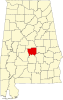 | |
| Towns | ||
| CDPs | ||
| Unincorporated communities | ||
| Ghost town | ||
| Footnotes | ‡This populated place also has portions in an adjacent county or counties | |
Municipalities and communities of Elmore County, Alabama, United States | ||
|---|---|---|
| Cities |  | |
| Towns | ||
| CDPs | ||
| Unincorporated communities | ||
| Indian reservation | ||
| Ghost town | ||
| Footnotes | ‡This populated place also has portions in an adjacent county or counties | |