1963 Atlantic hurricane season
| 1963 Atlantic hurricane season | |
|---|---|
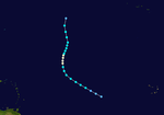
 Season summary map | |
| Seasonal boundaries | |
| First system formed | July 31, 1963 |
| Last system dissipated | October 29, 1963 |
| Strongest storm | |
| Name | Flora |
| • Maximum winds | 145 mph (230 km/h) (1-minute sustained) |
| • Lowest pressure | 940 mbar (hPa; 27.76 inHg) |
| Seasonal statistics | |
| Total depressions | 9 |
| Total storms | 9 |
| Hurricanes | 7 |
| Major hurricanes (Cat. 3+) | 2 |
| Total fatalities | 7,225 |
| Total damage | $588.8 million (1963 USD) |
The 1963 Atlantic hurricane season was a below average Atlantic hurricane season, with nine named storms. Although the season officially began on June 1, the first storm did not form until nearly a month later. Hurricane Cindy made landfall in Texas before dissipating in the southern portion of the state. In late September, Hurricane Edith moved through the Windward Islands and Greater Antilles before dissipating east of the Bahamas, before causing ten fatalities, and leaving roughly $47 million (1963 USD) in damage in the Caribbean. Following Edith was Hurricane Flora, a powerful hurricane that struck Haiti and Eastern Cuba in early October. Throughout its lifetime, Flora killed over 7,000 people, making the system the fifth or sixth deadliest Atlantic hurricane of all time. The final hurricane of the season, Ginny, was a tropical cyclone that affected parts of North Carolina in the middle of October. Three people were killed as a result of the storm, and damage totals reached $500,000.
The 1963 season as a whole was very destructive, with at least 7,225 fatalities, and $588.8 million in damage. However, not all storms affected land areas. Hurricane Beulah in late August formed east of the Lesser Antilles and moved north, several hundred miles to the east of Bermuda. In addition, Tropical Storm Three in the middle of September formed between the United States East Coast and Bermuda before dissipating well northeast of Newfoundland.
Storms

Hurricane Arlene
| Category 2 hurricane (SSHWS) | |
| Duration | July 31 – August 10 |
|---|---|
| Peak intensity | 105 mph (165 km/h) (1-min); 969 mbar (hPa) |
A cloud mass in the central Atlantic became a tropical depression on July 31. It headed to the west, becoming a tropical storm on August 2. Arlene rapidly intensified that day to become a 100 mph (155 km/h) Category 2 hurricane, but lack of outflow weakened Arlene to a tropical depression on August 4. For the next three days, a disturbed area of low pressure that may have had a circulation moved to the northwest. On August 8, while turning northeastward, conditions favored development again, and Arlene rapidly intensified to a hurricane that night. Arlene passed over Bermuda on August 9, and, after reaching its peak of 100 mph (155 km/h) again that night, steadily weakened until it became extratropical on August 11. Arlene caused $300,000 (1963 USD, $2.99 million 2024 USD) in property damage in Bermuda, but no lives were lost.
Hurricane Beulah
| Category 3 hurricane (SSHWS) | |
| Duration | August 20 – August 28 |
|---|---|
| Peak intensity | 120 mph (195 km/h) (1-min); 958 mbar (hPa) |
The precursor to Hurricane Beulah was a tropical wave moving across the tropical Atlantic. It was organized enough to be called a tropical depression on August 20, and it strengthened to tropical storm force the next day. Beulah moved northwestward, becoming a hurricane on August 22 and a major hurricane on August 24. The hurricane turned to the north, where the anticyclone that was favoring development to its south caused unfavorable conditions. Beulah weakened to a minimal hurricane, and raced to the northeast, maintaining hurricane strength until it became extratropical on August 28, 250 mi (402.33 km) east of Newfoundland.
Tropical Storm Three
| Tropical storm (SSHWS) | |
| Duration | September 10 – September 14 |
|---|---|
| Peak intensity | 60 mph (95 km/h) (1-min); 992 mbar (hPa) |
A weak circulation north of Puerto Rico moved northeastward, becoming a tropical depression on September 10. It was subtropical in nature, developing with the instability of cool and warm air, and became a tropical storm on September 11. This small storm reached its peak of 60 mph (95 km/h) on September 12, but a cold front to its west caused it to gradually lose tropical characteristics. The storm became extratropical on September 14, and was absorbed by the cold front on September 15.
Hurricane Cindy
| Category 1 hurricane (SSHWS) | |
| Duration | September 16 – September 20 |
|---|---|
| Peak intensity | 80 mph (130 km/h) (1-min); 996 mbar (hPa) |
A trough of low pressure over the Gulf of Mexico rapidly developed into a tropical storm on September 16. Cindy reached hurricane strength the next day, but did not strengthen further prior to its landfall on High Island, Texas. Cindy brought heavy rain to southeast Texas as it drifted southwestward over the state. The hurricane dissipated on September 20, after causing $12.5 million (1963 USD, $5.97 million 2024 USD) in damage and three deaths.
Hurricane Debra
| Category 1 hurricane (SSHWS) | |
| Duration | September 19 – September 24 |
|---|---|
| Peak intensity | 75 mph (120 km/h) (1-min); 999 mbar (hPa) |
On September 19, a westward moving tropical wave became a tropical depression in the central tropical Atlantic. It became a tropical storm on September 21, and spared the islands as it turned northward. Debra became a hurricane on September 21, but as it moved northward, it was gradually absorbed by a large extratropical storm. Debra dissipated on September 24.
Hurricane Edith
| Category 2 hurricane (SSHWS) | |
| Duration | September 23 – September 29 |
|---|---|
| Peak intensity | 100 mph (155 km/h) (1-min); 990 mbar (hPa) |
The Intertropical Convergence Zone developed a tropical depression on September 23, east of the southern Lesser Antilles. It moved west-northwestward, quickly intensifying to a hurricane on September 24. It crossed through the Windward Islands on September 25 as a 95 mph (145 km/h) hurricane, but upper level winds weakened it to a minimal hurricane prior to its Dominican Republic landfall on September 27. The island ripped apart the circulation, and Edith dissipated on September 29. Edith killed ten in Martinique, injured 50 across the Caribbean, and caused $47 million (1963 USD, $468 million 2024 USD) in damage. It was a prelude to Hurricane Flora just days later.
Hurricane Flora
| Category 4 hurricane (SSHWS) | |
| Duration | September 26 – October 12 |
|---|---|
| Peak intensity | 145 mph (230 km/h) (1-min); 940 mbar (hPa) |
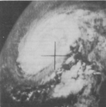
Hurricane Flora originated from a tropical depression which formed on September 26 in the Central Atlantic. The depression moved rapidly west-northwestward, and on September 29 it reached tropical storm status. It then rapidly intensified into a 120 mph (195 km/h) Category 3 hurricane by September 30. Flora moved through the Leeward Islands, first striking the island of Tobago, and passing near Grenada shortly afterwards. Flora then crossed the Caribbean Sea and strengthened to a Category 4 hurricane, peaking at 140 mph (220 km/h) winds.
Flora struck the southwest peninsula of Haiti on October 4 as a 140 mph (220 km/h) hurricane, causing heavy rains. Flora then hit southeast Cuba near Guantanamo Bay on the same day, but a high pressure system to its north and west caused it to drift over Cuba and nearby waters. During this time, intense driving rains caused catastrophic flooding, resulting in thousands of deaths and millions in crop damage. A shortwave trough finally pulled Flora to the northeast, bringing the hurricane into the Atlantic Ocean on October 8. Flora strengthened over the open Atlantic, but posed a threat only to shipping, and became extratropical on October 12.
Hurricane Flora was the fifth or sixth deadliest Atlantic hurricane of all time, causing over 7,000 deaths and hundreds of millions of dollars in damage, mostly due to flooding from intense rains as it stalled over Cuba and the surrounding areas. Damage estimates (mostly crop losses) reached over $500 million (1963 USD, $4.98 billion 2024 USD).
Hurricane Ginny
| Category 2 hurricane (SSHWS) | |
| Duration | October 16 – October 29 |
|---|---|
| Peak intensity | 110 mph (175 km/h) (1-min); 958 mbar (hPa) |
A cold-core trough of low pressure existed over the Bahamas, leading to the development of a depression on October 16. The depression moved northward, reaching tropical storm force winds on October 19. Reconnaissance aircraft reported a cold-core system that day, but as Ginny became better organized, it warmed, becoming a hurricane on October 20 and having an official warm core on October 22. After looping off the coast of North Carolina and moving southwestward, Ginny weakened to a tropical storm, but as it crossed over the Gulf Stream again, it restrengthened to a hurricane. Ginny turned to the northeast on October 25, remaining offshore but coming close enough to cause rain and winds. The hurricane's intensity fluctuated as it headed northeastward, reaching its peak of 110 mph (175 km/h) on October 29. Ginny became extratropical due to the cooler waters and cooler air on October 29, just after making landfall on southwest Nova Scotia.
Ginny was unusual as it is one of the latest hurricanes on record to make landfall near New England, and was reported to have produced 18 in (457.2 mm) of snow over Maine. The hurricane caused a total of seven deaths and $300,000 in damage (1963 USD, $2.99 million 2024 USD).
Tropical Storm Helena
| Tropical storm (SSHWS) | |
| Duration | October 25 – October 29 |
|---|---|
| Peak intensity | 50 mph (85 km/h) (1-min); ≤1001 mbar (hPa) |
Tropical Storm Helena formed from an easterly wave on October 25. It became a tropical storm that day, and reached its peak of 50 mph (85 km/h) before hitting the Lesser Antilles. Helena's intensity fluctuated for the next three days, but upper level shear from Ginny and a low pressure surface trough caused it to dissipate on October 29. Though it was weak, Helena was able to cause five deaths and $500,000 (1963 USD, $4.98 million 2024 USD) in damage.
Storm names
The following names were used for named storms (tropical storms and hurricanes) that formed in the North Atlantic in 1963. Storms were named Ginny and Helena for the first time in 1963. Names that were not assigned are marked in gray.
|
|
Retirement
The name Flora was later retired.


