Campezo/Kanpezu
Appearance
Campezo / Kanpezu
Kanpezu (Basque) | |
|---|---|
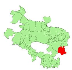
 Location of Kanpezu within Álava Province | |
| Country | Spain |
| Autonomous community | |
| Province | Álava |
| Eskualdea / Comarca | Campezo-Montaña Alavesa |
| Government | |
| • Mayor | Aitor Aginaga Legorburu (PNB) |
| Area | |
| • Total | 85.02 km2 (32.83 sq mi) |
| Elevation | 575 m (1,886 ft) |
| Population (2010) | |
| • Total | 1,126 |
| • Density | 13/km2 (34/sq mi) |
| Time zone | UTC+1 (CET) |
| • Summer (DST) | UTC+2 (CEST) |
| Postal code | 01110 |
| Official language(s) | Basque, Spanish |
| Website | Official website |

Kanpezu (Spanish: Campezo) is a municipality located in the province of Álava, in the Basque Country, northern Spain.
This municipality lies on the western side of the Codés mountain range.
Villages
- Antoñana
- Bujanda
- Orbiso
- Oteo
- Santa Cruz de Campezo / Santikurutze Kanpezu, capital of the Cuadrilla de Campezo-Montaña Alavesa comarca and main town of the municipality
External links
Wikimedia Commons has media related to Campezo-Kanpezu.
43°40′19″N 2°20′59″W / 43.67194°N 2.34972°W

