Tiszaföldvár: Difference between revisions
Content deleted Content added
gallery |
actual city limit sign |
||
| Line 7: | Line 7: | ||
|image_skyline = Tiszaföldvár légifotó4.jpg |
|image_skyline = Tiszaföldvár légifotó4.jpg |
||
|image_caption = Aerial view |
|image_caption = Aerial view |
||
|image_blank_emblem=Tiszafoldvar_rovastabla.png |
|||
|blank_emblem_type=City limit sign (rovas script) |
|||
|latd=46 |latm=59 |lats= |latNS=N |
|latd=46 |latm=59 |lats= |latNS=N |
||
|longd=20 |longm=15 |longs= |longEW=E |
|longd=20 |longm=15 |longs= |longEW=E |
||
Revision as of 19:41, 14 July 2011
Tiszaföldvár | |
|---|---|
 Aerial view | |
| Country | |
| County | Jász-Nagykun-Szolnok |
| Area | |
| • Total | 80.34 km2 (31.02 sq mi) |
| Population (2002) | |
| • Total | 12,027 |
| • Density | 150/km2 (400/sq mi) |
| Time zone | UTC+1 (CET) |
| • Summer (DST) | UTC+2 (CEST) |
| Postal code | 5430 |
| Area code | 56 |
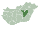
Tiszaföldvár is a town in Jász-Nagykun-Szolnok county, in the Northern Great Plain region of central Hungary.
Geography
It covers an area of 80.34 km2 (31 sq mi) and has a population of 12,027 people (2002).
Gallery
-
Tiszaföldvár name written in Szekely-Hungarian script and latin letters.
International relations
Twin towns — Sister cities
Tiszaföldvár is twinned with
46°59′N 20°15′E / 46.983°N 20.250°E


