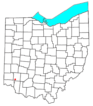
Twenty Mile Stand, Ohio

Twenty Mile Stand is an unincorporated community in southeastern Deerfield Township, Warren County, Ohio, United States.[1] It lies on the old 3C Highway in Town 4 East, Range 2 North, Section 21 of the Symmes Purchase and in the center of the area known as "Landen". It is about three miles south-south west of Kings Mills, two miles southwest of Fosters, and twenty miles northeast of Cincinnati.
A post office called Twenty Mile Stand was established in 1819, the name was changed to Twentymile Stand in 1895, and the post office closed in 1904.[2] In the 19th century, the town was a stagecoach stop 20 miles (32 km) from downtown Cincinnati, hence the name.[3] In April 2013, the original stagecoach stop, known as the Twenty Mile House, was demolished and replaced with a modern strip mall and gas station. The house had been a fine and casual restaurant, bar and tavern for generations.[4]
References[edit]
- ^ U.S. Geological Survey Geographic Names Information System: Twenty Mile Stand, Ohio
- ^ "Warren County". Jim Forte Postal History. Retrieved January 17, 2016.
- ^ Peacefull, Leonard (1996). A Geography of Ohio. Kent State University Press. p. 217. ISBN 9780873385251. Retrieved December 8, 2013.
- ^ "Photos: 20-Mile House torn down". WLWT. April 16, 2013. Retrieved October 18, 2020.
39°18′23″N 84°16′48″W / 39.30639°N 84.28000°W

