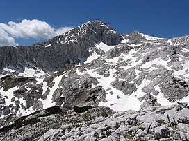
Carinthian–Slovenian Alps
Appearance
| Carinthian-Slovenian Alps | |
|---|---|
| Template:Lang-sl Template:Lang-de | |
 Mount Grintovec (2,558 m) | |
| Highest point | |
| Peak | Grintovec |
| Elevation | 2,558 m (8,392 ft) |
| Coordinates | 46°21′25″N 14°32′10″E / 46.35694°N 14.53611°E |
| Geography | |
| Countries | Slovenia, Austria and Italy |
| Parent range | Alps |
| Borders on | Carnic and Gailtal Alps, Julian Alps and Prealps and Slovenian Prealps |
| Geology | |
| Orogeny | Alpine orogeny |
The Carinthian-Slovenian Alps (in Slovenian Koroško-Slovenske Alpe, in German Kärntnerisch-Slowenische Alpen) are a mountain range in the eastern part of the Alps. They are located in Slovenia, Austria and, for a very small area in westernmost part of the range, in Italy.
Geography
The range belongs to the drainage basin of the Danube River.
SOIUSA classification
According to SOIUSA (International Standardized Mountain Subdivision of the Alps) the Carinthian-Slovenian Alps are an Alpine section, classified in the following way:[1]
- main part = Eastern Alps
- major sector = Southern Limestone Alps
- section = Carinthian-Slovenian Alps
- code = II/C-35
Subdivision
The Carinthian-Slovenian Alps are divided in two subsections:
- Karavanke (SL: Karavanke; DE: Karawanken) - SOIUSA code:II/C-35.I;
- Kamnik–Savinja Alps (SL: Kamniško-Savinjske Alpe; DE: Steiner Alpen) - SOIUSA code:II/C-35.II.
Notable summits

Some notable summits of the Carinthian-Slovenian Alps are:
| Name | metres | feet |
|---|---|---|
| Grintovec / Grintavec | 2,588 | 8,392 |
| Skuta | 1,836 | 6,024 |
| Veliki Stol / Hochstuhl | 2,532 | 8,307 |
| Kepa / Mittagskogel | 2,139 | 7,018 |
| Golica / Kahlkogel | 1,836 | 6,024 |
| Peca / Petzen | 2,125 | 6,971 |
References
- ^ Marazzi, Sergio (2005). Atlante Orografico delle Alpi. SOIUSA (in Italian). Priuli & Verlucca. ISBN 978-88-8068-273-8.

