
Uhlířov
Uhlířov | |
|---|---|
Municipality | |
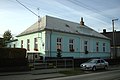
 Houses in Uhlířov | |
 Flag  Coat of arms | |
 Uhlířov | |
| Coordinates: 49°53′49″N 17°50′29″E / 49.89694°N 17.84139°E | |
| Country | |
| Region | Moravian-Silesian |
| District | Opava |
| Government | |
| • Mayor | Jiří Švendt |
| Area | |
| • Total | 3.87 km2 (1.49 sq mi) |
| Elevation | 298 m (978 ft) |
| Population (2017) | |
| • Total | 343[1] |
| • Density | 89/km2 (230/sq mi) |
| Postal code | 747 84 |
| Website | www.uhlirov.cz |
Uhlířov (German: Köhlersdorf) is a village in the Moravian-Silesian Region of the Czech Republic. As of 2018, the population was 343.
The first written mention of the village was in 1389.
Gallery
-
 Main road
 -
 Bell and memorial
 -
 Kindergarten


References
- ^ "Population of Municipalities as of 1 January 2017". Czech Statistical Office. Retrieved 26 December 2017.
External links
Wikimedia Commons has media related to Uhlířov.
This Moravian-Silesian Region location article is a stub. You can help Wikipedia by expanding it. |