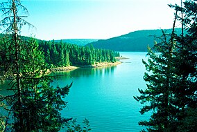
Dworshak State Park
Appearance
| Dworshak State Park | |
|---|---|
IUCN category V (protected landscape/seascape) | |
 Dworshak Reservoir | |
| Location | Clearwater County, Idaho, United States |
| Nearest city | Orofino, Idaho |
| Coordinates | 46°35′N 116°17′W / 46.58°N 116.28°W[1] |
| Area | 850 acres (340 ha) |
| Elevation | 1,600 ft (490 m)[1] |
| Designation | Idaho state park |
| Established | 1989[2] |
| Administrator | Idaho Department of Parks and Recreation |
| Website | Dworshak State Park |

Dworshak State Park is a public recreation area covering 850 acres (340 ha) along the western shore of Dworshak Reservoir north of Orofino in Clearwater County, Idaho, United States. The state park comprises three units: Freeman Creek, Three Meadows Group Camp, and Big Eddy Lodge and Marina. There are opportunities for boating, fishing, camping, swimming, water-skiing, and hiking in the park.[1]
Wildlife
The residential animals that inhabit this state park are deer, kokanee, osprey, black crappie, bass, trout and bald eagles.
See also
References
- ^ a b c "Dworshak State Park". Idaho Parks and Recreation. Retrieved May 28, 2012.
- ^ "History: State Lands in Idaho". Idaho Museum of Natural History. Retrieved March 4, 2011.
External links
- Dworshak State Park Idaho Parks and Recreation
- Dworshak State Park Location Map Idaho Parks and Recreation


