Upper Cumberland Regional Airport
Upper Cumberland Regional Airport | |||||||||||
|---|---|---|---|---|---|---|---|---|---|---|---|
| Summary | |||||||||||
| Airport type | Public | ||||||||||
| Owner | Upper Cumberland Airport Authority | ||||||||||
| Serves | Cookeville, Tennessee Sparta, Tennessee | ||||||||||
| Elevation AMSL | 1,025 ft / 312 m | ||||||||||
| Coordinates | 36°03′21″N 085°31′51″W / 36.05583°N 85.53083°W | ||||||||||
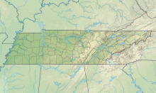
| Map | |||||||||||
| Runways | |||||||||||
| |||||||||||
| Statistics (2012) | |||||||||||
| |||||||||||
Upper Cumberland Regional Airport (ICAO: KSRB, FAA LID: SRB) is a public use airport located adjacent to Tennessee State Route 111 approximately 8.5 nautical miles (15.7 km) south of the central business district of Cookeville and 9 nautical miles (17 km) northwest of the central business district of Sparta. Owned by the Upper Cumberland Airport Authority, which comprises the Cities of Cookeville and Sparta and the governments of White County and Putnam County,[1] it is included in the National Plan of Integrated Airport Systems for 2011–2015, which categorized it as a general aviation facility.[2]
Although many U.S. airports use the same three-letter location identifier for the FAA and IATA, this airport is assigned SRB by the FAA but has no designation from the IATA (which assigned SRB to Santa Rosa Airport in Santa Rosa, Beni, Bolivia).[3][4]
Facilities and aircraft
Upper Cumberland Regional Airport covers an area of 343 acres (139 ha) at an elevation of 1,025 feet (312 m) above mean sea level. It has one runway designated 4/22 with an asphalt surface measuring 6,704 by 100 feet (2,043 x 30 m).[1]
For the 12-month period ending April 24, 2012, the airport had 21,028 aircraft operations, an average of 57 per day: 99% general aviation, 0.7% air taxi, and 0.3% military. At that time there were 37 aircraft based at this airport: 97% single-engine and 3% multi-engine.[1]
References
- ^ a b c d FAA Airport Form 5010 for SRB PDF. Federal Aviation Administration. Effective November 15, 2012.
- ^
"2011–2015 NPIAS Report, Appendix A" (PDF, 2.03 MB). National Plan of Integrated Airport Systems. Federal Aviation Administration. October 4, 2010.
{{cite web}}: External link in|work= - ^ "Airline and Airport Code Search (SRB: Santa Rosa)". International Air Transport Association (IATA). Retrieved October 13, 2013.
- ^ "Santa Rosa Airport, Bolivia (IATA: SRB, ICAO: SLSR)". Aviation Safety Network. Retrieved October 13, 2013.
External links
- FAA Terminal Procedures for SRB, effective July 11, 2024
- Resources for this airport:
- FAA airport information for SRB
- AirNav airport information for KSRB
- FlightAware airport information and live flight tracker
- NOAA/NWS weather observations: current, past three days
- SkyVector aeronautical chart, Terminal Procedures

