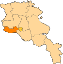
Aygeshat, Khoy
Appearance
- For the other town of this name in Armavir Province, see Aygeshat, Armavir (west).
Aygeshat Այգեշատ | |
|---|---|
| Coordinates: 40°14′09″N 44°17′12″E / 40.23583°N 44.28667°E | |
| Country | Armenia |
| Marz (Province) | Armavir |
| Area | |
• Total | 4.98 km2 (1.92 sq mi) |
| Elevation | 870 m (2,850 ft) |
| Population (2011) | |
• Total | 2,055 |
| • Density | 410/km2 (1,100/sq mi) |
| Time zone | UTC+4 (GMT+4) |
Aygeshat (Template:Lang-hy; also, Aigeshat, known as Hajighara until 1935), is a village in the Armavir Province of Armenia. It is home to the ruined 6th- to 7th-century Targmanchats Vank or Church of Surb Targmanchats (Holy Translators' Church) as well as the 18th-century Church of Surb Gevorg (Saint George), partially restored in the early 20th century. There is also an early tower of Adar Davit on a hill nearby from the 2nd or 1st centuries BC.[1] There is also a monument dedicated to the victims of World War II, 2nd- to 1st-century tombs, 10th- to 18th-century graves, and an early 19th-century wall. The village has a school (235 students), first aid station, house of culture, and a community center.[2]
Gallery
-
Ruins of the 6th- or 7th-century Targmanchats Vank
-
Surb Gevorg Church of the 18th century, restored early 20th century
See also
References
- ^ Kiesling, Brady; Kojian, Raffi (2005). Rediscovering Armenia: Guide (2nd ed.). Yerevan: Matit Graphic Design Studio. p. 67. ISBN 99941-0-121-8.
- ^ "Aigeshat Edjm. (Armavir)". CAA: Union of Communities of Armenia. Archived from the original on 2015-05-30. Retrieved May 29, 2015.
- Aygeshat, Khoy at GEOnet Names Server
- World Gazeteer: Armenia – World-Gazetteer.com
- Report of the results of the 2001 Armenian Census, Statistical Committee of Armenia
- Kiesling, Brady (June 2000). Rediscovering Armenia: An Archaeological/Touristic Gazetteer and Map Set for the Historical Monuments of Armenia (PDF). Archived (PDF) from the original on 6 November 2021.
External links
Wikimedia Commons has media related to Aygeshat.


