A515 road
Appearance
Route map:
| A515 | |
|---|---|
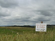
 The A515 where it is crossed by the Tissington Trail | |
| Location | |
| Country | United Kingdom |
| Road network | |
The A515 is a primary route in England. It runs 48 miles (77 km) from Lichfield, Staffordshire to Buxton, Derbyshire.
Route
The A515 begins off the A51 road just outside Lichfield. It crosses the Trent and Mersey Canal and passes through the villages of Kings Bromley and Yoxall. As it crosses the River Dove, the road enters Derbyshire. Near Sudbury the road briefly follows the route of the A50 road, before heading northwards again. The road goes through the market town of Ashbourne, and shortly afterwards enters the Peak District National Park. It passes through several villages including Fenny Bentley and Newhaven The road terminates in Buxton at its roundabout with the A53 road.
External links
KML is from Wikidata

 Media related to A515 road (England) at Wikimedia Commons

