Meggarine Guedima
Appearance
Meggarine Guedima | |
|---|---|
Village | |
| Coordinates: 33°12′2″N 6°6′2″E / 33.20056°N 6.10056°E | |
| Country | |
| Province | Touggourt Province |
| District | Megarine District |
| Commune | Megarine[1] |
| Elevation | 68 m (223 ft) |
| Time zone | UTC+1 (CET) |
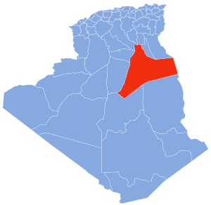
Meggarine Guedima is a neighbourhood in the oasis town of Megarine, in the southeast of Algeria. Administratively, it forms part of the municipality of Meggarine,[1] which in itself is part of the Touggourt Province, Algeria. The village is located 10 kilometres (6.2 mi) east of the provincial capital Touggourt.[2]
References
- ^ a b "Décret n° 84-365, fixant la composition, la consistance et les limites territoriale des communes. Wilaya d'El Oued" (PDF) (in French). Journal officiel de la République Algérienne. 19 December 1984. p. 1551. Archived from the original (PDF) on 21 October 2013. Retrieved 2 March 2013.
- ^ "Adjadja, Ouargla, Algeria". Google Maps. Retrieved 1 May 2013.
Neighbouring towns and cities


