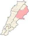
Taybeh (Baalbek)
Appearance
Taybeh
(طيبة (بعلبك)) | |
|---|---|
Village | |
| Coordinates: 33°57′29″N 36°10′01″E / 33.95806°N 36.16694°E | |
| Country | |
| Governorate | Baalbek-Hermel Governorate |
| District | Baalbek District |
| Elevation | 3,580 ft (1,090 m) |
| Time zone | UTC+2 (EET) |
| • Summer (DST) | +3 |
Taybeh (Arabic: (طيبة (بعلبك))) is a village in the Baalbek District in Baalbek-Hermel Governorate.
History
[edit]In 1838, Eli Smith noted el-Taiyibeh as a village in the Baalbek area, whose inhabitants were Catholic.[1]
In popular culture
[edit]The 2011 Lebanese film Where Do We Go Now? directed by Nadine Labaki was partly shot in the village because it features a church next to a mosque, as in the plot of the movie.
References
[edit]Bibliography
[edit]External links
[edit]- Taybeh, Localiban


