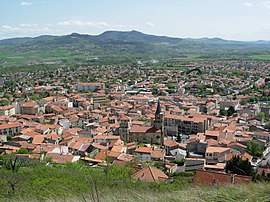
Cournon-d'Auvergne
Appearance
Cournon-d'Auvergne | |
|---|---|
 Panoramic view of Cournon-d'Auvergne | |
| Coordinates: 45°44′32″N 3°11′50″E / 45.7422°N 3.1972°E | |
| Country | France |
| Region | Auvergne-Rhône-Alpes |
| Department | Puy-de-Dôme |
| Arrondissement | Clermont-Ferrand |
| Canton | Cournon-d'Auvergne |
| Intercommunality | Clermont Auvergne Métropole |
| Government | |
| • Mayor (2020–2026) | François Rage[1] |
Area 1 | 18.58 km2 (7.17 sq mi) |
| Population (2021)[2] | 20,193 |
| • Density | 1,100/km2 (2,800/sq mi) |
| Time zone | UTC+01:00 (CET) |
| • Summer (DST) | UTC+02:00 (CEST) |
| INSEE/Postal code | 63124 /63800 |
| Elevation | 314–542 m (1,030–1,778 ft) (avg. 352 m or 1,155 ft) |
| 1 French Land Register data, which excludes lakes, ponds, glaciers > 1 km2 (0.386 sq mi or 247 acres) and river estuaries. | |
Cournon-d'Auvergne (French pronunciation: [kuʁnɔ̃ dovɛʁɲ]; Auvergnat: Cornon d'Auvèrnhe) is a commune in the Puy-de-Dôme department in Auvergne-Rhône-Alpes in central France. It lies 10 km (6.2 mi) southeast of Clermont-Ferrand, the prefecture and largest city of Puy-de-Dôme.
Population
|
| ||||||||||||||||||||||||||||||||||||||||||||||||||||||||||||||||||||||||||||||||||||||||||||||||||||||||||||||||||
| |||||||||||||||||||||||||||||||||||||||||||||||||||||||||||||||||||||||||||||||||||||||||||||||||||||||||||||||||||
| Source: EHESS[3] and INSEE (1968-2017)[4] | |||||||||||||||||||||||||||||||||||||||||||||||||||||||||||||||||||||||||||||||||||||||||||||||||||||||||||||||||||
Twin towns
 Lichtenfels, Germany, since 1992
 Ariccia, Italy, since 4 March 2000
See also
References
- ^ "Répertoire national des élus: les maires" (in French). data.gouv.fr, Plateforme ouverte des données publiques françaises. 13 September 2022.
- ^ "Populations légales 2021" (in French). The National Institute of Statistics and Economic Studies. 28 December 2023.
- ^ Des villages de Cassini aux communes d'aujourd'hui: Commune data sheet Cournon-d'Auvergne, EHESS (in French).
- ^ Population en historique depuis 1968, INSEE
Wikimedia Commons has media related to Cournon-d'Auvergne.


